Error 500 (Server Error)!!1500.That’s an error.There was an error. Please try again later.That’s all we know.
תמצית מידע על הערכת אסון בטקסס
אירוע נזק, תווית מזל"ט ארגונית ובקשת לקוח אינם קובעים אילו נתונים ניתן ללכוד, איזו תוצאה תומכת התמונות או המסלול הנוכחי עבור אתר ספציפי. בנו קובץ הערכה סביב היקף הלקוח, התנאים בפועל, ההקשר של האנשים והמשיבים, ציוד מדויק, מסירת נתונים וחלופת בדיקה קרקעית לפני הקצאת אלמנט אווירי.
מה צריכה הצעה להערכת מזל"ט באסון טקסס לקבוע לפני תחילת העבודה?
שכבת החלטה
ראיות לשמירה
מה זה יכול לקבוע
מה היא לא יכולה לקבוע
היקף הערכה
שאלת הלקוח, הקשר רכוש או תשתית, תצפיות מיועדות, מקבל הנתונים וגבול ההחלטה
במה נועדה ההערכה לתמוך
אבחנה, מסקנה בטיחותית או תוצאת תביעה
תנאי האתר
מיקום בפועל, הקשר נזק, פעילות מגיב, אנשים בקרבת מקום, גבול גישה וקשר נוכחי
מה קורה באתר
שתווית אסון מספקת תשובה הפעלה אוניברסלית
מערכת מדויקת
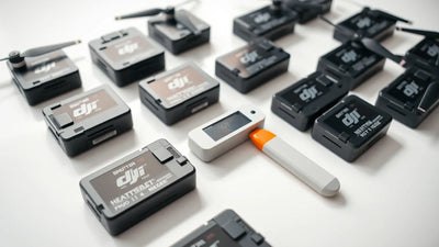
מטוסים, בקר, סוללות, תצורת חיישנים, סדרתי, מצב ורשומות זמינות
איזו ערכה מוצעת
שתווית דגם מבטיחה תצפית או תוצאה ספציפית
מסלול הפרויקט הנוכחי
פעילות בפועל, אתר, הקשר של אנשים, מפעיל ומידע כתוב עדכני
אילו שאלות זקוקות לבדיקה עדכנית
אישור מועתק, ויתור, מצב חירום, אגרה, קנס, כיסוי או סיכום רשות
בדיקת קרקע
תמונות קרקע, הערות אתר, מסלול בדיקה מקצועי ומשלוח מתוקן
כיצד ניתן להמשיך בעבודה באחריות
שצילומי אוויר מחליפים כל שיטת בדיקה
מדוע אין להתייחס לתמונות אוויר כאל אבחון נזק?
צילומי אוויר יכולים להוות חלק מתעודת תצפית מתועדת, אך הם אינם קובעים כשלעצמם מצב מבני, בטיחות, ביטוח, כיסוי או מסקנה לתיקון. שאלת הלקוח, תנאי האתר, המערכת המדויקת והמסירה המקצועית צריכים להישאר גלויים בקובץ פרויקט אחד כך שהפלט לא מוגזם.
כיצד על צוות להפוך את הסקירה לתוכנית פעולה?
פעולה
מה לשמור
1. הגדירו את שאלת ההערכה
רשום את שאלת הלקוח, ההתבוננות המיועדת, הנמען וגבול ההחלטה.
2. תאר את תנאי האתר הנוכחיים
שמור על מיקום, הקשר נזק, מגיבים, אנשים בקרבת מקום, גישה וקשר נוכחי ביחד.
3. תיעד את המערכת המדויקת
שמור מטוסים, בקר, סוללות, תצורת חיישנים, סדרתי, מצב ורשומות זמינות.
4. השתמש בעובדות הפרויקט הנוכחיות
הצג את האתר האמיתי, הפעילות, הקשר האנשים והמפעיל באמצעות מסלולים נוכחיים רלוונטיים.
5. שימרו על גבול הבדיקה
שמור תמונות קרקע ושבילי בדיקה או מסירה מתאימים עבור אותה שאלה.