


נתיב המל"טים הנוכחי של ויאטנם
השתמש בכללי המל"טים הממשלתיים הנוכחיים, מידע רשות התעופה האזרחית של וייטנאם ובנתיב הרשות המוסמכת עבור מטרת המטוס, הבעלים או המפעיל המדויק, המיקום, התאריך וצילום. שמור ראיות יבוא או בעלות, רישום מטוס, הרשאת טיסה, גישה לאתר ופרטיות כשאלות נפרדות. אל תסתמך על סיכום פנאי 2024 או משקל דגם כתוצאת ההרשאה הנוכחית.
תקציר תכנון צילומי נוף וייטנאם
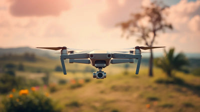
מיקום נוף, משקל מטוס, מצלמה והגדרת מבקרים אינם מחליטים באופן עצמאי מה עשוי להתאים לצילום מוצע בווייטנאם. התחל עם המטוס המדויק והערכה שסופקה, המיקום והקשר האנשים, וחלופת צילום קרקע. לאחר מכן חפש אישור עדכני עבור המקום והפעילות בפועל לפני תזמון אלמנט אווירי.
האם אני צריך רישיון או אישור עדכני אחר עבור צילומי נוף פנאי בוייטנאם?

מדוע תדריך נוף צריך להפריד בין המטוס לבין החלטת המיקום?
תיעוד מטוס יכול לקבוע איזה ציוד נחשב. הוא אינו עונה על שאלות עדכניות עבור פארק לאומי מסוים, חוף, אזור מורשת, מלון, רכוש פרטי או התכנסות ציבורית. שמירה על תיעוד הערכה, איש הקשר באתר, המסלול הנוכחי וחלופת הקרקע יחד נותנת לצלם קובץ החלטה הקשור לצילום האמיתי ולא סף היסטורי או מפה כללית.
כיצד על צוות להפוך את הסקירה לתוכנית פעולה?
נתיבי Reboot Hub קשורים
שאלות נפוצות
האם דף זה יכול להחליט אם צילום נוף בווייטנאם צריך אישור מסוים?
לא. המיקום, המטוס, הקשר האנשים והפעילות המוצעת זקוקים לאישור עדכני דרך הנתיבים הרלוונטיים.
האם מטוס קטן יותר מסיר כל שאלת מיקום או פרטיות?
לא. האתר המדויק, ההקשר של האנשים והכללים הנוכחיים עדיין זקוקים לבדיקה עבור הצילום המוצע.
מה צלם צריך לשמור בתיעוד הערכה?
שמור את המטוס, הבקר, המצלמה, הסוללות, האביזרים, הראיות הסדרתיות ותיעוד המצב ביחד.
מדוע לתכנן אלטרנטיבה לצילום קרקע?
זה משמר את הסיפור כאשר העדויות הזמינות באתר או האישור הנוכחי אינם תומכים באלמנט אווירי.
מתי יש לעיין שוב בתיק התכנון?
סקור אותו כאשר המיקום, התאריך, הקשר האנשים, המטוס, תוכנית הלכידה או היקף הפרויקט משתנים.
Keep exploring
Further reading
From ה-Reboot Hub Chronicle




























From מדריכי מזל"ט















