מיפוי תירס במזג אוויר חם הוא שאלה של תכנון משימה, לא תוצאה קבועה של זמן טיסה. יש להעריך יחד את המטוס המדויק, מצב הסוללה, פריסת השדה, הרוח, דרישת התמונות, תוכנית המפעיל ותנאי האתר הנוכחיים לפני שצוות מתחייב לכיסוי אווירי.
מה צריך צוות מיפוי תירס בטקסס להקים לפני משימת DJI במזג אוויר חם?
שכבת החלטה
ראיות לשמירה
מה זה יכול לקבוע
מה היא לא יכולה לקבוע
ערכת מיפוי מדויקת
גרסת מטוס, מצלמה, בקר, סוללות, סדרות ורשומות מצב
איזו מערכת פיזית מתוכננת
כיסוי או סיבולת עבור תצורה אחרת
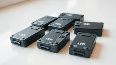
מצב הסוללה
התנהגות טעינה, מצב גופני, אזהרות, היסטוריית מחזורים היכן שזמינה ותיעוד הפעלה לדוגמה
אילו סוללות זקוקות לבדיקה נוספת
זמן פעולה קבוע בתנאים הנוכחיים
תקציר שדה
גבולות שדה, מטרת דימויים, מכשולים, הקשר של אנשים ואלטרנטיבה מבוססת
מה בעצם דורשת משימת המיפוי
אוסף אווירי זה הוא השיטה היחידה שניתן לבצע
מזג אוויר ותוואי אתר
מזג אוויר נוכחי, תצפיות בשטח ותוואי מקומי רלוונטי למבצע בפועל
אילו תנאים צריכים אישור נוכחי
תוצאה קבועה מדוגמא חום היסטורית
תיק שליחות
תוכנית השקה, סיבוב סוללה, קריטריוני התאוששות, תיעוד תצפית ותוכנית מסירה
מה הצוות בדק לפני העבודה
תוצאה לתאריך מאוחר יותר או שדה שונה
מדוע על צוות מיפוי תירס להימנע משימוש בטענה גנרית לזמן טיסה במזג אוויר חם?
ביצועי הסוללה יכולים להשתנות בהתאם לסוללה המדויקת, המטוס, המטען, הרוח, דפוס המשימה, תנאי השטח והעומס התרמי הנוכחי. תוכנית משימה מתועדת נותנת לצוות שטח דרך בטוחה יותר להחליט אם להמשיך, להשהות או להשתמש בשיטת איסוף מבוססת מאשר מספר שהועתק מתנאים של מישהו אחר.
כיצד על צוות להפוך את הסקירה לתוכנית פעולה?
פעולה
מה לשמור
זהה את ערכת המיפוי המדויקת
שמור את המטוס, המצלמה, הבקר, הסוללות, הסדרות וראיות המצב בקובץ אחד.
סקור כל סוללה מתוכננת
בדוק מצב פיזי, התנהגות טעינה, אזהרות גלויות והראיות הזמינות עבור כל סוללה.
כתוב את מטרת השדה
רשמו את גבולות השטח, התמונות הדרושים, המכשולים, ההקשר של האנשים ואלטרנטיבה מבוססת.
אשר את התנאים הנוכחיים
סקור את האתר הנוכחי ואת תנאי מזג האוויר תוך מחשבה על הפעולה בפועל לפני ההשקה.
השתמש בקריטריוני התאוששות שמרניים
תכנן את סיבוב הסוללה, נקודות תצפית, מפעילי התאוששות ואלטרנטיבה ללא השקה לפני תחילת העבודה.