Skip to content

Ghana Construction Mapping: Evidence Before Equipment Choice

Ghana construction-mapping planning brief

A software name, construction label or aircraft recommendation does not prove that a particular site can produce the record a team needs. Start with the site question, exact kit, capture method, people, data boundary and current project route before buying or presenting a mapping solution.

What should a Ghana construction team establish before choosing a drone-mapping setup?

Decision layer Evidence to retain What it can establish What it cannot establish
Site question Specific construction decision, area, changes to document, client, site contact and intended output What the project needs to answer That a mapping label guarantees a useful result
Exact kit Aircraft, controller, payload, batteries, accessories, software account route, serial and condition What system is actually being considered That a family name includes every needed component
Capture method Documented capture plan, coverage boundary, ground-control or reference approach where applicable and review owner What the team intends to collect A universal accuracy or software-compatibility result
People and data Responsible operator, site people, data access, storage and client handover boundary Who handles the information That a construction job has no privacy or access questions
Current project route Current site, client and responsible-route confirmation What needs current review That a purchase approves field work
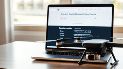
Ghana construction-mapping brief with documented drone kit, capture method, site and data-boundary evidence

Why should the site decision come before a mapping equipment recommendation?

Mapping equipment supports a documented question; it cannot define the question for the site. A team that records the required output, exact kit, method and data boundary can compare options honestly and recognise what still requires current project confirmation.

How should a team turn the review into an action plan?

Action What to retain
1. Define the site decision Write the construction question, area, required output, client and responsible site contact.
2. Record the exact candidate kit Keep aircraft, payload, controller, batteries, relevant account route, serial and condition evidence.
3. Write a capture method Document what will be collected, what is outside scope and who reviews the output.
4. Set data boundaries Keep access, storage, people and handover expectations visible.
5. Confirm the current route Review the actual site and project through the relevant current responsible route.

Related Reboot Hub paths

Related Reboot Hub path Use it for
Drone Wiki model reference hub Identify the exact aircraft and supplied kit
DJI Drone Comparison 2026 Compare documented model roles
Drone grading standard Review condition evidence before purchase
The Reboot Hub Standard Understand documented equipment review
Pre-owned DJI Enterprise options Compare documented enterprise-oriented equipment paths
Seller and serial evidence guides Document a supplied kit before money moves

Frequently asked questions

Does a software name prove mapping compatibility?

No. The exact aircraft, payload, account route, capture method and required output need their own review.

What should the project brief include?

Keep the site question, area, client, exact kit, capture method and data boundary together.

Can a product listing promise mapping accuracy?

No. Accuracy depends on the actual method, site, equipment, review and project conditions.

Why document data access?

It clarifies who can collect, store, review and receive the project material.

Does purchasing equipment approve site work?

No. Site and current project-route questions remain separate.

Prev post
Next post

Leave a comment

Please note, comments need to be approved before they are published.

Keep exploring

Further reading