Live Drone Data Integration All Public Safety Agencies Need for DFR
On June 10, 2026, AirData UAV and LeoSight launched a live-data integration that streams real-time telemetry and flight data directly into LeoCommand — transforming how police dispatchers and field teams manage Drone as First Responder (DFR) operations. This breakthrough removes the latency that plagued earlier DFR rollouts, enabling instantaneous shared situational awareness. For agencies still flying under Part 107 waivers with BVLOS routes, this integration closes a critical gap between drone operators and command. The immediate disruption: every public safety drone program now faces a new benchmark for interoperability — and agencies that fail to adopt risk being left behind on response times, data integrity, and mission safety.

The public safety drone landscape shifted meaningfully on June 10, 2026, as AirData UAV and LeoSight announced a deep integration that pushes live flight data and telemetry directly into the LeoCommand platform. This is not merely a software update—it is a fundamental change in how dispatchers, field commanders, and remote pilots share a common operational picture during Drone as First Responder (DFR) missions. For an industry where seconds separate effective response from missed opportunities, this integration delivers a level of real-time awareness that was previously fragmented across separate systems.

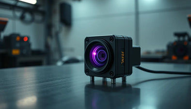
AirData UAV has long been the backbone of commercial drone fleet management, processing terabytes of flight logs, battery cycles, and maintenance records daily. LeoSight, meanwhile, emerged as a specialized unified command platform built from the ground up for public safety—handling everything from 911 call routing to drone tasking and video distribution. By linking these two ecosystems, the partners have effectively eliminated data silos that forced DFR teams to toggle between a drone operations screen and a command dashboard.
The result: when a drone takes off for a priority call, its altitude, speed, battery level, remaining flight time, and even sensor status appear instantly on the same LeoCommand interface that dispatchers use to track patrol units. Field officers see the same data on their mobile terminals. There is no manual relaying of “drone is at 400 feet with 70% battery”—the system speaks directly and continuously.
LeoSight and AirData: A New Standard for Real-Time Situational Awareness
The technical backbone of this integration relies on AirData’s robust API, which streams telemetry at sub-second intervals. LeoSight consumes that data through a dedicated connector and renders it as actionable overlays on its map-centric dashboard. Dispatchers can now click on a drone icon and see its full flight status, including geofencing alerts, signal strength, and estimated time to target. For field teams already using LeoCommand for mobile video streaming, this means they no longer have to guess whether the drone is still on station or returning to launch.
From a regulatory standpoint, this integration arrives at a pivotal moment. FAA Advisory Circular 107-2A and the ongoing BEYOND program have pushed more agencies to apply for waivers for operations beyond visual line of sight (BVLOS). When a drone flies out of the remote pilot’s direct view, the command center becomes the next best source of oversight. LeoSight plus AirData provides a centralized log of every flight parameter, which not only enhances safety but also simplifies waiver compliance documentation.
For the commercial drone operator—whether flying inspections, surveying, or mapping—the implications are equally significant. As agencies upgrade their DFR capabilities, they demand higher-performance drones with integrated software support. This drives a secondary effect on the certified refurbished DJI drones market: agencies retiring older models that lack the necessary API compatibility often sell them through channels like Reboot Hub, creating a steady stream of affordable, flight-ready units for commercial use. Likewise, repair shops that can restore and modernize legacy drones become essential partners in hardware lifecycle management.
Implications for Drone as First Responder (DFR) Programs
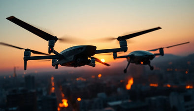
Drone as First Responder programs have proliferated across the United States over the past four years, with cities like Chula Vista, California; Brookhaven, Georgia; and Grand Prairie, Texas reporting dramatic reductions in response times—often by two to four minutes on priority calls. Yet the Achilles’ heel of many DFR deployments has been the “cognitive overhead” of keeping command staff synchronized with what the drone sees and does. The AirData–LeoSight integration directly addresses this friction.
Consider a scenario: a 911 call reports a suspicious vehicle in a parking lot. The drone is launched autonomously from a dock. In previous setups, the dispatcher would receive a live video feed but would have to ask the pilot verbally for altitude, distance to suspect, battery status, and remaining flight time. Now, all that data is displayed as a persistent data bar alongside the video stream. The pilot can focus on flying and observing while the dispatcher sees exactly how long the drone can remain overhead before needing to return for a battery swap.
Equally important, the integration supports post-mission analytics. AirData’s full suite of flight analysis—including geofence breach detection, thermal profiling, and automatic log synchronization—now flows back into LeoSight’s incident reports. This creates a single source of truth for evidence, training, and fleet performance reviews. For public safety IT departments, this reduces the number of vendor relationships and the associated integration headaches.
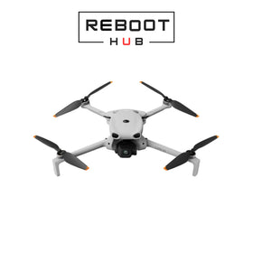
Ready to Upgrade Your Fleet?
Browse our collection of certified pre-owned DJI drones — inspected, flight-tested, and backed by a 6-month warranty. Save up to 40% versus retail.
What This Integration Means for Commercial Operators and Agencies
Question: What does this integration mean for law enforcement agencies already running DFR?
It means they can now achieve true real-time shared situational awareness without toggling between applications. The data stream from AirData into LeoCommand eliminates the “flashing light” problem—where dispatchers have to guess the drone’s status because the telemetry is one refresh cycle behind. For agencies operating multiple drones on a single incident, the map view shows all assets with their live flight data, enabling a tactical airspace manager (sometimes called a “drone supervisor”) to de-conflict routes and prioritize assets.
Question: What does this mean for commercial drone service providers?
If you offer drone services to public safety clients—such as aerial mapping for crash reconstruction or thermal scanning for search-and-rescue—your value proposition now includes the ability to plug into a standards-based command ecosystem. The AirData–LeoSight integration sets a precedent that interoperability is no longer optional. Any provider using a fleet management system that cannot stream live data into LeoSight or similar platforms will find themselves at a disadvantage when bidding on government contracts. This is accelerating demand for drone models that support full API telemetry, such as the DJI Matrice 350 RTK and the M3E series, which in turn drives the used drone market for older enterprise drones that can be upgraded with third-party payloads.
The Bigger Picture: Data Standardization and the Future of Public Safety Drones
The AirData–LeoSight partnership is not an isolated development. Over the past two years, multiple jurisdictions have mandated that all drone data—telemetry, video, and sensor logs—be transmitted in a standardized format compatible with their emergency operations centers. This is driven in part by the Department of Homeland Security’s (DHS) SAVER program and the National Incident Management System (NIMS) guidelines, which emphasize data sharing across agencies. The integration announced on June 10, 2026, directly answers that call for standardized, live data ingest.
For the broader drone market, this signals that software integration capabilities will become a primary differentiator in procurement decisions. Drones that can speak directly to command platforms like LeoSight will command a premium, while those limited to basic RC links will see declining resale values. That has a direct consequence for the second-hand market: smart buyers will look for drones with proven API compatibility, while owners of older models may need to invest in aftermarket telemetry bridges or consider retiring those units through trade-in programs.
Reboot Hub has observed a steady uptick in inquiries from public safety agencies looking to sell surplus drones after upgrading to fleets that support AirData integration. Those same units—often DJI Inspire 1 or Matrice 200 series—become excellent bargains for commercial mappers or inspection firms that do not require the live command integration. For agencies that prefer to keep existing hardware but need an upgrade path, our professional DJI repair services can refurbish gimbals, replace worn batteries, and certify flight controllers to ensure legacy platforms remain airworthy and capable of supporting third-party telemetry modules.
In conclusion, the AirData UAV and LeoSight integration raises the bar for what public safety drone programs can achieve. Live data streaming is no longer a nice-to-have—it is becoming a baseline requirement for agencies that want to maximize response efficiency, maintain compliance, and protect their communities. As the industry continues to evolve toward fully integrated mission stacks, both OEMs and aftermarket providers must adapt to this new standard of real-time shared awareness.
FAQ
1. How does the AirData–LeoSight integration help with FAA Part 107 compliance?
The integration automatically archives all flight telemetry and logs within LeoCommand, providing a clear record of every mission. For agencies operating under Part 107 waivers—especially those for BVLOS operations—this automated logging simplifies documentation required by the FAA during audits or waiver renewals.
2. Can existing DFR drones be retrofitted to support this integration?
Yes, if the drone runs a modern autopilot that can output telemetry via a standard protocol (e.g., MAVLink or AirData’s supported payloads). Most DJI Enterprise models sold after 2022 already have built-in AirData compatibility. Older drones may require an additional telemetry bridge module, which can be installed during a professional service session.
3. Is this integration only for law enforcement, or can fire departments and EMS use it?
LeoSight is designed for all public safety disciplines, including fire, EMS, and search-and-rescue. The same live telemetry stream that helps a SWAT team track a drone overhead can also help a fire incident commander monitor a thermal drone over a wildfire perimeter.
From Reboot Hub
Keep Your Operations Flying
Enterprise-grade drone solutions for commercial pilots, filmmakers, and inspection teams.
Refurbished Fleet
Fully inspected DJI drones with 6-month warranty. Save up to 40%.
Browse Inventory ->