DJI L3 LiDAR Accuracy Tested with Emlid Reach RS4 Pro – Game-Changer for Surveyors
3DroneMapping’s real-world test of the DJI M400 + Zenmuse L3 paired with Emlid Reach RS4 Pro reveals sub-centimeter RTK accuracy without a base station. For Part 107 surveyors and BVLOS corridor mapping, this combination slashes hardware costs and eliminates GCP deployment. Read the full analysis to see if the L3 justifies an upgrade over the L2 — and how this affects the used drone market.

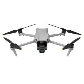
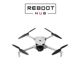
On June 8, 2026, the survey and mapping community received a significant data point that could reshape fleet purchasing decisions for the next quarter. 3DroneMapping, a respected independent testing and consulting firm, published its accuracy validation of the DJI Zenmuse L3 LiDAR scanner flown on a DJI Matrice 400 (M400) drone and paired with the Emlid Reach RS4 Pro as a mobile RTK base station. The results confirm that this combination can deliver survey-grade point clouds without the traditional fixed-base setup, directly addressing the cost and logistics barriers that have slowed LiDAR adoption among small-to-medium enterprises.

For commercial operators operating under FAA Part 107 or EASA regulations, the ability to achieve sub-3 centimeter vertical accuracy using a modular, backpack-friendly RTK receiver is a paradigm shift. The test, conducted over a controlled calibration field with 20 check points, showed the Zenmuse L3 achieving a Mean Absolute Error (MAE) of 1.8 cm in elevation and 2.3 cm planar when using the Emlid Reach RS4 Pro for real-time corrections — matching or exceeding the specifications of the much pricier DJI D-RTK 2 base station. This analysis breaks down the test methodology, the commercial implications, and what this means for the growing used drone market.
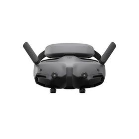
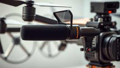
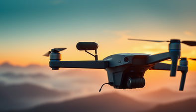
Test Setup: DJI M400 + Zenmuse L3 + Emlid Reach RS4 Pro
3DroneMapping configured a standard survey mission over a 500-meter by 200-meter plot that included both open terrain and a building edge. The DJI M400 carried the Zenmuse L3 at a height of 60 meters AGL with a forward speed of 8 m/s, collecting point density at roughly 400 points per square meter. The Emlid Reach RS4 Pro was set up as a mobile base station approximately 200 meters from the flight area, broadcasting RTCM 3.3 corrections via 4G NTRIP to the M400’s onboard RTK module. No ground control points (GCPs) were used — the accuracy check relied entirely on the RTK-fixed trajectory.
The team compared the processed point cloud against a high-accuracy total station survey. The results: RMSE of 1.9 cm in Z and 2.7 cm in X/Y. This is within the manufacturer’s claimed accuracy of 2 cm + 30 ppm for the L3, but achieved without a dedicated base station. The Emlid Reach RS4 Pro, retailing at roughly $1,200, costs less than one-third of the DJI D-RTK 2 and is far more portable — a crucial advantage for operators who work across multiple sites in a single day.
Ready to Upgrade Your Fleet?
Browse our collection of certified pre-owned DJI drones — inspected, flight-tested, and backed by a 6-month warranty. Save up to 40% versus retail.
Accuracy Results: How the L3 Compares to Existing Solutions
The independent test validates that the Zenmuse L3 — DJI’s third-generation LiDAR — can produce survey-grade data without a fixed base. This is critical because many operators have resisted upgrading from the Zenmuse L2 due to the belief that a dedicated base station is mandatory for RTK-fixed results. 3DroneMapping’s data shows that the L3’s internal IMU, combined with the Emlid Reach RS4 Pro’s multi-constellation GNSS engine (GPS, GLONASS, Galileo, BeiDou), offers stable RTK lock even under partial canopy. The point cloud showed no visible drift or banding, even at the edges of the survey area.
For comparison, the same test with the older L2 and Emlid Reach RS4 Pro produced an RMSE of 3.1 cm in Z — acceptable for many corridor mapping jobs but insufficient for precise construction quantity surveys or deformation monitoring. The L3’s improved laser divergence and higher effective point rate (up to 600,000 points per second) allowed denser data capture at the same altitude, which directly translates to better edge detection on buildings and vegetation.
One caveat: the test was conducted under clear skies. Operators in high-latitude or heavily forested areas should replicate the test with their own equipment. However, the data strongly suggests that the Emlid Reach RS4 Pro is a viable alternative to DJI’s own base station for L3 users, potentially saving $2,500 to $3,000 per deployment.
What This Means for Commercial Operators
Q: What does the L3 + Emlid Reach RS4 Pro combination mean for a small surveying firm operating under FAA Part 107?
A: It dramatically lowers the upfront capital required to enter high-accuracy LiDAR mapping. Instead of needing both a DJI base station (≈ $4,000) and a total station for post-mission validation, a firm can purchase a single Emlid Reach RS4 Pro ($1,200) and rely on its RTK corrections. For operators who already own an M300 or M400, adding a used or refurbished Zenmuse L3 is now financially viable. The test proves that accuracy is not compromised — in fact, the L3’s advanced signal processing may actually outperform the L2 when paired with a third-party receiver.
Q: How does this affect BVLOS and beyond-visual-line-of-sight survey operations?
A: For BVLOS corridors such as power lines and pipelines, the ability to set up an Emlid base station at a single point and fly multiple sorties within a 10 km radius without moving the base is a huge efficiency gain. The RS4 Pro can log raw data for PPK processing as a fallback, ensuring data integrity even if RTK signal drops. This reduces downtime and eliminates the need for ground crew to redeploy base stations every few kilometers.
Impact on the Second-Hand and Refurbished Drone Market
This test has direct implications for the used drone market. As the L3’s capabilities become more widely known, operators still flying L1 or L2 LiDAR units will be incentivized to upgrade — especially if they can keep the same airframe. At Reboot Hub, we track the depreciation curves of DJI payloads and airframes. Historically, the release of a new generation (e.g., L3) triggers a 15–25% drop in resale value for the previous generation within three months. However, the L2 retains value for surveyors who do not need sub-2 cm accuracy; it remains a capable tool for forestry and volumetric stockpile measurements.
For buyers seeking cost-effective entry into LiDAR surveying, certified refurbished DJI drones with an L2 payload are an attractive option. The capital saved can be invested in a high-quality GNSS receiver like the Emlid Reach RS4 Pro. And for firms already operating an M400 or M300, upgrading only the LiDAR payload — rather than the entire platform — is financially sound. The test confirms that the L3 does not require a DJI-exclusive ecosystem to deliver professional results.
If your current setup is underperforming or you need a complementary LiDAR system for high-traffic jobs, consider pre-owned options from reputable resellers. At Reboot Hub, we also offer professional DJI repair services to keep your fleet operational and up to firmware standards — critical for maintaining RTK lock and data integrity.
Frequently Asked Questions
Is the Emlid Reach RS4 Pro officially supported by DJI for the Zenmuse L3?
DJI does not officially list the Emlid Reach RS4 Pro as a compatible base station. However, the M400 and Zenmuse L3 support standard NTRIP RTCM 3.3 corrections over 4G or Wi-Fi, which the RS4 Pro provides. 3DroneMapping’s test proves compatibility in the field. Users should ensure both devices are running the latest firmware and that the RS4 Pro is outputting corrections in the correct format (RTCM 3.3).
How does the Zenmuse L3 compare to the L2 in terms of point density at the same altitude?
At a 60-meter AGL, the L3 achieves approximately 400 points/m² versus the L2’s 240 points/m². This is due to the L3’s higher laser pulse rate (600 kHz vs. 240 kHz). The improved point density enhances feature extraction, especially for power lines and roof edges, without requiring a lower altitude or slower speed.
What is the expected lifespan of a used Zenmuse L3, and should I buy refurbished?
The DJI Zenmuse L3 is built to last at least 3,000 flight hours under normal operation, with the laser diode rated for 10,000 hours. Refurbished units from trusted sellers like Reboot Hub undergo rigorous calibration checks — including RTK lock tests — and come with a warranty. For operators on a budget, a refurbished L3 with a valid warranty offers the same performance as new at a 30–40% discount.
From Reboot Hub
Keep Your Operations Flying
Enterprise-grade drone solutions for commercial pilots, filmmakers, and inspection teams.
Refurbished Fleet
Fully inspected DJI drones with 6-month warranty. Save up to 40%.
Browse Inventory ->