The Data Deluge: Why Drone as First Responder Programs Are Hitting a Wall
A California fire district reveals the hidden bottleneck in public safety drone operations: data management. As DFR programs scale from proof-of-concept to daily deployment under FAA Part 107 waivers, agencies are drowning in terabytes of flight data, struggling to extract actionable intelligence from thermal and visual feeds. This analysis reveals the operational gridlock, the commercial opportunities for data processing firms, and the critical implications for second-hand fleet procurement. Failure to adapt means mission failure.

Editorial notes
- This article combines named outside reporting with Reboot Hub's own analysis for drone buyers, fleet operators, repair customers, and pre-owned DJI market watchers.
- Source facts are separated from interpretation. When a report provides limited data, the article states that limitation and frames Reboot Hub's view as analysis.
- Reboot Hub has commercial links to drone products and repair services; those links are reader resources and do not determine the article's conclusion.
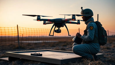
The promise of the Drone as First Responder (DFR) program has always been seductive: a drone launches from a fire station or police precinct within seconds of an emergency call, arrives on scene long before ground units, and provides a real-time, god’s-eye view of unfolding chaos. For the past three years, agencies across California, Texas, and Florida have rushed to adopt this model, spurred by FAA waivers and a wave of public safety grants. But as the operational tempo has accelerated from occasional sorties to near-constant airborne coverage, a new and insidious threat has emerged—not from an adversary, but from the very data the drones produce.
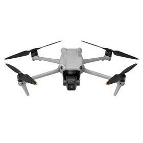
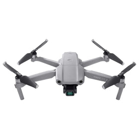
On May 28, 2026, a senior fire district technology officer in California disclosed a stark reality: their DFR program, which now flies a fleet of six DJI Matrice 350 RTK and three DJI Mavic 3 Enterprise drones, is generating more than 4 terabytes of raw flight data per month. This includes high-resolution visual footage, radiometric thermal imaging, and real-time GPS telemetry. The problem is not getting the aircraft into the air—it is managing, processing, and extracting actionable intelligence from the flood of information they bring back. The officer, speaking on condition of anonymity, stated, “We are drowning in data. We have terabytes of footage from last month’s wildfire response that we will never be able to fully analyze. It’s a mission-critical bottleneck.”
This revelation, detailed in a report published on May 29, 2026, underscores a fundamental shift in the public safety drone landscape. The initial phase of DFR adoption was about proving the concept: can a drone beat a patrol car to a 911 call? The answer, resoundingly, was yes. But now, as programs scale from pilot projects to permanent operational assets, the challenge has evolved from hardware acquisition to data lifecycle management. For the commercial drone industry, this represents both a burgeoning market opportunity and a stark warning for operators who underestimate the backend infrastructure required for serious aerial surveillance.
Fleet readiness
Keep DJI hardware available without overbuying new units.
Use this news as a planning signal for inspected DJI aircraft, repair support, and trade-in timing.
The Operational Reality: From Flight Logs to Actionable Intelligence
The California fire district’s experience is not an anomaly. It is a canary in the coal mine for the entire public safety drone ecosystem. A typical DFR mission, lasting 15 to 30 minutes, can generate between 50 and 150 gigabytes of data from a single flight, depending on sensor payload and resolution. When an agency flies 20 to 30 missions per day—as many large DFR programs now do—the data accumulation becomes staggering. The core issue is that raw video footage, even when streamed live to a command center, is not intelligence. It is noise.
To transform that noise into actionable intelligence, agencies must employ sophisticated data management platforms that can automatically geotag, timestamp, and catalog every frame. They need AI-driven analytics to detect anomalies—a heat signature that could indicate a hidden victim, a vehicle moving away from a crime scene, or a change in terrain after a natural disaster. Without such systems, a fire captain reviewing footage from a wildfire is essentially watching hours of unindexed video, hoping to spot a critical detail. This is not scalable, and it is not sustainable.
The FAA’s Part 107 regulations, which govern most public safety drone operations, require meticulous record-keeping. Flight logs, maintenance records, and incident reports must be maintained for a minimum of two years. For agencies operating under a Part 107 waiver for BVLOS (Beyond Visual Line of Sight) operations—a common requirement for DFR programs—the data retention and audit trail requirements are even more stringent. The California fire district now employs a dedicated data manager, a role that did not exist in their budget three years ago, simply to ensure compliance with federal record-keeping standards.
What This Means for Commercial Operators and the Second-Hand Market
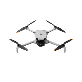
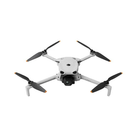
For the private sector, the implications of this data management crisis are profound. The operational pain points experienced by public safety agencies are directly transferable to commercial drone enterprises in surveying, construction, agriculture, and energy inspection. A pipeline inspection company flying a DJI Matrice 300 RTK with a LiDAR payload faces the same fundamental challenge: massive data generation without a streamlined pipeline for processing and analysis.
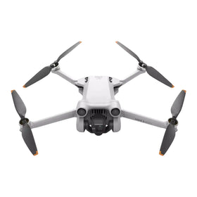
This is where the used drone market enters the equation. As agencies and commercial operators upgrade their fleets to handle higher data volumes—often moving from older DJI Mavic 2 Enterprise models to the newer Matrice 4 Series or the DJI Mavic 3E with increased onboard storage and processing capabilities—the secondary market for inspected pre-owned equipment is experiencing a surge in supply. At Reboot Hub, we are seeing an increasing number of trade-ins from public safety agencies that are swapping out entire fleets to standardize on platforms with better data management integration. This creates a unique opportunity for smaller operators and emerging drone service providers to acquire high-quality, flight-tested hardware at a fraction of the retail cost, provided they have the data management infrastructure to handle the output.
However, the data bottleneck also creates a new line of due diligence for buyers in the used drone market. A drone with a high-end thermal camera is only as valuable as the software ecosystem that can process its data. Buyers must now evaluate not just the airframe and sensor condition, but also whether the drone supports modern data management protocols like RTK correction integration, real-time geotagging, and cloud-based data streaming. A drone that cannot interface with a modern GIS platform like ArcGIS or DroneDeploy is, for many professional applications, a paperweight.
Ready to Upgrade Your Fleet?
Browse our collection of inspected pre-owned DJI drones — inspected, flight-tested, and backed by a 6-month warranty. Save up to 40% versus retail.
Q&A: What Does the California Fire District Crisis Mean for Drone Pilots and Operators?
Q: I am a Part 107 commercial pilot flying for a small surveying firm. How does this data management issue affect me?
A: Directly. If you are generating raw data without a structured processing workflow, you are losing money and risking client dissatisfaction. The California fire district’s experience is a cautionary tale: raw data is a liability, not an asset. You need to invest in software that can automate orthomosaic stitching, point cloud generation, and thermal analysis. Platforms like Pix4D, DroneDeploy, and DJI's own Terra are becoming essential. Furthermore, if you are considering upgrading your drone, ensure the new platform supports these workflows. A DJI Mavic 3E with RTK module, for example, can significantly reduce post-processing time by embedding geolocation data directly into the image metadata.
Q: Should I be concerned about data privacy regulations when flying DFR-style missions?
A: Absolutely. The California fire district’s data management challenge is compounded by California’s strict privacy laws, including the California Consumer Privacy Act (CCPA). Any aerial footage that captures identifiable individuals or private property must be handled with extreme care. Agencies are now required to implement automated redaction tools to blur faces and license plates before footage is used for training or public records requests. For commercial operators, this means that data management is not just an operational efficiency issue—it is a legal compliance issue. Failure to properly manage and secure drone data can result in lawsuits, loss of license, and severe reputational damage.
Q: What is the commercial opportunity in the data management space for drone service providers?
A: Enormous. The market for drone data processing and analytics software is projected to grow at a CAGR of 25% through 2030, according to industry analysts. There is a massive gap between the hardware capabilities of modern drones and the software infrastructure required to exploit them. Startups and established firms that can offer turnkey data management solutions—from ingest to AI analysis to archival—will find a hungry market in both public safety and commercial sectors. For drone pilots, adding a data management certification to your resume (e.g., becoming a certified Pix4D or DroneDeploy operator) can command a premium rate of 20-30% higher than standard flight-only services.
The Hardware Response: New Drones Built for Data
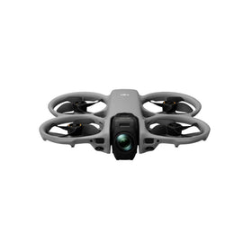
Recognizing the data management bottleneck, drone manufacturers are pivoting their hardware design philosophy. The latest generation of enterprise drones, such as the DJI Matrice 4 Series (released in late 2025) and the Autel Robotics EVO Max 4T, feature onboard AI processing units that can perform real-time object detection and classification without requiring a continuous data link to a ground station. This edge computing capability is a direct response to the data deluge problem: by processing data in-flight, the drone can transmit only metadata and key frames back to the command center, dramatically reducing bandwidth requirements and storage needs.
Furthermore, these new platforms support standardized data formats like MISB (Motion Imagery Standards Board) for direct integration with military-grade command and control systems. For public safety agencies, this is a game-changer. It means that a drone feed can be ingested directly into a 911 dispatch center’s existing software, complete with geolocation overlays and automatic incident tagging, without requiring a separate video management system. The California fire district is reportedly evaluating an upgrade to the Matrice 4 Series specifically to address their data management woes, though the cost—approximately $18,000 per airframe with a full sensor suite—is a significant barrier for budget-constrained agencies.
This hardware evolution has a direct impact on the second-hand market. As agencies like the California fire district upgrade to new platforms with integrated data management capabilities, they offload their previous-generation equipment. At Reboot Hub, we are currently processing a large batch of DJI Matrice 300 RTK drones that were traded in by a municipal police department upgrading to the Matrice 4 Series. These units, which are still highly capable for many commercial applications, are available at a significant discount. However, as noted earlier, buyers must be prepared to invest in the external data management software ecosystem to make the most of these older platforms. A Matrice 300 RTK paired with a DJI Smart Controller and a DroneDeploy subscription is still a formidable and cost-effective aerial intelligence platform.
The Path Forward: Data Management as the New Standard
The California fire district’s data management crisis is not a failure of technology—it is a failure of planning. For too long, the drone industry has focused on the aircraft as the primary value driver, neglecting the backend infrastructure that transforms flight data into mission-critical intelligence. As DFR programs continue to scale, and as commercial drone operations become more sophisticated, data management will cease to be an optional add-on and will become a core competency requirement.
For the everyday commercial operator, the lesson is clear: do not wait until you are drowning in terabytes of unprocessed data to build your data management pipeline. Invest in the software, the training, and the hardware that can handle the data load. If you are in the market for a used drone, prioritize platforms that offer robust SDK support for data management integration. And if your current fleet is generating more data than you can handle, consider upgrading to a inspected pre-owned system that is designed for the modern data-intensive workflow.
At Reboot Hub, we understand that the drone is only half the equation. That is why every refurbishment-labeled DJI drone we sell comes with a detailed flight log and sensor diagnostic report, ensuring that you know exactly what data the platform can produce and how to manage it. We also offer professional DJI repair services to keep your fleet operational and your data pipelines flowing. The future of drone operations is not just about flight—it is about intelligence. And intelligence starts with data management.
FAQ: Data Management for Drone as First Responder Programs
What is the biggest data management challenge for public safety drone programs?
The primary challenge is the sheer volume of raw data generated per mission—often 50-150 GB per flight—combined with the lack of automated tools to index, analyze, and archive that data in a way that is legally compliant and operationally useful. Without a structured data management pipeline, agencies quickly accumulate terabytes of unprocessed footage that cannot be effectively searched or used for evidence.
How does FAA Part 107 affect data management for DFR programs?
FAA Part 107 requires operators to maintain detailed flight logs, maintenance records, and incident reports for a minimum of two years. For agencies operating under BVLOS waivers, the record-keeping requirements are even more stringent. This creates a legal mandate for robust data management systems that can automatically generate and store compliant records, adding another layer of complexity beyond simple video storage.
What should commercial operators look for in a used drone to ensure good data management capability?
Commercial operators should prioritize drones that support RTK correction for accurate geotagging, have open SDKs for integration with third-party data management software like Pix4D or DroneDeploy, and offer onboard storage with fast data transfer speeds (e.g., USB-C or built-in SSD). Models like the DJI Matrice 300 RTK or the newer Matrice 4 Series are excellent choices. Avoid older platforms that rely solely on SD cards and lack geotagging capabilities, as they will require significant post-processing effort to generate usable data.
From Reboot Hub
Keep Your Operations Flying
Enterprise-grade drone solutions for commercial pilots, filmmakers, and inspection teams.
Pre-owned Fleet
Fully inspected DJI drones with 6-month warranty. Save up to 40%.
Browse Inventory ->