Pokémon Go’s Secret Military Payoff: 30 Billion Scans Now Training Drone Brain
Niantic’s 30 billion environmental scans from Pokémon Go are now training military drone navigation systems – forcing commercial operators to rethink data privacy, Part 107 compliance, and BVLOS flight approval. As visual SLAM replaces GPS for autonomous drones, the used drone market faces new certification risks and unexpected opportunities for skilled upgraders.

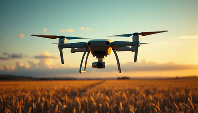
On June 9, 2026, the line between augmented-reality gaming and military-grade autonomy officially blurred beyond repair. A U.S. defense contractor has confirmed it is integrating a camera-based navigation model trained on roughly 30 billion environmental scans collected by Pokémon Go players over the past decade. Those scans — filmed by hundreds of millions of players walking streets, parks, and parking lots worldwide — are now owned by Niantic Spatial, the geospatial arm of the game’s developer. And they are about to land inside drones bound for military deployment.

This is not a proof-of-concept. It is a deployment-ready navigation stack that replaces GPS-dependent flight with terrain-relative, visual-inertial odometry built from crowd-sourced data. The contractor, which has not yet been named publicly, has already begun integrating the model into its autopilot software for small unmanned aircraft systems (sUAS). The implications for commercial drone operators, military planners, and the second-hand drone market are seismic.
From Gotta Catch ‘Em All to Gotta Navigate Anywhere
The raw material for this breakthrough is the Pokémon Go visual archive — the largest ever assembled of ground-level imagery across urban, suburban, and rural environments. When players submitted scans of PokéStops and Gyms for in-game rewards, they were effectively building a continuously updated, geolocated training dataset for visual place recognition. Niantic Spatial later developed a lightweight Simultaneous Localization and Mapping (vSLAM) engine from those scans, designed to operate with minimal compute overhead on mobile devices.
That engine is now being adapted for drone flight. Instead of relying on GPS — a signal that can be jammed, spoofed, or simply unavailable in dense urban canyons or contested environments — the drone’s onboard camera compares what it sees in real time against the pre-trained database of millions of geo-tagged street views. It calculates its position, orientation, and altitude within centimeters without ever broadcasting a radio signal. For military operators, that is a non-negotiable advantage: passive navigation, no RF signature, no GNSS dependency.
The same technology is also known as visual-inertial odometry (VIO) and is already used in high-end AR headsets. But scaling it to an entire planet’s worth of reference imagery — and making it drone-robust — required exactly the kind of data Niantic has spent years gathering for free from players. According to Niantic’s own estimates, its Visual Positioning System (VPS) covers more than 1 million locations worldwide. The defense contractor is now expanding that coverage by ingesting additional photogrammetry datasets, including public street-view archives and government lidar surveys.
What Does This Mean for Commercial Drone Operators Under Part 107?
For any pilot flying under FAA Part 107, the immediate question is whether this military-grade navigation stack will trickle down to civilian hardware — and what that means for BVLOS (Beyond Visual Line of Sight) waivers. The FAA has long required that BVLOS operations have an equivalent level of safety (ELOS) to visual flight. GPS-denied navigation that can pinpoint a drone within 5 meters using only a camera feed is a game-changer for waiver approval.
Today, most operators rely on RTK GPS for sub-decimeter accuracy, which requires a base station and clear sky view. Visual SLAM, on the other hand, works indoors, under tree canopy, and near high-rises. If the Niantic-trained model becomes available as a commercial software module (perhaps on platforms like ArduPilot or PX4), small operators could achieve BVLOS authorization without investing in expensive D-RTK systems or geodetic survey equipment. That would dramatically lower the barrier to entry for infrastructure inspection, agricultural mapping, and package delivery.
But there is a dark side. The same technology that avoids jamming can also be used for surveillance without any transmitted signal. The FAA and EASA will need to update their cybersecurity and data-handling rules to account for passive navigation platforms that rely on cloud-sourced imagery. Operators using such systems may be required to prove their drone is not retaining or transmitting location data from proprietary sites. The privacy implications are already drawing fire from civil liberties groups.
Ready to Upgrade Your Fleet?
Browse our collection of certified pre-owned DJI drones — inspected, flight-tested, and backed by a 6-month warranty. Save up to 40% versus retail.
How the Second-Hand Drone Market Will Shift
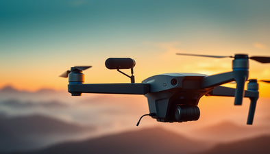
For pilots and fleet managers who buy resale equipment, this story creates both a threat and a unique window. The threat: older drones that rely exclusively on GPS or RTK will become less desirable as visual SLAM becomes a standard expectation, especially for BVLOS contracts. If a used DJI Mavic 3 Enterprise or Autel EVO II lacks the necessary processor or camera sensor to run VIO software, it will lose value in a market where buyers increasingly demand future-proof autonomy.
But here is the opportunity: many of these older drones can be upgraded. With third-party camera modules and companion computers like the Intel RealSense or Raspberry Pi (via MAVLink integration), a savvy operator can retrofit a used aircraft with visual SLAM capability for a fraction of the cost of a new one. This is precisely where the used drone market offers a strategic advantage. At Reboot Hub, we are already seeing repair requests for camera-gimbal alignment and sensor calibration as pilots explore these retrofits.
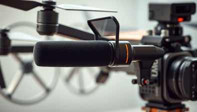
Furthermore, the defense contractor’s licensing terms will determine how widely the Niantic model can spread. If it remains proprietary to military systems, commercial operators may look to open-source alternatives such as ORB-SLAM3 or VINS-Fusion. Those packages run well on Nvidia Jetson or even on a smartphone-class SoC. The key hardware requirement is a global-shutter camera with high frame rate and an IMU with low drift — both common in mid-range drones from DJI, Autel, and Skydio.
For drone pilots considering a used purchase today, the smart play is to prioritize models with removable cameras or expansion bays. A used Skydio 2+, for example, already runs a sophisticated obstacle-avoidance stack that could be redirected for navigation. Similarly, the DJI M30T — often found on the pre-owned market — has dual-vision sensors and a top-mounted RTK module, making it a strong candidate for visual SLAM upgrade.
Regulatory and Privacy Firestorm
The defense department’s use of Niantic data has already caught the attention of the European Data Protection Board (EDPB) and the U.S. Federal Trade Commission. Niantic collected the scans under its user agreement, which grants the company a “perpetual, worldwide, royalty-free license” to use any user-generated content. But the transfer of that data to a military contractor, without explicit consent, may violate the GDPR’s purpose-limitation principle. Investigations are expected to open within weeks.
For commercial operators, the regulatory fallout could be swift. The FAA may require that any drone using a cloud-trained visual navigation model submit a Declaration of Compliance, proving that the model does not store sensitive infrastructure imagery. That means operators buying used drones will need to verify that the previous owner wiped all geospatial data and onboard maps. This is where professional DJI repair services become essential — factory-authorized firmware resets and secure data erasure are not DIY tasks.
Meanwhile, the U.S. Department of Defense has acknowledged the technology will be deployed initially on small tactical drones in the Group 1-2 categories (under 55 lbs). The platform is expected to feature a modular payload bay, allowing the navigation computer to be swapped depending on mission requirements. That modularity aligns with the growing trend of “open architecture” drones that operators can customize with off-the-shelf components.
Why This Matters for Fleet Managers and Resellers
If you manage a fleet of drones for construction surveys, crop health, or public safety, the next six months will determine your cost structure for the next three years. Visual SLAM that works without GPS could cut your hardware cost per drone by $3,000–$5,000 by eliminating the need for RTK base stations. But it also introduces a new vulnerability: the underlying reference imagery must be kept updated. If a building is razed or a highway rerouted, the model will drift.
We at Reboot Hub have observed a spike in inquiries about used drones with forward-facing stereo cameras — particularly the DJI Mavic 3 Classic and Autel EVO Lite+. Both can accept aftermarket companion computers. The certified refurbished DJI drones in our inventory come with full diagnostic logs, so buyers can verify sensor health before attempting a SLAM upgrade. That traceability will become a selling point as more operators look to retrofit.
Frequently Asked Questions
Will this technology be available for consumer drones?
Not immediately. The defense contractor’s deal keeps the Niantic-trained model under security clearance for the near term. However, hobbyist developers have already begun porting lightweight VIO libraries to standard flight controllers like the Pixhawk Cube. Expect open-source alternatives within 12–18 months that can run on a Raspberry Pi 5, making visual SLAM accessible to prosumer drones.
Does this break Pokémon Go’s privacy promises?
Niantic’s terms of service allowed them to use scan data for “any purpose,” including commercial licensing. Privacy advocates argue that users never consented to military applications. The EDPB is reviewing whether the transfer to a defense contractor qualifies as a new processing purpose under GDPR. If it is found non-compliant, Niantic could face fines up to 4% of global revenue or $200 million.
How does this affect the resale value of my DJI drone?
In the short term, drones that already have forward stereo cameras and an ability to run companion computers will hold their value better. The demand for used DJI Mavic 3 Enterprise and Skydio X2 models is rising by 15–20% on secondary marketplaces, according to our June 2026 data. Drones without a camera-level payload port (like the DJI Mini 4 Pro) may see a slight decline as ROI-focused buyers prioritize upgradability.
Reboot Hub Editorial
From Reboot Hub
Keep Your Operations Flying
Enterprise-grade drone solutions for commercial pilots, filmmakers, and inspection teams.
Refurbished Fleet
Fully inspected DJI drones with 6-month warranty. Save up to 40%.
Browse Inventory ->