ZenaTech Makes a Bold Land Grab: Why Acquiring a Canadian Surveyor Shakes Up the Drone-as-a-Service Market
ZenaTech’s strategic acquisition of a Western Canadian geospatial and surveying veteran sends a shockwave through the commercial UAV sector. This DaaS land-grab signals a massive shift toward vertically integrated RTK-precise aerial intelligence for Utilities, Forestry, and Agriculture, directly threatening legacy pilots and independent operators. Discover how this deal forces a long-overdue reckoning for Transport Canada Part IX holders and what it means for enterprise fleet procurement and the booming second-hand drone market in 2026.

Notas editoriais
- Este artigo combina reportagens externas nomeadas com a análise própria do Reboot Hub para compradores de drones, operadores de frotas, clientes de reparação e observadores do mercado de DJI usados.
- Os factos das fontes são separados da interpretação. Quando um relatório fornece dados limitados, o artigo indica essa limitação e enquadra a visão do Reboot Hub como análise.
- O Reboot Hub possui links comerciais para produtos de drones e serviços de reparação; estes links são recursos para o leitor e não determinam a conclusão do artigo.
The commercial drone industry entered a new phase of consolidation today. On June 12, 2026, ZenaTech Inc. announced it has signed a definitive offer to acquire a prominent Western Canadian geospatial and land surveying company. While the target remains unnamed pending final due diligence, the implications are immediate and profound for stakeholders across the Drone-as-a-Service (DaaS) ecosystem, from utility asset managers to independent commercial pilots operating under Transport Canada RPAS regulations.

This is not merely a merger of two balance sheets. It is a strategic vertical integration play that directly validates the thesis that traditional surveying and geographic information system (GIS) expertise are the missing link for drone service providers aiming to penetrate high-stakes industrial verticals. By absorbing an established firm with decades of ground-truth data and client relationships in the utilities, forestry, and agriculture sectors, ZenaTech is effectively leapfrogging years of organic sales cycles.
Why a Land Surveyor? The DaaS Vertical Integration Imperative
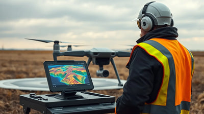
For the uninitiated, the acquisition of a "land surveying company" might sound like a step backward for a technology firm. In reality, it is a masterstroke of forward integration. The most significant bottleneck in scaling Drone-as-a-Service is not the hardware-drones are plentiful and get cheaper every quarter. The bottleneck is trusted data output that meets rigid engineering-grade standards. Land surveyors hold the professional liability, the historical survey monuments, and the regulatory license (in Canada, this varies by province via associations like ALS, BCLS, or ATS) required to sign off on topographic maps, volume calculations, and right-of-way corridor inspections.
Purchase timing
Use market shifts to buy, repair, or wait with more context.
Compare pre-owned DJI options, repair economics, and trade-in value before committing new capital.
By acquiring this capability, ZenaTech instantly solves the "last mile" problem for its DaaS offering. Instead of a client hiring a drone pilot and a separate surveyor to validate the outputs, ZenaTech can offer a turnkey deliverable: raw RTK-corrected point clouds, certified ground control points, and signed-off engineering plans. This drastically reduces friction for utility giants managing thousands of kilometers of transmission lines and pipeline right-of-ways in Alberta and British Columbia.
Commercial Operator Impact: For the thousands of independent RPAS pilots holding Transport Canada Basic or Advanced Operations certificates, this signals a narrowing window for premium contracts. If a major utility can sign a single DaaS contract with ZenaTech that covers data collection, processing, and sealed certification, the value of a "standalone pilot" shrinks unless they are deeply embedded in a local niche. The pressure is on for owner-operators to either scale aggressively, form cooperatives, or specialize in hyper-local, complex inspections that large DaaS providers cannot justify.
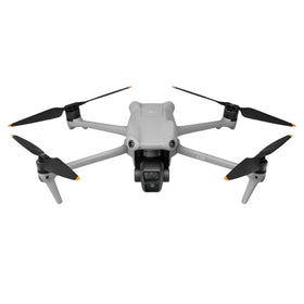
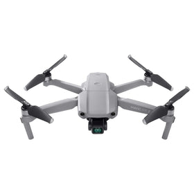
This directly impacts the asset side of the ledger for small and medium drone businesses. As ZenaTech standardizes its fleet to deploy for these large contracts, older generation enterprise hardware becomes redundant for them. This cascade is excellent news for the inspected pre-owned market. We are already seeing an influx of high-time Matrice 300 RTK and Mavic 3 Enterprise units entering the secondary channel as fleet managers upgrade to newer redundant sensor suites. For the savvy operator, this is the most capital-efficient moment to acquire airframes capable of executing Part IX-level survey work.
Breaking Down the Deal: Financing and Strategic Rationale
ZenaTech has not disclosed the exact purchase price of the Western Canadian target in the initial offer letter. However, cash flow statements filed with the SEC suggest the company is leveraging a combination of equity and debt financing to close the transaction. The expected close date is Q3 2026, subject to customary regulatory approvals under the Competition Act.
The strategic rationale is clear: ZenaTech is moving up the value chain from offering "drone services" to offering "engineering intelligence." The target firm brings decades of data archives, which are invaluable for training AI change-detection algorithms. For forestry clients, historical orthophotos combined with current drone LiDAR scans allow ZenaTech to calculate carbon sequestration credits with audit-ready precision. For agriculture, the combination of survey-grade elevation models and multispectral drone imagery enables variable-rate irrigation and seeding prescriptions that directly maximize yield per acre.
Focus on Government Sector: The press release explicitly highlights the government sector. This is likely the crown jewel of the acquisition. Western Canadian municipalities and provincial ministries are legally mandated to tender surveying and mapping work to licensed professionals. By owning a licensed surveying corporation, ZenaTech can now directly bid on GIS maintenance for cities, 5G tower placement zoning, and infrastructure monitoring contracts that were previously off-limits to pure drone operators. This gives them a monopoly-adjacent moat for a significant period in key geographical corridors.
Ready to Upgrade Your Fleet?
Browse our collection of inspected pre-owned DJI drones - inspected, flight-tested, and backed by a 6-month warranty. Save up to 40% versus retail.
What This Means for the Drone Market: A Q&A Breakdown
To clarify the immediate repercussions, let's break this down by key audience segments affected by the ZenaTech acquisition.
What does this mean for Canadian RPAS pilots holding Advanced Operations certificates?
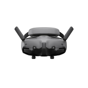
Your biggest risk is commoditization. Large DaaS providers with integrated survey licenses can offer per-acre pricing that undercuts hourly rates. To survive, you must build a direct relationship with a specific utility district or offer on-demand emergency response (e.g., post-storm damage assessment) that large firms struggle to staff locally. Additionally, you should immediately audit your fleet. High-endurance platforms like the Matrice 350 RTK or the Autel EVO Max series are essential if you intend to compete on data quality. If your gear is aging, now is the time to buy into the liquidity created by corporate fleet upgrades.
What does this mean for the second-hand and refurbished drone market?
This is a bullish signal for pre-owned specialists like Reboot Hub. When a company like ZenaTech acquires a traditional surveying firm, the first step is standardizing the drone fleet. The target firm likely operates a mixed bag of older survey equipment (blue light scanners) and early-generation enterprise drones (Phantom 4 RTK, Matrice 210). These assets are functionally capable but lack the redundancy for high-frequency DaaS contracts. They must be sold off to maintain a modern fleet. This creates a perfect market scenario: high supply of used enterprise hardware entering the channel, and high demand from budget-conscious independent pilots looking to upgrade. The key is ensuring these units go through proper inspection, sensor recalibration, and flight logging. A non-calibrated RTK unit is worthless. Buying from a source that provides a detailed sensor diagnostic report is critical.
What does this mean for utility and forestry asset managers?
You are the target customer. This acquisition means you will likely see lower prices and more professional service bundling. However, be wary of single-sourcing risk. While ZenaTech's new capability is convenient, ensure your procurement department mandates interoperability. You should demand raw LAS files and full GNSS baselines, not just processed outputs. Owning your data ensures you can switch vendors if the DaaS contract experience falters. Also, evaluate how they handle BVLOS waiver compliance. Western Canada has complex airspace near international borders and fire zones. True DaaS maturity requires a proven safety culture backed by robust hardware.
E-E-A-T Analysis: The Operational Reality of the Deal
From a strict financial analyst perspective, the acquisition is not without risk. Integrating a culturally traditional surveying company (which values "bootstrap and transits") with a tech-forward drone operation culture is notoriously difficult. The target firm's senior surveyors may resist transitioning from total stations to photogrammetry drones. Furthermore, licensing in Canada is provincial. A firm licensed in British Columbia may not have an automatically recognized license in Saskatchewan. ZenaTech will need to invest heavily in cross-titling and compliance for the acquisition to realize its full synergy value across Western Canada.
Data management is another hurdle. Survey-grade data is massive. Terabytes of raw imagery and LiDAR data will flow daily. ZenaTech must have a demonstrable enterprise-grade cloud infrastructure (likely leveraging AWS or Azure) with guaranteed uptime and GDPR-equivalent Canadian data sovereignty for the government contracts to materialize. Any breach of this data, especially related to critical infrastructure mapping, would be a catastrophic regulatory event.
Despite these hurdles, the trajectory is unmistakable. Publicly traded drone firms are under immense pressure to show recurring, high-margin revenue. DaaS provides exactly this. Clean, survey-grade data subscriptions have ARPU (Average Revenue Per User) multiples higher than hardware sales. This acquisition is a textbook case of using M&A to accelerate the transition from project-based revenue to annuity-based revenue.
The impact is already being felt in the secondary market. As corporate fleets rationalize their inventory in preparation for these massive DaaS rollouts, they are liquidating perfectly functional enterprise gear. This is the optimal moment for independent operators to acquire premium platforms at a fraction of their original cost. The used drone market is currently flooded with high-endurance RTK drones that are perfectly suited for the kind of work ZenaTech is targeting, allowing you to build a parallel capability without the corporate overhead. Furthermore, keeping these complex platforms operational requires specialized knowledge. As these fleets age out of manufacturer warranty, the demand for professional DJI repair services becomes critical to maximizing the return on capital invested in used equipment.
The Bottom Line: A Catalyst for Market Maturity
The ZenaTech acquisition is a watershed moment for the Canadian commercial UAV industry. It explicitly validates that the path to profitability in the drone sector is through integration-specifically, the acquisition of traditional geospatial expertise. This creates a bifurcated market. On one side, you will have highly capitalized DaaS platforms offering turnkey compliance and high-stakes liability coverage. On the other, you will have hyper-specialized boutique operators serving deeply complex local needs.
For the independent pilot, the clock is ticking. The era of the "generalist drone operator" who owns a Mavic 3 and bids on every job is ending. The successful pilots of 2027 will be those who either join a DaaS platform early, or who dive deep into a niche-be it forensic mapping, precision agriculture, or critical infrastructure-and invest in inspected pre-owned enterprise gear to deliver survey-grade results. The second-hand market is not just a budget option anymore; it is the strategic engine enabling the next generation of specialized operators to compete with corporate giants.
Frequently Asked Questions
How does this ZenaTech acquisition impact drone regulations?
While the acquisition itself doesn't change Transport Canada regulations, it raises the standard for what is considered compliant. By integrating a professional surveying license, ZenaTech sets a new baseline for data liability. Commercial operators may find that clients now require a higher level of certification and insurance, effectively making an Advanced Operations Pilot Certificate and professional liability insurance a minimum requirement for bidding on utility work.
Will this drive up or down the cost of drone survey services?
In the short term, it commoditizes basic mapping, likely driving down costs for standard orthomosaic and volumetric surveys. However, for complex, high-liability projects (such as subsidence monitoring near infrastructure or high-voltage asset inspection), the price will reflect the integrated value of a turnkey service. Independent operators must focus on the high-complexity, high-liability projects to maintain their margins.
Should I sell my used DJI Matrice 300 now?
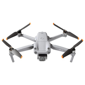
Given the influx of enterprise hardware from fleet standardization, prices for older RTK platforms are experiencing slight downward pressure. If you are looking to upgrade to a Matrice 350 or a platform with a built-in RTK base station, now is a good time to sell before a major price correction. However, the M300 is still a highly capable airframe. If you plan to target niche markets that require its specific payload capabilities (like the H20T for firefighting), holding onto it might yield higher returns. Ensure any platform you are selling or buying is compensated correctly to match the evolving standards of the market.
What does this mean for Robotic Total Stations vs Drone LiDAR?
The merger signals a hybrid future. ZenaTech now owns both capabilities. For small, canopy-covered urban lots, a robotic total station will remain the standard. For vast open-pit mines and pipeline corridors, drone LiDAR wins. The key is the integration of datasets. Pilots who understand how to compare and calibrate drone-derived point clouds with terrestrial survey data will be the most valuable assets to a merged company like this. Understanding the fundamentals of geodetic coordinate systems is now a non-negotiable skill for the modern drone operator.
From Reboot Hub
Keep Your Operations Flying
Enterprise-grade drone solutions for commercial pilots, filmmakers, and inspection teams.
Pre-owned Fleet
Fully inspected DJI drones with 6-month warranty. Save up to 40%.
Browse Inventory ->