Pokémon Go Creator’s New Deal: Your Drone Photos Are Now Training AI
In a seismic shift for the commercial drone industry, Niantic Spatial—the spinoff of Pokémon Go fame—has partnered with Spexi to leverage a global, decentralized drone imagery network for building hyper-detailed 3D maps. This isn’t just about gaming; it represents a massive new revenue stream for drone pilots and a fundamental change in how AI and robotics are trained. We analyze the immediate implications for Part 107 operators, the second-hand drone market, and the future of geospatial data monetization. Miss this analysis, and you risk being left behind in the data gold rush.

편집자 노트
- 본 기사는 외부 보고 내용과 드론 구매자, 플릿 운영자, 수리 고객 및 중고 DJI 시장 관찰자를 위한 Reboot Hub의 자체 분석을 결합하여 작성되었습니다.
- 소스 팩트는 해석과 분리됩니다. 보고서의 데이터가 제한적인 경우, 기사 내에 해당 제한 사항을 명시하고 Reboot Hub의 견해를 분석으로 정의합니다.
- Reboot Hub는 드론 제품 및 수리 서비스와 상업적 링크로 연결되어 있습니다. 해당 링크는 독자 리소스이며 기사의 결론을 결정짓지 않습니다.
In a development that signals a profound shift in the commercial drone landscape, Niantic Spatial, the spatial computing spinoff from the creator of Pok - mon Go, has announced a strategic partnership with Spexi, operator of what it claims is the world's largest decentralized drone imagery network. The deal, confirmed on May 30, 2026, is not about catching virtual creatures. It is about capturing the physical world in unprecedented detail to train the next generation of artificial intelligence and autonomous robotics.
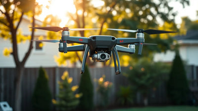
For the drone industry, this is a watershed moment. The partnership directly monetizes the work of thousands of drone pilots, turning their aerial imagery into a high-value asset for AI development. It also creates a new, compelling use case for both new and pre-owned DJI drones, as the demand for consistent, high-quality geospatial data skyrockets. This analysis breaks down the mechanics of the deal, its impact on the market, and what it means for the average commercial operator.
The Niantic-Spexi Partnership: A New Data Pipeline for AI
Niantic Spatial, which was spun out of Niantic Inc. in late 2025, has long been a leader in augmented reality and spatial understanding. Their foundational technology-the Visual Positioning System (VPS)-relies on a deep understanding of physical spaces. Until now, that understanding was built largely from ground-level smartphone data. The partnership with Spexi changes the game by adding a high-altitude, high-resolution, and systematic layer of data.
Reader resources
Turn this drone news into a practical next step.
Compare inspected pre-owned DJI drones, repair options, and trade-in timing before the market moves again.
Spexi operates a decentralized network where independent drone pilots, often called "Flyers," capture orthorectified imagery of specific geographic areas. These images are then stitched together into high-resolution, georeferenced map tiles. The quality and consistency of this data are critical for machine learning models, which require massive, diverse, and accurately labeled datasets to function effectively.
"This partnership is about bridging the digital and physical worlds in a way that has never been done before," said a representative from Niantic Spatial in the official release. "By leveraging Spexi's network, we gain access to a constant, global stream of fresh, high-fidelity aerial data. This is the fuel for the next generation of AI that will power autonomous drones, delivery robots, and augmented reality experiences."
The implications are vast. For AI training, the data helps models understand terrain, building geometry, vegetation patterns, and even dynamic changes like construction or seasonal shifts. This is a direct challenge to traditional, centralized mapping approaches that rely on expensive satellite imagery or dedicated, company-owned aircraft. The decentralized model is faster, cheaper, and more scalable.
What This Means for Commercial Drone Operators and Pilots
For the thousands of commercially licensed drone pilots operating under FAA Part 107, this partnership represents a new and potentially lucrative revenue stream. Spexi's model pays pilots for the data they capture. The Niantic deal dramatically expands the demand for that data, creating a more robust and competitive marketplace for aerial imagery.
Here is the direct impact on the pilot community:
- Monetization of Existing Skills: Pilots who already fly for real estate, inspection, or agriculture can now add a new client: the AI training data market. The requirements for Spexi's network are specific (e.g., high overlap, consistent altitude, good lighting), but they are well within the capabilities of most commercial operators.
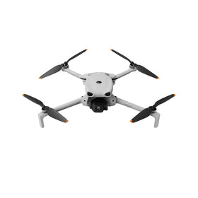
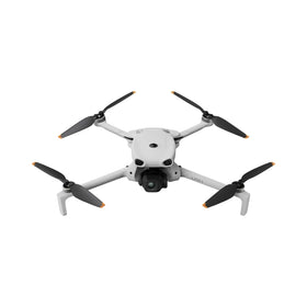
- Increased Value of Equipment: The demand for consistent, high-quality data increases the value of reliable, survey-grade drones. This is a significant tailwind for the used drone market, as operators upgrade their gear to meet the new data standards or expand their fleets to cover more territory.
- Shift from Service to Product: Many drone businesses are built on service contracts (e.g., "I will inspect your cell tower for $500"). This model shifts the focus toward data-as-a-product. A pilot captures a 10-square-kilometer area, uploads the data, and gets paid for the product itself, not the hours flown. This is a fundamental business model innovation.
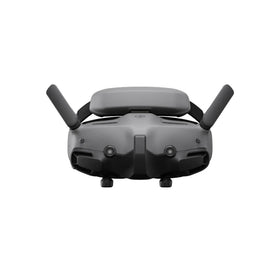
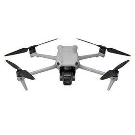
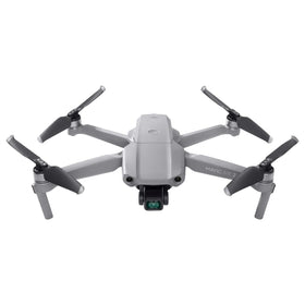
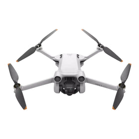
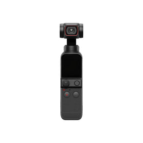
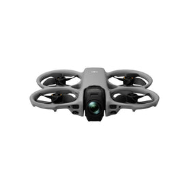
For the second-hand and refurbished drone market, this news is a powerful catalyst. As pilots seek to maximize their data capture efficiency, they will demand drones with high-quality mechanical shutters, robust RTK modules, and reliable flight characteristics. The DJI Mavic 3 Enterprise series and the Phantom 4 RTK are prime examples of aircraft that are ideal for this kind of work. Their availability on the refurbished market makes them an accessible entry point for pilots looking to participate in this new economy.
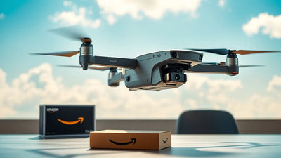
Ready to Upgrade Your Fleet?
Browse our collection of inspected pre-owned DJI drones - inspected, flight-tested, and backed by a 6-month warranty. Save up to 40% versus retail.
The Technology Behind the Deal: GSD, RTK, and Data Standards
The quality of data required for AI training is not trivial. The partnership between Niantic and Spexi will demand imagery that meets rigorous technical specifications. Key among them are Ground Sample Distance (GSD), georeferencing accuracy, and radiometric consistency.
GSD and Resolution: For detailed 3D models, a GSD of 1-2 cm/pixel is often necessary. This requires flying at relatively low altitudes (e.g., 60-100 meters AGL) with high-resolution sensors. Drones like the DJI Mavic 3E, with its 20MP 4/3 CMOS sensor, are well-suited for this task. The demand for such high-resolution data will increase the value of drones with larger sensors.
RTK and PPK Georeferencing: The 3D models must be perfectly aligned with the real world. This requires sub-centimeter accuracy, which is only achievable with Real-Time Kinematic (RTK) or Post-Processed Kinematic (PPK) positioning systems. Drones equipped with RTK modules, such as the DJI Phantom 4 RTK or the Mavic 3 Enterprise RTK, will be the workhorses of this network. This is a critical point for the refurbished market, as these specialized units are often significantly cheaper than new ones.
Data Volume and Processing: The scale of the project is immense. Spexi claims to have mapped millions of acres. Processing this data into usable 3D models requires powerful photogrammetry software (e.g., Pix4D, Agisoft Metashape) and cloud computing resources. Niantic's own AI tools will then digest these models to extract features, understand geometry, and train neural networks.
This technical demand creates a virtuous cycle for the drone industry: higher data quality requirements drive pilots to invest in better equipment, which in turn fuels the market for both new and pre-owned DJI drones. It also increases the need for professional maintenance and repair services to keep these precision instruments in peak condition.
Market Trends and the Future of Decentralized Data Collection
The Niantic-Spexi partnership is a powerful validation of the decentralized data collection model. This model, often referred to as "crowd-sourced" or "gig-economy" mapping, has been growing for years, but this deal moves it firmly into the mainstream. It signals to investors and the broader tech industry that there is a massive, scalable market for geospatial data gathered by independent operators.
Several key market trends are converging:
- AI's Insatiable Appetite for Real-World Data: The most advanced AI models, particularly those for robotics and autonomous navigation, require training data that reflects the complexity and diversity of the real world. Satellite imagery is too low-resolution and infrequent. Street-level data is limited. Drone data, captured at the perfect intermediate scale, is the missing link.
- The Rise of the "Data-as-a-Service" (DaaS) Model: Drone service providers are increasingly being asked to deliver not just images, but structured, analysis-ready data. This partnership accelerates that trend, creating a direct pipeline from a pilot's SD card to an AI training cluster.
- Increased Valuations for Drone Data Companies: Spexi, as the platform connecting pilots to clients, becomes a highly valuable intermediary. This deal will likely increase interest in similar platforms and could lead to a wave of consolidation in the drone data aggregation space.
- Impact on the Second-Hand Market: As more pilots enter this space, the demand for affordable, capable hardware will surge. This is excellent news for the refurbished drone market. At Reboot Hub, we are already seeing increased interest from operators looking for cost-effective ways to scale their data collection fleets. A DJI Mavic 3 Enterprise RTK, purchased at a 40% discount in the used drone market, can pay for itself in just a few data collection missions for the Spexi network.
Furthermore, the partnership underscores the importance of drone maintenance. These aircraft are now tools of production for a global AI economy. A grounded drone is not just a missed flight; it is a missed data sale. This is why having access to professional DJI repair services is becoming a critical business continuity requirement for commercial operators. Ensuring your fleet is ready to fly at a moment's notice is no longer optional; it is a competitive advantage.
What This Means for the Drone Industry: A Q&A Analysis
Q: What does the Niantic-Spexi deal mean for a typical Part 107 pilot?
A: It means you now have a new, scalable, and potentially very lucrative client. Instead of flying for a single client who pays by the hour, you can fly a defined area, upload your data, and get paid for the product. It shifts your business from selling your time to selling your data. It also means your equipment is now a capital asset that directly generates revenue in the AI economy.
Q: What does this mean for the DJI and drone hardware market?
A: It creates a strong, sustained demand for high-quality, survey-grade drones. The DJI Mavic 3E and Phantom 4 RTK are ideally suited for this work. This demand will stabilize prices in the new market and increase the velocity of the used market. We expect to see more pilots trading in older, less capable drones for these RTK-equipped models. This is a clear "buy" signal for the refurbished drone market.
Q: What are the potential challenges or risks?
A: The main challenges are data consistency and quality control. Spexi will need to ensure that the millions of images captured by thousands of different pilots meet the same rigorous standards. There are also potential privacy concerns with such a detailed, global map being created. However, for the commercial drone industry, the opportunities far outweigh the risks. The key is to be prepared with the right equipment and a clear understanding of the data requirements.
Frequently Asked Questions
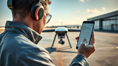
How can I start earning money by flying for the Spexi network?
To join the Spexi network, you need to be a commercially licensed drone pilot (FAA Part 107 in the US or equivalent in your country), have a suitable drone (ideally one with RTK/PPK capability and a high-resolution mechanical shutter camera), and pass Spexi's quality assurance process. You then use their app to find available "Fly Zones" in your area, capture the required imagery, and upload it for review and payment.
What drone models are best for this kind of AI training data collection?
The best drones for this work are those with high-resolution sensors (20MP or more), mechanical shutters to avoid rolling shutter distortion, and RTK modules for sub-centimeter georeferencing. The DJI Mavic 3 Enterprise RTK, DJI Phantom 4 RTK, and Autel Robotics EVO II Pro RTK are all excellent choices. These models are also commonly available on the refurbished market, offering a lower-cost entry point.
Does this partnership affect the value of my used DJI drone?
Yes, positively. The increased demand for data collection directly increases the demand for capable hardware. Drones that can meet the technical standards for this kind of work (good cameras, RTK, reliable flight) are seeing their resale value hold or even increase. If you own a DJI Mavic 3E or Phantom 4 RTK, you have a highly sought-after asset. If you are looking to sell, now is an excellent time to list it on a reputable platform like Reboot Hub.
Disclaimer: The views and analysis presented in this article are for informational purposes only and do not constitute financial or investment advice. The drone market is subject to rapid change. Always conduct your own due diligence.
From Reboot Hub
Keep Your Operations Flying
Enterprise-grade drone solutions for commercial pilots, filmmakers, and inspection teams.
Pre-owned Fleet
Fully inspected DJI drones with 6-month warranty. Save up to 40%.
Browse Inventory ->