DJI Terra 5.2.5: The LiDAR Workflow Fix That Pros Have Been Waiting For
DJI's latest Terra update, version 5.2.5, directly addresses the most persistent LiDAR workflow frustrations for professional drone operators. From smoother point cloud alignment to faster processing, this analysis breaks down what's new and what it means for your commercial operations.

On May 20, 2026, DJI released version 5.2.5 of its DJI Terra software, a seemingly incremental update that, upon closer inspection, delivers substantial improvements to the LiDAR processing workflow that professional drone operators have long complained about. For the thousands of surveyors, construction managers, and infrastructure inspectors who rely on DJI's enterprise ecosystem daily, this update is not just a patch—it's a productivity unlock.
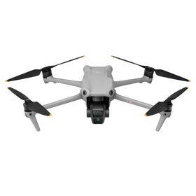
DJI Terra has been the company's primary photogrammetry and LiDAR processing engine since its launch, but for all its power, it has been plagued by workflow friction, particularly when handling large LiDAR datasets from the Zenmuse L1 and L2 sensors. Version 5.2.5 directly targets these pain points, promising faster point cloud alignment, more reliable ground point classification, and a streamlined export pipeline. In a market where time is money, these fixes could save commercial operators hours per project.

What's New in DJI Terra 5.2.5: A Deep Dive
At first glance, the changelog for DJI Terra 5.2.5 appears modest. However, the underlying changes are significant for anyone who has ever wrestled with a 500-million-point LiDAR dataset. The headline improvements center on the LiDAR workflow, specifically in three key areas: point cloud alignment, ground point classification, and data export stability.
According to DJI's release notes, the update "optimizes the alignment algorithm for multi-session LiDAR data," which is a technical way of saying that merging multiple flight missions into a single, coherent point cloud should now be faster and more accurate. Previously, users often had to manually adjust tie points or reprocess entire blocks when alignment failed, a process that could take an entire afternoon. Version 5.2.5 introduces a smarter, more automated alignment routine that reduces the need for manual intervention.

The second major fix is in ground point classification. For survey-grade LiDAR work, accurately separating the ground from vegetation, buildings, and other features is critical for creating accurate digital terrain models (DTMs). DJI Terra 5.2.5 includes an updated classification model that reportedly handles complex terrain—such as steep slopes, dense understory, and urban canyons—with greater reliability. This is a direct response to feedback from civil engineers and surveyors who found previous versions prone to misclassifying low-lying vegetation as ground points.
Finally, the update addresses several export-related bugs. Users reported that exporting classified point clouds to industry-standard formats like LAS and LAZ could sometimes result in corrupted files or incomplete metadata. Version 5.2.5 resolves these stability issues, ensuring that the data you spend hours processing actually arrives intact in your CAD or GIS software.

Ready to Upgrade Your Fleet?
Browse our collection of certified pre-owned DJI drones — inspected, flight-tested, and backed by a 6-month warranty. Save up to 40% versus retail.
What Does DJI Terra 5.2.5 Mean for Commercial Drone Operators?
Ready to Upgrade Your Fleet?
Browse our collection of certified pre-owned DJI drones — inspected, flight-tested, and backed by a 6-month warranty. Save up to 40% versus retail.
To understand the real-world impact of this update, we need to look at the typical workflow of a commercial LiDAR operator. A surveyor using a DJI Matrice 350 RTK with a Zenmuse L2 sensor might fly four to six missions over a 100-acre site. Each mission generates a raw LiDAR dataset that must be aligned, classified, and exported. With previous versions of DJI Terra, a single misalignment could force the operator to restart the entire processing chain, wasting hours of compute time.
Version 5.2.5 directly addresses this bottleneck. The improved alignment algorithm means that multi-session projects are more likely to process on the first attempt. The enhanced ground classification reduces the need for manual editing in third-party software like Terrasolid or Global Mapper. And the export stability fixes mean that the final deliverable—whether it's a DTM, a contour map, or a volumetric analysis—is ready for client presentation without last-minute file corruption scares.
For operators working under FAA Part 107 or EASA regulations, where project deadlines are often tight and penalties for delays can be severe, these efficiency gains translate directly into improved profitability. A project that previously required a full day of processing might now be completed in half that time, freeing up the operator to take on more work.
Furthermore, this update reinforces the value proposition of DJI's enterprise ecosystem. By continuously improving DJI Terra, DJI is signaling that it is serious about being a full-stack provider for commercial drone operations, not just a hardware manufacturer. This is a critical differentiator in a market where competitors like Autel Robotics and Skydio offer excellent hardware but lack a comparable software ecosystem.
Impact on the Second-Hand and Refurbished Drone Market
For the second-hand and refurbished drone market, the release of DJI Terra 5.2.5 has a nuanced but important implication. When a software update extends the capabilities of older hardware, it can increase the residual value of that hardware. For example, a used DJI Matrice 300 RTK paired with a Zenmuse L1 sensor that was previously considered "legacy" now becomes more attractive to budget-conscious operators because the software improvements make the overall system more productive.
At Reboot Hub, we have observed that software updates are a key consideration for buyers in the used drone market. A drone that is supported by the latest software is far more valuable than one that is not, even if the hardware is identical. This update means that older DJI LiDAR platforms remain viable for commercial work, which is excellent news for operators looking to enter the LiDAR space without investing in brand-new equipment.
For those considering upgrading their fleet, the enhanced capabilities of DJI Terra 5.2.5 make it an ideal time to invest in a certified refurbished DJI drones. These units undergo rigorous inspection and flight testing, and they come with a 6-month warranty, offering a cost-effective path to professional-grade LiDAR capabilities. The software update ensures that even a refurbished Matrice 350 RTK will perform at its best, delivering the same processing quality as a brand-new unit.
Broader Market Trends and Competitive Landscape
DJI Terra 5.2.5 arrives at a time when the commercial drone industry is increasingly focused on software as the differentiator. Hardware platforms like the Matrice 400 series and the Zenmuse L3 are reaching maturity, with incremental hardware improvements offering diminishing returns. The real value now lies in the software that processes and analyzes the data collected by these platforms.
Competitors are taking note. Autel Robotics has been investing heavily in its Explorer app and cloud processing platform, while Skydio has positioned its 3D Scan software as a key selling point for its enterprise drones. However, DJI's sheer installed base—estimated at over 70% of the global commercial drone market—gives it a significant advantage in terms of user feedback and development resources. The company can rapidly iterate on DJI Terra based on real-world usage data from hundreds of thousands of operators.
From a regulatory perspective, the update does not directly address any new FAA or EASA mandates. However, by improving the accuracy and reliability of LiDAR data, it indirectly supports compliance with survey-grade standards required for certain infrastructure projects. For example, the FAA's Part 107 waiver process for beyond visual line of sight (BVLOS) operations often requires high-fidelity terrain models, which DJI Terra 5.2.5 can now produce more reliably.
How to Update and What to Watch For
Updating to DJI Terra 5.2.5 is straightforward. Users can download the update from the DJI official website or through the DJI Assistant 2 software for enterprise drones. The update is free for all existing DJI Terra users, which is consistent with DJI's policy of bundling software updates with hardware purchases.
However, there are a few caveats. First, the update is only available for the desktop version of DJI Terra (Windows). The mobile version (DJI Pilot) does not include the same LiDAR processing capabilities, so operators should ensure they are using a compatible PC. Second, while the alignment and classification improvements are significant, they are not a silver bullet. Extremely challenging environments—such as heavy canopy cover in rainforests or highly reflective surfaces in industrial plants—may still require manual intervention.
Finally, operators should be aware that the update may require recalibration of existing workflows. If you have custom processing templates or batch scripts, you may need to adjust them to take full advantage of the new algorithms. DJI has published updated documentation on its support portal, and there are several community forums where early adopters are sharing their experiences.
Conclusion: A Small Update with Big Implications
DJI Terra 5.2.5 is a textbook example of how incremental software improvements can have outsized impacts on professional workflows. By fixing the LiDAR alignment, classification, and export issues that have frustrated commercial operators for years, DJI has made its enterprise ecosystem more productive and more reliable. For surveyors, construction managers, and infrastructure inspectors, this update translates directly into time savings and reduced frustration.
The implications for the second-hand drone market are equally important. As software updates extend the useful life of older hardware, the used drone market becomes an increasingly attractive option for operators who want professional-grade LiDAR capabilities without the full retail price tag. At Reboot Hub, we are already seeing increased interest in certified pre-owned DJI Matrice 300 RTK and 350 RTK systems, and we expect this trend to continue as more operators discover the benefits of the latest DJI Terra update.
For those looking to maintain their existing fleet, our professional DJI repair services ensure that your hardware is in peak condition to take full advantage of the software improvements. A well-maintained drone combined with the latest software is the most cost-effective path to success in the competitive world of commercial drone operations.
Frequently Asked Questions (FAQ)
Is DJI Terra 5.2.5 a free update?
Yes, DJI Terra 5.2.5 is a free update for all existing users of DJI Terra. It can be downloaded from the DJI official website or through the DJI Assistant 2 software. No additional license purchase is required.
What drone models are compatible with the new LiDAR fixes in DJI Terra 5.2.5?
The LiDAR workflow improvements in version 5.2.5 are primarily designed for the Zenmuse L1 and L2 sensors, which are commonly used with the DJI Matrice 300 RTK, Matrice 350 RTK, and Matrice 400 series drones. Users flying these combinations will see the most benefit from the updated alignment and classification algorithms.
Will DJI Terra 5.2.5 work on macOS or Linux?
No, DJI Terra is currently only available for Windows (Windows 10 or later). There is no official support for macOS or Linux. Users on other operating systems will need to use a Windows virtual machine or a dedicated PC for DJI Terra processing.
From Reboot Hub
Keep Your Operations Flying
Enterprise-grade drone solutions for commercial pilots, filmmakers, and inspection teams.
Refurbished Fleet
Fully inspected DJI drones with 6-month warranty. Save up to 40%.
Browse Inventory ->