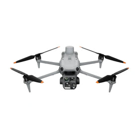
ideaForge Secures Survey of India Order for Q6 V2 Mapping UAVs
ideaForge has received an order from the Survey of India for Q6 V2 UAVs to support mapping and geospatial work. The deal signals growing public-sector demand for Indian-built commercial drones and matters for operators watching enterprise procurement trends.

Quick answer
ideaForge Technology Limited has received an order from the Survey of India for its Q6 V2 UAVs to support mapping and geospatial applications, as reported by SUAS News.
- The order involves Q6 V2 UAVs for Survey of India mapping and geospatial work
- The reporting comes from SUAS News and is attributed to that source
- The deal points to public-sector demand for Indian-built commercial drones
- Operators should watch how government survey programs influence fleet procurement
Evidence: SUAS News
Market context
Turn market news into a buy, repair, or trade-in decision.
Compare pre-owned availability, resale timing, and repair economics before the market moves again.

ideaForge Technology Limited has received an order from the Survey of India for its Q6 V2 unmanned aerial vehicles, according to reporting from SUAS News. The order is tied to mapping and geospatial applications, placing the Indian drone manufacturer inside a public-sector procurement channel that commercial operators and fleet buyers watch closely.
The development matters beyond a single contract. Government survey agencies tend to buy in structured batches, set operational expectations that influence broader market standards, and create service and support demand that ripples through the commercial UAV ecosystem. For drone buyers, repair customers, and operators managing mixed fleets, the order is a useful signal about where enterprise-grade mapping demand is heading in Asia.
The reported order and the source picture
SUAS News reports that ideaForge has secured an order from the Survey of India for Q6 V2 UAVs to support mapping and geospatial applications. The report does not specify the number of units, contract value, delivery timeline, or deployment regions. Those details remain unconfirmed in the available source data, and Reboot Hub is not treating them as established facts.
What can be stated plainly is the buyer and the platform. The Survey of India is the national mapping agency responsible for topographic surveys, geodetic control, and related geospatial datasets. ideaForge is an established Indian UAV manufacturer with a product line aimed at enterprise, defense, and industrial users. The Q6 V2 is positioned for surveying and mapping work, though specific technical parameters were not detailed in the source material and should not be assumed from memory or outside references.
For procurement teams, the absence of unit counts and pricing is normal at this stage. Government orders are often announced before full commercial terms are public. The meaningful early signal is directional: a national mapping agency is buying Indian-built fixed-wing or hybrid UAVs for geospatial tasks that would otherwise rely on imported platforms or traditional survey methods.
Why government geospatial procurement matters commercially
Public-sector mapping contracts are not isolated events. They shape how surveyors, engineering firms, and infrastructure contractors think about UAV adoption. When a national agency standardizes on a platform for mapping workflows, downstream service providers often follow because they want compatibility with government data formats, processing pipelines, and operational expectations.
The Survey of India order also reinforces a pattern Reboot Hub has observed in commercial UAV markets: geospatial work is becoming a stable, repeatable demand category rather than a pilot-project curiosity. Mapping drones fly structured missions, generate recurring maintenance needs, and require spare parts and repair support over multi-year service life. That has direct implications for how operators budget for fleet upkeep.
For buyers outside India, the order is a reminder that enterprise drone procurement is increasingly regional. Indian agencies are buying Indian platforms, supported by local service networks and domestic supply chains. Operators evaluating pre-owned DJI drones or imported platforms should consider whether local support, parts availability, and regulatory familiarity outweigh upfront hardware cost.
What this means for drone owners and the market
The immediate takeaway for commercial operators is that mapping and geospatial demand continues to consolidate around purpose-built platforms. A national survey agency does not buy consumer camera drones for topographic work. It buys platforms designed for area coverage, consistent data capture, and integration with geospatial software. That distinction matters when fleet managers decide whether a general-purpose drone can handle survey contracts or whether a dedicated mapping platform is required.
Repair and maintenance demand follows the same logic. Survey fleets fly long missions over varied terrain, which accelerates wear on airframes, propulsion systems, and sensors. Operators running mapping workloads should expect higher parts consumption than casual or inspection-only use. For those managing pre-owned DJI drones or mixed fleets, the lesson is to plan maintenance around mission intensity rather than calendar age alone. Reboot Hub tracks these ownership and repair patterns in its Drone Wiki, where operators can review platform-specific upkeep considerations before committing to a fleet purchase or service plan. For owners evaluating service and lifecycle risk, Drone Wiki explains the relevant repair, parts, resale, or operational path.
The order also suggests that public-sector buyers value continuity. Once an agency builds training, maintenance, and data workflows around a specific platform family, switching costs rise. That benefits manufacturers with established service ecosystems and creates a secondary market dynamic where operators seek parts, batteries, and support for platforms that remain in government service for years.
What operators should watch next
The most useful follow-up signals will be contract details, delivery timelines, and any public statements about how the Q6 V2 units will be deployed across Survey of India field offices. Those details would clarify whether this is a pilot batch or a broader fleet expansion, and whether the order creates immediate service and support opportunities for third-party repair providers.
Operators should also watch whether other Indian government agencies follow with similar geospatial UAV orders. Public-sector procurement tends to cluster once a reference deployment exists. A successful Survey of India program could accelerate adoption by state mapping departments, infrastructure authorities, and disaster management agencies, expanding the installed base of Indian-built mapping drones and the associated parts and repair market.
For buyers and fleet planners, the practical step is to treat this order as a demand signal rather than a product endorsement. The Q6 V2 may or may not suit a given operator's payload, endurance, or software requirements. What matters is that national mapping agencies are committing to UAV-based geospatial workflows, and that commitment will shape training, parts availability, and resale value for platforms in the same category.
FAQ
Frequently asked questions
What did ideaForge announce?
According to SUAS News, ideaForge Technology Limited has received an order from the Survey of India for Q6 V2 UAVs to support mapping and geospatial applications. Specific unit counts, values, and timelines were not included in the available report.
Why does a Survey of India order matter to commercial drone operators?
Government mapping agencies set procurement patterns that influence downstream service providers, parts availability, and platform longevity. A national agency standardizing on a mapping UAV signals stable demand for geospatial drone work and related maintenance support.
Should drone buyers change their fleet plans based on this order?
Not immediately. The order is a market signal, not a product specification. Buyers should evaluate mapping platforms on their own operational requirements, local support, and parts access, while noting that public-sector geospatial demand appears to be strengthening in Asia.
Which sources support this update?
The visible evidence links identify SUAS News; each source is used only for the claim it directly supports.
What remains subject to change?
Retail pricing, availability, product bundles and regulatory timelines can change. Readers should verify the latest terms with the named retailer, manufacturer or regulator before acting.
How should buyers or operators use this analysis?
Use the verified facts as a starting point, then compare mission fit, lifecycle support, maintenance needs and current procurement terms before making a purchase or fleet decision.
Fuentes consultadas
- SUAS News - primary source
No había documentación oficial adicional disponible al momento de la publicación.
Reboot Hub Editorial ofrece análisis de compra, reparación, reventa y operatividad para propietarios de drones. Si detecta algún error, contáctenos para solicitar una revisión de corrección conforme a nuestra política editorial.