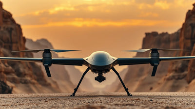
Taiwan's AIDC Breaks GPS Dependency: A New Era of Anti-Jam Drone Navigation
On June 2, 2026, Taiwan's Aerospace Industrial Development Corporation (AIDC) dropped a bombshell: a GPS-independent navigation system for tactical drones. This isn't just a tech demo; it's a direct response to the electronic warfare saturation in the Taiwan Strait and Ukraine. For commercial operators flying BVLOS missions under FAA Part 107 waivers or conducting RTK surveying in contested airspace, the implications are seismic. This system uses terrain-referenced navigation (TRN) and visual odometry, rendering GPS jamming and spoofing useless. We break down the technology, the immediate threat to the DJI ecosystem, and what this means for the global second-hand drone market—where demand for hardened, non-GPS-dependent airframes is about to skyrocket. Is your fleet ready for a post-GPS world?

Redaktionelle noter
- Denne artikel kombinerer navngiven ekstern rapportering med Reboot Hub's egen analyse for dronekøbere, flådeoperatører, reparationskunder og observatører af det brugte DJI-marked.
- Kildefakta er adskilt fra fortolkning. Når en rapport indeholder begrænsede data, gør artiklen opmærksom på denne begrænsning og præsenterer Reboot Hub's synspunkt som en analyse.
- Reboot Hub har kommercielle links til droneprodukter og reparationstjenester; disse links er ressourcer til læseren og er ikke bestemmende for artiklens konklusion.
TAIPEI, TAIWAN - June 2, 2026 - In a move that sends shockwaves through the global unmanned aerial vehicle (UAV) industry, Taiwan's state-owned Aerospace Industrial Development Corporation (AIDC) has publicly unveiled a fully operational GPS-independent drone navigation system. This breakthrough, reported exclusively by Taiwan News, is not merely an incremental upgrade; it represents a fundamental re-engineering of how drones perceive and navigate their environment, effectively rendering the world's most pervasive vulnerability-GPS signal dependency-obsolete.
For years, the drone industry has operated under a silent assumption: the Global Positioning System (GPS) is a reliable, free utility. Commercial operators rely on it for everything from automated crop spraying to precision mapping. Military tacticians depend on it for surveillance and strike coordination. However, the brutal realities of the conflict in Ukraine and the escalating electronic warfare (EW) capabilities in the Taiwan Strait have exposed a critical Achilles' heel. GPS is easily jammed, spoofed, and denied. AIDC's new system, which combines Terrain-Referenced Navigation (TRN), Visual Inertial Odometry (VIO), and advanced LiDAR SLAM (Simultaneous Localization and Mapping), provides a hardened, multi-layered alternative that functions flawlessly in GPS-denied environments.
This development arrives at a pivotal moment. As of today, the global drone market is increasingly bifurcated between consumer-grade platforms heavily reliant on GNSS (Global Navigation Satellite Systems) and a new generation of tactical and commercial platforms designed for resilience. AIDC's announcement directly challenges the status quo, putting immense pressure on market leaders like DJI and Autel Robotics to accelerate their own anti-jam capabilities. For the second-hand and refurbished drone market, this news is a powerful catalyst, shifting buyer preference towards airframes that can be retrofitted or are already equipped with redundant navigation systems.
Enterprise procurement
Turn this market signal into a fleet requirement.
Discuss mission profile, quantities, configuration, delivery, and lifecycle support with Reboot Hub.
The Technology Behind the Breakthrough: How AIDC Killed the GPS Dependency
To understand the magnitude of this announcement, one must first understand the vulnerability it addresses. Standard commercial drones, including the ubiquitous DJI Mavic 3 Enterprise or Autel EVO Max 4T, use a combination of GPS and GLONASS for primary positioning. While they have internal IMUs (Inertial Measurement Units), these sensors drift significantly over time without a satellite correction. A simple $50 jammer can cause a $15,000 enterprise drone to lose its position, trigger a return-to-home (RTH) fail-safe, or, in a worst-case scenario, fly away uncontrollably.
AIDC's system eliminates this single point of failure. The core technology is a fusion of three distinct methods:
- Terrain-Referenced Navigation (TRN): The drone carries a pre-loaded digital elevation map (DEM) of its operational area. Its onboard downward-facing sensors, likely a combination of radar altimeter and LiDAR, scan the ground below. The system matches this real-time scan against the stored map to pinpoint its exact location with sub-meter accuracy, independent of any satellite signal.
- Visual Inertial Odometry (VIO): Using high-resolution optical cameras and a dedicated vision-processing unit, the drone tracks visual features on the ground (rocks, trees, building corners) from frame to frame. By calculating the apparent motion of these features, the drone determines its velocity and position relative to its starting point. This is similar to the technology used in DJI's "Vision Positioning" but is hardened for high-speed, low-altitude tactical flight.
- LiDAR SLAM: For night operations or low-visibility conditions (dust, fog), the system activates a solid-state LiDAR sensor. This creates a real-time 3D point cloud of the environment, allowing the drone to navigate through complex terrain-such as urban canyons or dense forests-without any external reference.
The result is a navigation system that is effectively immune to RF jamming and GPS spoofing. This is a game-changer for BVLOS (Beyond Visual Line of Sight) operations, which are currently the holy grail of commercial drone logistics. The FAA's Part 107 waiver process for BVLOS is notoriously strict, largely due to concerns about lost link and navigation integrity. A drone that can navigate without GPS is inherently safer and more reliable, potentially accelerating regulatory approval for critical infrastructure inspection and long-range delivery.
Immediate Impact on the Commercial and Tactical Drone Landscape
While AIDC is a defense contractor, the technologies they develop inevitably trickle down to the commercial sector-or create a demand for it. For everyday commercial drone pilots, this news signals a shift in what "enterprise-grade" means. A drone that loses its GPS lock over a pipeline or a construction site is currently a liability. In the future, it will be an asset that can continue its mission.
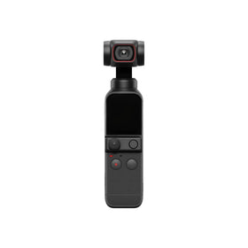
For operators of pre-owned DJI drones, the immediate concern is retrofitting. While the DJI Matrice 350 RTK and DJI Matrice 30 Series have impressive redundancy, they still rely on GNSS as their primary navigation source. The AIDC system suggests a future where a secondary, non-GPS nav unit becomes a standard requirement for high-stakes jobs. This could be an add-on module, similar to how RTK modules are currently sold, or it could be an integrated system in next-generation airframes.
The most immediate commercial disruption will be felt in the defense and security sector. Companies like Skydio, which already emphasizes visual navigation, and the American defense giant Anduril Industries, will see this as a validation of their approach. However, AIDC's system is specifically designed for fixed-wing and high-speed tactical drones, a segment where GPS denial is most lethal. This puts pressure on the entire supply chain, from sensor manufacturers (like Velodyne and Hesai) to flight controller developers (like Pixhawk and CubePilot).
Ready to Upgrade Your Fleet?
Browse our collection of inspected pre-owned DJI drones - inspected, flight-tested, and backed by a 6-month warranty. Save up to 40% versus retail.
What Does AIDC's GPS-Free Navigation Mean for the Second-Hand and Refurbished Drone Market?
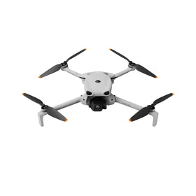
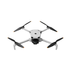
This is where the analysis gets granular for our audience at Reboot Hub. The used drone market is highly sensitive to technological obsolescence. When a new feature becomes a "must-have," the value of older models that lack it plummets. Currently, the DJI Phantom 4 RTK and even the first-generation Mavic 2 Enterprise are losing value not because they take bad photos, but because they lack redundancy features like RTK modules or obstacle avoidance.
AIDC's announcement accelerates this depreciation curve for any drone that is purely GNSS-dependent. Here is the immediate market analysis:
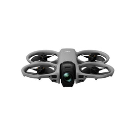
- Demand for "Hardened" Airframes: We predict a surge in demand for drones that can accept secondary navigation payloads. The DJI Matrice 350 RTK and the Autel EVO Max 4T, with their modular payload bays, will hold their value better than integrated, sealed drones like the DJI Mavic 3 Classic. Buyers will pay a premium for airframes with open SDKs that allow for custom navigation algorithms.
- Retrofit Opportunities: This creates a massive opportunity for repair centers. We expect to see a rise in demand for professional DJI repair services that can install third-party navigation modules. This is not a simple firmware update; it requires hardware integration, new wiring harnesses, and custom 3D-printed mounts. Our repair team is already preparing for this.
- Geographic Price Disparity: Drones sold in regions with high EW threats (Eastern Europe, South China Sea, Middle East) will command a premium if they have anti-jam capabilities. Conversely, consumer drones destined for low-risk areas (North America, Western Europe) will see less immediate impact, but the psychological shift is already happening.
For commercial pilots and fleet managers, the takeaway is clear: when evaluating a used drone for purchase, the presence of a VIO module or a LiDAR SLAM capability is no longer a "nice-to-have." It is becoming a core safety requirement, especially for those seeking Part 107 BVLOS waivers. A drone that can "see" its way home is infinitely more valuable than one that relies on a radio signal that can be easily cut.
Geopolitical Context and the Race for Navigation Resilience
We cannot discuss this technology without acknowledging the geopolitical powder keg that is the Taiwan Strait. AIDC is a direct arm of Taiwan's defense ministry. This system is explicitly designed to counter the People's Liberation Army's (PLA) advanced electronic warfare capabilities, which include the ability to jam GPS over a wide area. This is not a theoretical threat; during recent PLA exercises, GPS interference was reported in northern Taiwan and the Matsu Islands.
The commercial implication is that "dual-use" technology is now the standard. The same navigation system that helps a drone fly through a canyon in a combat zone can help a survey drone map a deep mine or a delivery drone navigate a city center with tall buildings that block satellite signals. This convergence of military and commercial requirements is driving innovation faster than any market force alone.
Companies like DJI are caught in a difficult position. Their consumer and enterprise drones are built for global mass markets, where cost is king. Adding a high-end TRN system is expensive. However, the European Union's recent push for "cyber-resilient" drones and the US Department of Defense's ban on DJI products are forcing a split in the market. The high-end commercial and defense sectors will migrate towards resilient navigation, while the consumer market may lag behind. This creates a clear tier in the second-hand market: cheap, GPS-only drones for hobbyists, and expensive, multi-modal navigation drones for professionals.
Future Outlook: The End of the "Lost Drone" Problem?
The holy grail of drone operations is the elimination of the "flyaway." Every commercial operator has a story of a drone that lost signal, failed to RTH, and was never seen again. AIDC's system, combined with onboard processing, could effectively end this. A drone that can navigate by sight and by terrain map can always find its way back to a visual landmark or a pre-programmed home point, even if the radio link is dead and the GPS is jammed.
We anticipate that within 18-24 months, navigation resilience will be a key marketing point for all enterprise drones. The DJI Matrice 400 (or whatever the next generation is called) will likely debut with a "Terrain Awareness Navigation" mode. Autel will follow suit. The pioneers in this space, however, will be defense contractors like AIDC, General Atomics, and Turkish Aerospace Industries, who are building this from the ground up.
Frequently Asked Questions
1. Will this AIDC system be available for commercial DJI drones?
Not directly. The AIDC system is a proprietary defense-grade system likely integrated into their own tactical UAVs (like the Tengyun or indigenous designs). However, the underlying technologies-TRN, VIO, and LiDAR SLAM-are commercially available. We expect third-party manufacturers to release "anti-jam" navigation payloads that can be mounted on standard drones like the DJI Matrice 350 RTK within the next 12 months. These will be expensive initially but will become standard as supply chains mature.
2. How does GPS-independent navigation affect my FAA Part 107 BVLOS waiver application?
Positively. The FAA is primarily concerned with the "lost link" scenario. If your drone can demonstrate a proven ability to navigate and land safely without GPS, your waiver application becomes significantly stronger. It proves a higher level of safety and reliability. We recommend documenting your drone's VIO and obstacle avoidance capabilities in your safety case. A drone with a secondary non-GPS nav system is a strong argument against the need for visual observers.
3. Should I sell my current GPS-only drone now before prices drop?
It depends on your market. If you operate in a high-risk EW environment or serve defense clients, yes, you should upgrade as soon as possible. For general commercial surveying or photography, the value of a DJI Mavic 3E or Phantom 4 RTK is stable for now, but the depreciation curve will steepen once major manufacturers announce integrated anti-jam systems. If you are looking to trade up, Reboot Hub offers competitive trade-in values on pre-owned DJI drones that are compatible with future retrofit modules.
This analysis was prepared by the Reboot Hub Editorial team on June 2, 2026. Stay ahead of the market curve. For fleet upgrades or repairs, visit our marketplace.
--
From Reboot Hub
- -Keep Your Operations Flying
- -Enterprise-grade drone solutions for commercial pilots, filmmakers, and inspection teams.
- -Pre-owned Fleet
- - - -Fully inspected DJI drones with 6-month warranty. Save up to 40%.
- - - - Browse Inventory -> - - -Expert Repair
- - - -Professional diagnostics with genuine OEM parts. Same-day estimates.
- - - - Book a Repair -> - - -Spare Parts
- - - -Batteries, propellers, gimbals -- premium OEM components, fast shipping.
- - - - Shop Parts -> - - -