Real-Time Drone Mapping Helps Landslide Teams Plan Safe Rescue Routes
After a July 17 landslide in Chongqing, JOUAV demonstrated how real-time drone mapping gives emergency managers a 3D hazard model before crews deploy. For fleet operators, this case underscores the value of on-site rapid mapping in dangerous environments.

A landslide in Pengshui County, Chongqing, on July 17 left emergency crews with a familiar problem: they needed to assess where it was safe to send people, but the unstable ground made visual reconnaissance risky. The response included a demonstration from JOUAV, showing how real-time drone-generated 3D mapping can give responders a clear hazard picture before boots hit the ground.
This is not a laboratory simulation or a trade-show booth. It is a real-world operational case, reported by DRONELIFE, that illustrates how industrial drone systems are moving beyond periodic survey work into live, decision-support roles during active emergencies. For commercial UAV operators, fleet managers, and anyone involved in disaster response or high-risk site inspection, the implications are immediate and practical.
What the JOUAV demonstration showed
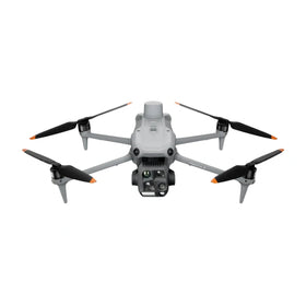
According to the source report, JOUAV deployed a drone system that produced a 3D map of the landslide area in near real time. The map allowed emergency managers to identify hazards, assess the extent of the debris field, and plan safer routes for ground crews before anyone entered the zone. The demonstration followed the actual landslide event, but the workflow—rapid aerial data capture, onboard processing, and delivery of a georeferenced 3D model—is what matters for the broader industry.
Industrial drone procurement
Source a brand-new industrial drone for this mission.
Discuss mission fit, aircraft model, quantities, configuration, pickup, and lifecycle support with Reboot Hub.

The critical operational detail is timing. In a landslide scenario, conditions can change by the minute. The ability to deliver a usable 3D model while the drone is still in the air—or within minutes of landing—shrinks the gap between detection and action. That is a different capability than post-event survey or periodic orthomosaic generation. It is a live decision-support tool.
For commercial operators who serve emergency management agencies, construction firms, or mining companies, this case reinforces a requirement: the payload and processing chain must be able to output usable geospatial data before the mission ends. Whether that means onboard processing, edge computing on the ground station, or a tethered-downlink to a cloud service, the expectation is shifting from "deliverable tomorrow" to "deliverable now."
Technology implications for fleet operators
The JOUAV demonstration in Chongqing does not specify which exact drone model or software was used, but the use case itself suggests several operational requirements that fleet operators should consider when evaluating their own equipment.
First, the aircraft must be stable enough to fly in close proximity to steep, debris-covered terrain. Landslide zones often present challenging airflows and limited safe landing areas. A system with high wind tolerance and reliable obstacle awareness is preferable. Second, the mapping payload needs to be capable of collecting overlapping high-resolution imagery over a localized area—typically a few hectares—and converting that into a 3D model without requiring a separate high-performance computer back at the office. Third, the data link must be robust enough to stream or transfer large mapping files in the field, especially if the processing happens on a ground station.
For operators who currently use older survey platforms or consumer-grade drones for similar mapping tasks, this case is a reminder that mission-critical applications demand industrial-grade reliability. A delay in data delivery or a failed mapping flight in an emergency context is not just an inconvenience; it can impact safety and operational tempo.
Operators should also consider the maintenance and repair pipeline for their mapping drones. If a platform is flown repeatedly in dusty, debris-laden environments, components such as gimbals, cameras, and rotors will experience accelerated wear. Having access to professional DJI repair services for platforms like the Matrice or Mavic Enterprise series ensures that downtime does not stretch into weeks when the next mission arrives.
What this means for enterprise operators
For enterprise operators who deploy drone fleets for inspection, surveying, or emergency response, the JOUAV case provides a concrete reference point for internal procurement decisions. When is it time to move from a general-purpose mapping drone to a dedicated real-time 3D mapping system?
One clear trigger is when your team’s mapping deliverables are consistently needed within the same operational shift. If you are producing maps for a construction site, a mining pit, or a disaster zone, and the end users need the data before the workday ends—or before crews enter the area—then a system capable of real-time or near-real-time output becomes a practical next step. The alternative is sending data to a post-processing office, waiting hours or overnight, and then having to re-fly if coverage was incomplete.
Another trigger is mission safety. In the landslide example, the 3D map directly guided ground crew routing. The same logic applies to any site where personnel are at risk—unstable terrain, hazardous materials, confined spaces. If your fleet is used to support human entry into such zones, then the speed and accuracy of the mapping system becomes a safety parameter, not just a productivity metric.
Fleet managers should also evaluate lifecycle support. A drone that will be used for real-time emergency response needs to be backed by a robust spare parts supply and rapid repair turnaround. Downtime during an emergency response season is unacceptable. For operators who rely on DJI platforms, sourcing genuine OEM spare parts from reputable suppliers ensures that the aircraft stays airworthy and mapping quality remains consistent.
For those currently operating pre-owned DJI drones, this case does not necessarily demand an immediate upgrade. Many pre-owned Matrice 300 RTK or Mavic 3 Enterprise units are capable of mapping missions if paired with the right payload and processing workflow. The key is to test the end-to-end timing: from takeoff to 3D model delivery, under field conditions, before committing to a mission contract that requires real-time output. For teams translating this development into mission and payload requirements, Reboot Hub's B2B drone procurement service can help scope configuration, fleet quantity, maintenance planning, and lifecycle support before a quotation.
Broader market trends for drone-based disaster tools
The JOUAV demonstration in Pengshui County is part of a larger shift in how emergency management agencies worldwide are integrating drone data into their operational playbooks. For several years, drones have been used for post-disaster damage assessment. The new frontier is pre-deployment situational awareness—the map before the crew goes in.
This trend has commercial implications for drone buyers and fleet operators. Agencies and contractors who respond to landslides, floods, earthquakes, and wildfires are increasingly expecting that drone maps will be available within minutes of arrival. That expectation creates a demand for both capable hardware and, more importantly, proven operational workflows. Vendors who can demonstrate a repeatable, safe, and fast mapping process—rather than just selling a drone that can technically do mapping—will have a competitive advantage.
For the second-hand drone market, this trend may increase demand for used industrial platforms like the DJI Matrice 350 RTK or Matrice 300 RTK, which are well-suited to payload-based mapping missions. Operators looking to build or expand a disaster-response fleet on a budget may find that inspected pre-owned DJI drones offer the necessary performance without the full price of new units. However, they must factor in the cost of a high-quality mapping payload and a ground station capable of handling real-time reconstruction.
Finally, the repair ecosystem matters. In the disaster-response sector, operators cannot afford long repair cycles. The growth of professional DJI repair services that use genuine parts and provide quick turnaround is a positive development for the commercial market. It means that mission-critical drones can be returned to service faster, reducing the need for large backup fleets.
How does real-time mapping differ from standard post-flight processing?
Standard survey workflows often require transferring imagery to a computer, running photogrammetry software offline, and then exporting a model—a process that can take hours. Real-time mapping, as demonstrated by JOUAV in the Chongqing landslide, uses onboard or edge processing to produce a 3D model within minutes, while the drone is still in the air or immediately after landing. The operational benefit is that decision-makers have a hazard map before ground crews deploy.
What should a fleet manager do to prepare for real-time mapping missions?
First, evaluate your current drone and payload to see if it can capture high-overlap imagery and stream data to a ground station capable of fast reconstruction. Second, test the workflow end-to-end in a safe environment to measure actual time from takeoff to model delivery. Third, ensure you have a support plan—either a backup drone or access to rapid repair—so that equipment failure does not compromise a mission timeline.
Is it cost-effective to use pre-owned drones for emergency mapping operations?
Yes, provided the drone is from a platform that supports the required payload and processing chain. Inspected pre-owned units such as the DJI Matrice 300 RTK can perform real-time mapping missions at a lower acquisition cost. The trade-off is that older platforms may lack some newer safety features or battery efficiency, so operators should evaluate the mission risk tolerance before relying on a pre-owned aircraft for life-safety applications.
Sources consulted
- Drone Landslide Response with Real-Time 3D Mapping - DRONELIFE - primary source
- DIU Blue UAS - official government source
Reboot Hub Editorial adds buyer, repair, resale, and operational analysis for drone owners. If you spot an error, contact us for correction review through our editorial policy.