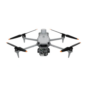
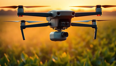
DJI Zenmuse L3 Star-Shaped LiDAR Method Maps Ground Under Dense Trees
Heliguy reports that DJI Zenmuse L3 star-shaped LiDAR scanning captures usable ground data beneath tree canopy. For commercial mapping operators, the technique addresses a long-standing limitation in forested terrain and expands practical LiDAR survey applications.

Quick answer
Heliguy reports that the DJI Zenmuse L3 star-shaped LiDAR scanning technique captures ground elevation data beneath dense tree canopy, improving terrain mapping in forested areas.
- The star-shaped scanning method is reported by Heliguy as a technique for DJI Zenmuse L3 LiDAR payloads
- The approach targets ground point capture under tree cover, a common limitation for aerial LiDAR mapping
- Commercial operators surveying forested or vegetated terrain may gain more complete ground models
- The report highlights a practical workflow refinement rather than a new hardware release
Commercial drone operators who map forested terrain have long accepted a frustrating trade-off: aerial LiDAR is excellent at capturing canopy structure, but ground elevation data beneath dense trees often arrives sparse, noisy, or incomplete. Heliguy, a UK-based DJI enterprise partner, has published a report examining a star-shaped LiDAR scanning technique for the DJI Zenmuse L3 payload that specifically targets this limitation. The method, as described in the source material, is designed to improve ground point capture under tree cover rather than introduce new hardware or firmware.
DJI buying context
Match product news to hardware you can actually deploy.
Check inspected DJI aircraft, repair support, and trade-in timing before deciding whether to upgrade, repair, or wait.

The development matters because ground truth under vegetation is foundational for forestry inventory, utility corridor planning, flood modeling, and construction site preparation. When ground points are missing, downstream digital terrain models require interpolation, which introduces error. Heliguy's reporting suggests that a deliberate flight pattern change, rather than a sensor upgrade, may meaningfully improve results for operators already flying the Zenmuse L3.
What Heliguy reported about the star-shaped scanning method
According to Heliguy's report, the star-shaped LiDAR scanning approach involves structuring the flight path so that the sensor revisits the same ground area from multiple angles. This multi-angle exposure increases the probability that laser pulses find gaps in the canopy and reach the ground surface. The technique is presented as an operational refinement for the DJI Zenmuse L3, a LiDAR payload designed for use with compatible DJI enterprise aircraft.
The core insight is geometric rather than technological. A conventional parallel-line survey grid may repeatedly sample the same canopy obstruction from the same angle, leaving persistent ground data voids. A star-shaped pattern changes the angle of incidence across passes, allowing pulses to slip through different openings in the foliage. Heliguy's reporting frames this as a practical technique that operators can apply without purchasing additional equipment.
Reboot Hub analysis: the significance of this report lies in its focus on workflow rather than hardware. For commercial operators who already own or lease a Zenmuse L3, the star-shaped method represents a zero-cost improvement path. For buyers evaluating LiDAR payloads, it reinforces that sensor performance is only part of the equation; flight planning discipline often determines whether a dataset is commercially deliverable.
Why ground capture under canopy remains a commercial challenge
LiDAR works by emitting laser pulses and measuring return time. In open terrain, a high proportion of pulses reach the ground and return cleanly. Under a closed forest canopy, many pulses reflect off leaves, branches, and trunks before ever reaching the soil surface. The result is a dense point cloud of vegetation returns with a thin, uneven distribution of ground returns beneath it.
For surveyors, this creates a classification problem. Software must distinguish ground points from vegetation points, and when ground points are too sparse, the resulting digital terrain model becomes unreliable. In sectors such as forestry carbon accounting, flood risk assessment, and pre-construction earthworks estimation, unreliable ground models translate directly into cost overruns or compliance risk.
Heliguy's report addresses this challenge by documenting a scanning pattern that increases ground point density without changing sensor specifications. The star-shaped approach is not a universal fix for every canopy condition, but it is a meaningful tool for operators working in moderate to dense vegetation where some ground visibility exists through canopy gaps.
What this means for drone owners and the market
For fleet managers and independent survey operators, the immediate takeaway is that LiDAR data quality can be improved through mission planning rather than capital expenditure. Teams that have been postponing forested-area projects due to poor ground returns may find that a revised flight pattern makes existing hardware viable for a wider range of contracts. This has direct revenue implications for operators who serve forestry, utility, mining, and environmental clients.
The pre-owned DJI market also responds to workflow refinements like this one. When a technique extends the useful capability of an existing payload, it can slow the perceived need to upgrade to newer sensors. Operators considering a pre-owned Zenmuse L3 or a compatible DJI enterprise aircraft may view the platform more favorably if documented techniques exist for challenging terrain. For repair and parts customers, the report reinforces that mature DJI LiDAR platforms remain operationally relevant, which supports continued investment in maintenance and genuine OEM spare parts. Reboot Hub's Drone Wiki tracks these platform-level developments because they affect how long commercial operators hold onto equipment before rotating it out of service. For owners evaluating service and lifecycle risk, Drone Wiki explains the relevant repair, parts, resale, or operational path.
Buyers evaluating LiDAR payloads should ask vendors and training providers whether documented flight techniques exist for their target terrain types. A sensor that performs well in open fields may underdeliver in forested corridors unless the operator knows how to plan missions accordingly. The Heliguy report is a reminder that procurement decisions should account for workflow maturity, not just hardware specifications.
Practical steps for operators and buyers
Operators who fly the Zenmuse L3 over vegetated terrain should review their current flight planning patterns and compare them against the star-shaped approach described by Heliguy. The technique may require more flight time than a standard grid, which affects battery planning and project pricing. Teams should test the method on a small reference site before committing to a full production workflow.
For buyers considering a LiDAR-equipped drone, the report underscores the value of training and documented operational knowledge. A payload without a proven workflow for challenging terrain is less valuable than one with a growing library of field-tested techniques. Procurement teams should factor training availability and vendor documentation into their total cost of ownership calculations.
Repair and maintenance customers should note that LiDAR payloads operating over forested terrain face different stress profiles than those flown over open ground. More complex flight patterns can mean longer missions and more frequent battery swaps, which affects wear on connectors, mounts, and power systems. Routine inspection of these components becomes more important as operators adopt more demanding flight routines.
FAQ
Frequently asked questions
What is the DJI Zenmuse L3 star-shaped LiDAR scanning method?
According to Heliguy, it is a flight planning technique that samples ground areas from multiple angles, increasing the chance that laser pulses pass through canopy gaps and return from the ground surface beneath trees.
Does the star-shaped method require new hardware or firmware?
No. Heliguy's report describes the approach as an operational technique for the existing DJI Zenmuse L3 payload, not a hardware upgrade or firmware change.
Who benefits most from this LiDAR scanning technique?
Commercial operators mapping forested, vegetated, or utility corridor terrain benefit most, particularly those whose current datasets show sparse ground returns under tree cover.
Which sources support this update?
The article distinguishes reported information from analysis and does not present an unverified source as official confirmation.
What remains subject to change?
Retail pricing, availability, product bundles and regulatory timelines can change. Readers should verify the latest terms with the named retailer, manufacturer or regulator before acting.
How should buyers or operators use this analysis?
Use the verified facts as a starting point, then compare mission fit, lifecycle support, maintenance needs and current procurement terms before making a purchase or fleet decision.
Sources consulted
- Heliguy via Google News - primary source
Additional official documentation was not available at publication time.
Reboot Hub Editorial adds buyer, repair, resale, and operational analysis for drone owners. If you spot an error, contact us for correction review through our editorial policy.