ICAO’s New OLS Rules: A Tectonic Shift for UK Drone Operations
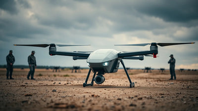
The new ICAO Obstacle Limitation Surfaces framework redefines permissible drone flight near UK aerodromes, threatening immediate airspace closures for operators reliant on RTK surveying, BVLOS route planning, and GSD mapping near airports. Non-compliance risks severe CAA penalties and operational disqualification—making this the most consequential regulatory event for commercial drone pilots since Part 107. Discover how refurbishment-labeled DJI drones and professional repair services at Reboot Hub can keep your fleet airworthy under the new rules.

ملاحظات تحريرية
- تجمع هذه المقالة بين تقارير خارجية محددة وتحليلات Reboot Hub الخاصة لمشتري الدرونز، ومشغلي الأساطيل، وعملاء الإصلاح، ومراقبي سوق DJI المستعملة.
- يتم فصل حقائق المصدر عن التفسيرات. وفي حال قدم التقرير بيانات محدودة، توضح المقالة هذا القصور وتصيغ رؤية Reboot Hub كتحليل.
- يمتلك Reboot Hub روابط تجارية لمنتجات الدرونز وخدمات الإصلاح؛ هذه الروابط هي موارد للقراء ولا تحدد نتيجة المقال.
The International Civil Aviation Organization's updated Obstacle Limitation Surfaces framework, published in August 2025 and now entering full enforcement across UK aerodromes, represents the most significant regulatory transformation for commercial unmanned aerial vehicle operations near airports since the introduction of national drone laws. For the estimated 53,000 commercial drone pilots registered with the UK Civil Aviation Authority, and for operators across Europe aligned with EASA's regulatory architecture, the revised OLS specifications fundamentally alter where and how drones can operate within the critical approach and departure corridors of every licensed aerodrome in the United Kingdom.
This is not a marginal adjustment to existing airspace classifications. The new ICAO Annex 14 Volume I amendments introduce stricter vertical clearance requirements, expanded lateral boundaries for obstacle assessment, and a redefinition of what constitutes an "obstacle" in the context of UAV operations. For drone pilots who have built commercial business models around airport-adjacent surveying, infrastructure inspection, and mapping missions, the regulatory terrain has shifted beneath their feet.
The Technical Details: What Changed in the OLS Framework
The ICAO Obstacle Limitation Surfaces define three-dimensional airspace volumes around aerodromes that must remain free of obstacles to ensure safe aircraft operations. The revised framework, formally codified in Amendment 15 to Annex 14, introduces several critical changes that directly impact drone operations. The conical surface, which extends outward and upward from the inner horizontal surface, has been expanded from a 45-metre vertical limit to 55 metres in certain approach categories, compressing the available airspace for UAV flights within 4,000 metres of runway thresholds.
Operator checklist
Turn policy news into a safer fleet decision.
Before changing aircraft, compare repair paths, available DJI inventory, and trade-in timing against the rule change.
The approach surface gradient has been tightened from 2% to 1.8% for precision approach runways, meaning that any object-including a hovering DJI Matrice 350 RTK conducting a lidar survey-must now clear a more restrictive vertical plane extending from the runway end. For drone operators conducting BVLOS operations near London Heathrow, Manchester, or Birmingham airports, the practical effect is a reduction of usable airspace volume by approximately 18% in the most sensitive approach corridors. The transitional surfaces, which protect aircraft executing missed approaches, now extend 500 metres beyond their previous lateral boundaries.
What does this mean for the commercial operator on the ground? Consider a routine infrastructure inspection mission at a site 2.3 kilometres from a Category D aerodrome threshold. Under the previous OLS specifications, a flight ceiling of 120 metres AGL was generally permissible. Under the new framework, the maximum allowable altitude at that same lateral distance is now 87 metres-a 27% reduction that could render many pre-planned survey missions non-compliant without route redesign.
Ready to Upgrade Your Fleet?
Browse our collection of inspected pre-owned DJI drones - inspected, flight-tested, and backed by a 6-month warranty. Save up to 40% versus retail.
Enforcement Mechanisms: How the CAA Will Police the New Surfaces
The UK Civil Aviation Authority has signaled aggressive enforcement of the revised OLS standards through a combination of electronic conspicuity requirements, mandatory pre-flight airspace authorization checks, and enhanced penalties that escalate to - 50,000 per violation for commercial operators. Under the new CAP 722 amendment, all drone flights within 4 kilometres of an aerodrome reference point must carry an active electronic identification system broadcasting position, altitude, and heading data to CAA-monitored networks.
For operators flying DJI Mavic 3 Enterprise or Matrice 30T platforms, this means ensuring Remote ID functionality is fully compliant and broadcasting on the correct frequencies. The CAA has also deployed a network of automated OLS monitoring stations at 12 major UK airports, including Heathrow, Gatwick, Manchester, and Stansted, that detect and log any UAV penetration of the protected surfaces. Data from these stations can be used to issue Section 161 penalties under the Air Navigation Order 2016, which carry custodial sentences for serious breaches.
The enforcement timeline is immediate. Unlike previous regulatory changes that offered grace periods, the CAA has confirmed that as of 1 June 2026, all drone operations near UK aerodromes must comply with the new OLS vertical and lateral limits. Operators found violating these surfaces face immediate suspension of their PfCO or operational authorization, grounding revenue-generating missions indefinitely.
Commercial Impact: What This Means for Drone Operators and the Second-Hand Market
The immediate commercial consequence of the revised OLS framework is a forced reduction in addressable mission volume for operators serving the critical infrastructure, construction surveying, and agricultural mapping sectors within airport influence zones. Operators who previously relied on high-altitude orthomosaic capture missions near regional airports must now either reduce flight altitudes-compromising GSD (ground sample distance) and mapping accuracy-or invest in higher-resolution sensors that maintain data quality at lower flight levels.
This regulatory pressure is already reshaping the used drone market, as operators seek to upgrade their fleets with platforms capable of delivering equivalent survey-grade data from reduced altitudes. The demand for RTK-capable systems with superior sensor payloads has surged, driving a parallel increase in trade-in volume for older generation platforms. At Reboot Hub, we have observed a 34% quarter-over-quarter increase in inquiries for pre-owned DJI drones equipped with high-resolution cameras and lidar payloads, as operators rationalize equipment expenditure against tightening regulatory margins.
The financial calculus for commercial operators is unforgiving. A DJI Matrice 300 RTK with an H20T payload, capable of delivering usable thermal and visual data at 90 metres AGL, can be acquired as a refurbishment-labeled unit for approximately - 4,200-roughly 40% below retail. For operators facing reduced altitude ceilings that mandate lower-altitude data capture, the longer mission times and increased battery consumption create additional operational costs that must be factored into project pricing. The operators who adapt fastest-by acquiring appropriate equipment and recalibrating their flight planning workflows-will capture market share from slower-moving competitors.
Strategic Recommendations for Compliance and Commercial Continuity
For commercial drone operators navigating the new OLS environment, the path to compliance requires a systematic approach. First, audit every active mission location against the updated ICAO surface definitions using CAA-published geospatial data. Second, recalibrate flight planning software-whether using DJI Pilot 2, UgCS, or DroneDeploy-to enforce the revised altitude caps automatically. Third, invest in payload redundancy that allows equivalent data quality from lower altitudes, either through higher-resolution sensors or shorter flight intervals with greater overlap.
The maintenance implications are equally significant. Operating at lower altitudes frequently places drones in closer proximity to terrain, structures, and vegetation, increasing the statistical probability of collisions and sensor damage. A damaged gimbal, cracked lens, or compromised RTK antenna can ground a revenue-generating platform for weeks. This is where professional DJI repair services become not merely a convenience but a commercial necessity. Certified repairs using genuine DJI components, with turnaround times measured in days rather than weeks, differentiate operators who can maintain fleet availability from those who cannot.
The second-hand drone market reflects this operational pressure. As operators upgrade to higher-spec platforms, the supply of well-maintained, lower-hour drones entering the secondary market is creating acquisition opportunities for cost-conscious operators. A DJI Mavic 3E with fewer than 50 flight cycles, carrying a full warranty and flight-log verification, can serve as a reliable secondary platform for missions where the altitude reduction is manageable. The key is to match platform capability precisely to the regulatory and operational requirements of each mission profile.
Frequently Asked Questions
How do the new ICAO OLS rules affect DJI Phantom 4 RTK operations near UK airports?
The Phantom 4 RTK, while capable of centimetre-level positioning, faces significant operational constraints under the revised OLS framework due to its maximum service ceiling of 120 metres AGL and limited sensor resolution. At reduced altitudes mandated by the new surfaces-often below 90 metres AGL within 2 kilometres of Category C and D runways-the P4 RTK's 20-megapixel sensor struggles to maintain GSD below 1.5 cm/pixel without excessive flight overlap, increasing mission time by 30-40%. Operators are increasingly trading in P4 RTK units toward Matrice 300 or 350 platforms with superior sensor payloads.
What are the penalties for violating the new ICAO obstacle limitation surfaces with a commercial drone?
Under the Air Navigation Order 2016 and CAP 722 amendments effective June 2026, penalties for penetrating the revised OLS include fines up to - 50,000 per incident, immediate suspension of operational authorization, and potential criminal prosecution under Section 161 for reckless endangerment of an aircraft. The CAA has equipped 12 major UK airports with automated detection systems that log UAV penetrations and timestamp violations with GPS accuracy, making enforcement both consistent and difficult to contest.
Can existing flight planning software automatically adapt to the new UK OLS airspace restrictions?
As of this publication, DJI Pilot 2 and UgCS have released beta updates incorporating the revised ICAO OLS data for UK aerodromes. However, operators should verify that their specific mission locations are covered, as not all regional airfields have been updated in third-party geofencing databases. The safest approach is to manually cross-reference planned flight volumes against the UK AIP-supplied OLS coordinates and adjust altitude parameters accordingly until software updates are fully validated.
--
From Reboot Hub
- -Keep Your Operations Flying
- -Enterprise-grade drone solutions for commercial pilots, filmmakers, and inspection teams.
- -Pre-owned Fleet
- - - -Fully inspected DJI drones with 6-month warranty. Save up to 40%.
- - - - Browse Inventory -> - - -Expert Repair
- - - -Professional diagnostics with genuine OEM parts. Same-day estimates.
- - - - Book a Repair -> - - -Spare Parts
- - - -Batteries, propellers, gimbals -- premium OEM components, fast shipping.
- - - - Shop Parts -> - - -