TU Delft’s 42KB Neural Drone: A GPS-Free Revolution for Commercial UAVs?
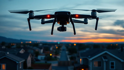
In a breakthrough that threatens to upend BVLOS navigation paradigms, TU Delft researchers have flown a drone 600 meters home using a neural memory of just 42KB—smaller than an email signature. For commercial operators navigating FAA Part 107 waivers and GNSS-denied environments, this honeybee-inspired algorithm promises autonomy without expensive RTK base stations or pre-mapped GSD corridors. The implications for the second-hand drone market are immediate: older airframes without RTK modules could gain new life, while the value of integrated neural processors may skyrocket. Fail to adapt, and your fleet risks obsolescence in a rapidly shifting regulatory landscape.

Redaktionella noter
- Denna artikel kombinerar namngiven extern rapportering med Reboot Hub egen analys för drönarköpare, flottoperatörer, reparationskunder och bevakare av begagnade DJI-marknaden.
- Källfakta är åtskilda från tolkning. Om en rapport tillhandahåller begränsad data, anges detta i artikeln och Reboot Hub perspektiv presenteras som en analys.
- Reboot Hub har kommersiella länkar till drönarprodukter och reparationstjänster; dessa länkar är resurser för läsaren och avgör inte artikelns slutsats.
In a development that could fundamentally reshape the commercial drone industry's approach to autonomous navigation, researchers at Delft University of Technology (TU Delft) have demonstrated a drone capable of navigating over 600 meters back to its launch point using a neural memory of just 42 kilobytes. To put that into perspective, that is smaller than most email signatures with a logo attached.
The flight, conducted without any GPS signal, without a pre-stored map, and with no communication link, represents a paradigm shift in how drones perceive and remember their environment. The trick, as the researchers explain, is borrowed wholesale from the honeybee-an insect renowned for its ability to navigate complex environments using minimal neural resources. For the commercial UAV sector, already wrestling with the high costs of RTK (Real-Time Kinematic) systems and the regulatory hurdles of BVLOS (Beyond Visual Line of Sight) operations, this breakthrough could not be more timely.
The Honeybee Algorithm: How 42KB Beats GPS
The core innovation lies in a neuromorphic navigation algorithm that mimics the honeybee's "optic flow" processing. Honeybees do not rely on GPS or detailed maps; instead, they measure the apparent motion of objects in their visual field as they fly. This "optic flow" provides direct velocity and distance cues. The TU Delft team has compressed this biological process into a neural network that runs on a lightweight, low-power microcontroller-the kind found in consumer electronics.
Reader resources
Turn this drone news into a practical next step.
Compare inspected pre-owned DJI drones, repair options, and trade-in timing before the market moves again.
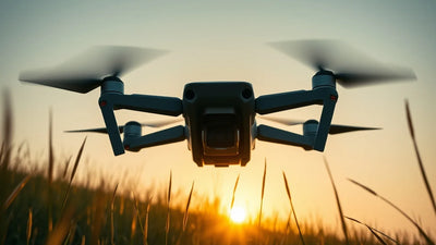
The drone, a custom quadcopter weighing just 72 grams, uses a single downward-facing camera. During its outbound flight, the neural network continuously encodes the visual scene into a compressed memory trace. When it is time to return home, the network reverses the process, comparing the current optic flow against the stored memory to steer the drone back along its original path. The entire memory footprint for a 600-meter flight is just 42KB.
This is not a simple "visual odometry" system that tracks features frame-by-frame. It is a holistic, bio-inspired method that learns the spatial structure of the flight path. The drone does not need to recognize landmarks or store a map-it simply "feels" its way home, just as a bee does. For the commercial drone market, this opens a door to a new class of resilient, low-cost navigation systems that can operate in GNSS-denied environments, such as urban canyons, dense forests, or underground infrastructure.
Commercial Impact: A New Era for BVLOS and Autonomous Operations
The immediate commercial implications are profound. The single greatest barrier to widespread BVLOS operations under FAA Part 107 waivers is the requirement for reliable, redundant navigation in the absence of GPS. Current solutions-dual-antenna RTK GNSS, ground-based radar, or pre-surveyed visual markers-are expensive, complex, and infrastructure-dependent. A 42KB neural memory that enables a drone to autonomously retrace its flight path without any external references could dramatically simplify the waiver process.
For operators conducting pipeline inspection, power line patrol, or agricultural survey work in rural or remote areas, this technology could reduce reliance on expensive RTK base stations. It also offers a failsafe navigation mode that activates automatically when GPS is lost, drastically improving safety in urban environments where signal interference or spoofing is a growing concern.
Ready to Upgrade Your Fleet?
Browse our collection of inspected pre-owned DJI drones - inspected, flight-tested, and backed by a 6-month warranty. Save up to 40% versus retail.
However, the technology is not without limitations. The current prototype has only been demonstrated over a 600-meter distance, and the algorithm's performance in dynamic environments-with moving objects, changing lighting, or seasonal vegetation-remains to be tested. Furthermore, the neural memory is specific to a single flight path; it does not generalize to new routes without a new outbound flight. Nonetheless, the proof-of-concept is compelling, and the research team is already working on scaling the approach to longer distances and more complex environments.
What Does This Mean for the Second-Hand Drone Market?
For the used drone market, this breakthrough signals a potential shift in valuation. Currently, drones equipped with RTK modules-such as the DJI Matrice 300 RTK, DJI Mavic 3 Enterprise RTK, or Autel EVO II RTK-command a significant premium in the secondary market. These systems are prized for their centimeter-level accuracy in surveying and mapping. However, if a low-cost neural navigation module can replicate some of that functionality without requiring a base station, the premium for RTK may erode.
Conversely, older airframes that lack RTK integration-such as the DJI Phantom 4 Pro or the original Mavic 2 Enterprise-could see a resurgence in value if they can be retrofitted with a neural navigation processor. This would open up a new market for pre-owned DJI drones that are upgraded with this capability. At Reboot Hub, we are already monitoring these trends. Our professional DJI repair services are positioned to integrate new navigation modules as they become commercially available, ensuring that our clients' fleets remain at the cutting edge.
For everyday commercial operators, the message is clear: the era of GPS-dependent autonomy may be drawing to a close. The ability to fly BVLOS without expensive ground infrastructure will lower the barrier to entry for small and medium-sized enterprises. It will also increase the operational resilience of existing fleets, reducing downtime caused by GNSS outages or interference. For the second-hand market, this means that drones with strong processing capabilities and modular architectures will retain their value better than those with tightly integrated, single-purpose navigation systems.
Regulatory and Technical Hurdles Ahead
Despite the excitement, the path to commercial deployment is fraught with challenges. The FAA and EASA will require extensive validation of any new navigation technology before granting BVLOS waivers. The neural network's behavior must be deterministic and explainable-a significant hurdle for deep learning approaches. Moreover, the system must demonstrate robustness to edge cases, such as flying through fog, heavy rain, or snow, where optic flow can be severely degraded.
The TU Delft team acknowledges these challenges. In their paper, they note that the current algorithm assumes a static environment and a clear visual field. Future work will focus on integrating inertial sensors (IMUs) to provide complementary data during periods of low visual contrast. They are also exploring multi-camera systems to improve depth perception and obstacle avoidance. For the commercial sector, the most likely near-term application is as a backup navigation mode, rather than a primary system. A hybrid approach-using GPS for long-range flight and the neural memory for terminal homing-could be the first practical deployment.
Frequently Asked Questions
How does the TU Delft drone navigate without GPS?
The drone uses a neuromorphic algorithm inspired by honeybee navigation. It measures "optic flow"-the apparent motion of objects in its visual field-to estimate its velocity and position. During the outbound flight, it encodes this information into a compressed neural memory of just 42KB. On the return journey, it compares the current optic flow against the stored memory to steer itself back along the original path.
What are the commercial implications for BVLOS operations?
This technology could dramatically simplify the BVLOS waiver process under FAA Part 107 by providing a reliable, infrastructure-free navigation backup. It reduces the need for expensive RTK base stations and pre-surveyed visual markers, lowering the cost of entry for commercial operators. However, regulatory validation and robustness testing are still required before widespread deployment.
Will this make RTK modules obsolete?
Not immediately. RTK provides centimeter-level accuracy for surveying and mapping, which this neural navigation system cannot match. However, for applications that require only meter-level precision-such as pipeline inspection or agricultural monitoring-this technology could replace RTK. In the long term, the premium for RTK in the second-hand market may decline, while drones with modular, upgradeable architectures will retain their value.
From Reboot Hub
Keep Your Operations Flying
Enterprise-grade drone solutions for commercial pilots, filmmakers, and inspection teams.
Pre-owned Fleet
Fully inspected DJI drones with 6-month warranty. Save up to 40%.
Browse Inventory ->