Drone LiDAR Flags Aboriginal Rock Shelters Missing From NSW Heritage Register
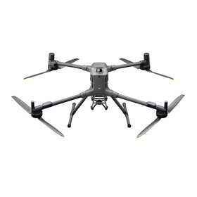
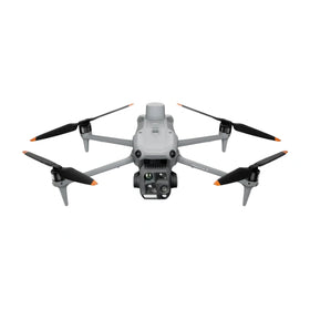
A DJI Matrice 350 with YellowScan LiDAR identified three Aboriginal rock shelters absent from the NSW heritage register. The finding shows how commercial drone operators can deliver mapping value beyond standard survey contracts, especially in dense terrain.

Quick answer
A DJI Matrice 350 equipped with a YellowScan LiDAR sensor identified three Aboriginal rock shelters that were missing from the New South Wales heritage register in the Blue Mountains region.
- The discovery was reported by DroneXL.co on October 25, 2026
- Bushwalkers had already observed the shelters before the drone survey
- The finding highlights LiDAR-equipped commercial drones as heritage and environmental mapping tools
- The work demonstrates enterprise drone value in dense forest and rugged terrain
Evidence: DroneXL.co
Market context
Turn market news into a buy, repair, or trade-in decision.
Compare pre-owned availability, resale timing, and repair economics before the market moves again.

Verified facts
What the available evidence confirms
| Aspect | Detail |
|---|---|
| Platform | DJI Matrice 350 |
| Sensor | YellowScan LiDAR |
| Location | Blue Mountains, New South Wales |
| Finding | Three Aboriginal rock shelters absent from NSW heritage register |
| Prior observation | Bushwalkers had already seen the shelters |
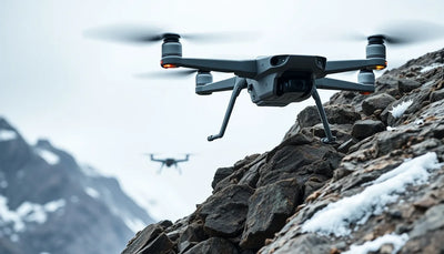
A drone survey in the Blue Mountains region of New South Wales has flagged three Aboriginal rock shelters that were not recorded on the state's official heritage register. According to reporting from DroneXL.co on October 25, 2026, the work was carried out using a DJI Matrice 350 platform equipped with a YellowScan LiDAR sensor. The shelters had already been observed by bushwalkers, but the aerial mapping exercise brought them into a formal identification workflow.
The development is a concrete example of how LiDAR-equipped commercial drones are moving beyond routine topographic survey and into heritage, environmental, and land-management applications. For drone operators, fleet buyers, and repair customers, the story matters less for the archaeological detail than for what it signals about where enterprise drone demand is heading.
What the source actually reported
The primary reporting from DroneXL.co describes a DJI Matrice 350 carrying a YellowScan LiDAR unit during work in the Blue Mountains. The sensor flagged three Aboriginal rock shelters that were absent from the New South Wales heritage register. The report notes that bushwalkers had already seen the shelters, which means the drone survey did not represent the first human observation. Instead, the LiDAR work created a repeatable, georeferenced record that could be fed into official heritage processes.
Reboot Hub analysis: the operational takeaway is that LiDAR payloads are being deployed on DJI enterprise platforms for tasks that require canopy penetration and terrain detail in dense bushland. The Matrice 350 is a heavy-lift commercial airframe, and pairing it with a YellowScan unit suggests a professional survey workflow rather than a casual mapping exercise. The source does not provide contract values, client names, or regulatory filings, so those details should not be assumed.
Why LiDAR work is changing commercial drone demand
LiDAR-equipped drones have become a meaningful segment of the enterprise market because they solve a problem that photogrammetry alone cannot always address: vegetation cover. In forested or scrub-heavy terrain, laser scanning can produce ground-surface models beneath tree canopies. That capability is directly relevant to heritage surveys, forestry, mining rehabilitation, powerline corridor inspection, and flood modelling.
For operators running DJI enterprise platforms, the implication is that payload flexibility matters. A Matrice 350 that can carry a YellowScan LiDAR unit on one job may carry a different sensor on the next. That versatility supports higher utilisation rates and broader service offerings. It also means that repair and spare parts demand is increasingly tied to payload integration, gimbal mounts, cabling, and sensor calibration rather than airframe damage alone.
What this means for drone owners and the market
The Blue Mountains finding reinforces a pattern that commercial drone buyers should watch: government agencies, land councils, environmental consultancies, and infrastructure owners are commissioning LiDAR surveys in terrain that was previously expensive or difficult to map. Each new use case expands the addressable market for enterprise drone services. For fleet managers, that means evaluating whether current airframes can support LiDAR payloads, or whether a heavier platform like the Matrice 350 is needed for future contract work.
For owners of pre-owned DJI enterprise drones, the story also has resale and maintenance implications. Platforms that are compatible with LiDAR payloads tend to hold operational relevance longer because their utility spans multiple job types. Buyers evaluating inspected pre-owned DJI airframes should consider payload compatibility and gimbal condition as part of the purchase decision. Genuine OEM spare parts and professional DJI repair support become more important when an airframe is expected to cycle between different sensor packages. For those mapping out the commercial drone repair and support landscape, the Drone Wiki offers a useful reference point for understanding platform and maintenance considerations. For owners evaluating service and lifecycle risk, Drone Wiki explains the relevant repair, parts, resale, or operational path.
The practical operator-facing question is straightforward: if you are bidding on environmental, heritage, or vegetation-heavy survey work, does your current fleet include a LiDAR-capable platform? If not, the cost of adding that capability may be offset by access to contract categories that photogrammetry-only operators cannot serve.
What remains uncertain
The source report is limited in scope. It does not identify the commissioning agency, the survey contractor, the timeline of the work, or whether the shelters have since been added to the NSW heritage register. It also does not specify which YellowScan model was used or what processing workflow produced the final classification. Those gaps matter for operators trying to benchmark their own LiDAR workflows against the reported work.
Reboot Hub analysis: the absence of official confirmation means this should be treated as a single-source report with a clear operational lesson rather than a definitive regulatory outcome. The value for commercial readers is in the demonstrated use case, not in any specific legal or administrative change. Drone buyers and fleet operators should monitor whether heritage and environmental agencies in Australia begin to formalise LiDAR-based survey requirements, as that would shift procurement patterns and service demand.
FAQ
Frequently asked questions
What drone platform was used in the Blue Mountains survey?
According to DroneXL.co, the survey used a DJI Matrice 350 equipped with a YellowScan LiDAR sensor.
What did the LiDAR survey find?
The LiDAR survey flagged three Aboriginal rock shelters that were absent from the New South Wales heritage register. Bushwalkers had already observed the shelters before the drone work.
Why does this matter for commercial drone operators?
It demonstrates that LiDAR-equipped enterprise drones are being used for heritage and environmental mapping in dense terrain, which expands the range of contract work available to operators with the right payload capability.
Which sources support this update?
The visible evidence links identify DroneXL.co; each source is used only for the claim it directly supports.
What remains subject to change?
Retail pricing, availability, product bundles and regulatory timelines can change. Readers should verify the latest terms with the named retailer, manufacturer or regulator before acting.
How should buyers or operators use this analysis?
Use the verified facts as a starting point, then compare mission fit, lifecycle support, maintenance needs and current procurement terms before making a purchase or fleet decision.
Konsulterade källor
- DroneXL.co - primary source
Ytterligare officiell dokumentation var inte tillgänglig vid publiceringstillfället.
Reboot Hub Editorial tillför analys gällande köp, reparation, andrahandsvärde och drift för drönarägare. Om du upptäcker ett fel, kontakta oss för granskning av rättelse via vår redaktionella policy.