SkyeBrowse Adds Cut-and-Fill Volume and Camera Blind Spot Tools
Drone mapping teams using SkyeBrowse can now compare 10 site surveys, calculate cut-and-fill volumes, verify accuracy against ground control points, and plan security camera placement in one workflow. The update signals tighter integration between aerial survey data and site security planning for commercial operators.

Quick answer
SkyeBrowse has added new tools that let drone mapping teams compare 10 site surveys, calculate cut-and-fill volumes, check accuracy against ground control points, and plan security camera placement directly in the platform.
- Multi-survey comparison now supports up to 10 site datasets
- Cut-and-fill volume calculations are available in-platform
- Accuracy checks against ground control points are included
- Security camera placement planning is now part of the workflow
Evidence: DroneDJ
Fleet readiness
Keep DJI hardware available without overbuying new units.
Use defense and fleet news as a planning signal for repair support, inspected pre-owned aircraft, and replacement timing.

Verified facts
What the available evidence confirms
| Capability | Operational use |
|---|---|
| Compare 10 site surveys | Track site changes over time without external software |
| Cut-and-fill volume calculation | Estimate earthwork quantities for construction planning |
| Ground control point accuracy check | Validate survey precision against known reference points |
| Security camera placement planning | Identify coverage gaps and blind spots before installation |
Drone mapping software provider SkyeBrowse has released a set of new tools aimed at construction survey teams, security planners, and commercial operators who need to move between aerial data and practical site decisions faster. According to reporting by DroneDJ, the update lets users compare up to 10 site surveys, calculate cut-and-fill volumes, check accuracy against ground control points, and plan security camera placement directly inside the SkyeBrowse platform.
The announcement matters because it reduces the number of software handoffs a drone mapping team has to manage. Instead of exporting data to a separate volume calculation tool or a security design package, operators can now perform more of that analysis in one place. For fleet managers and commercial drone service providers, that kind of workflow consolidation can translate into shorter project turnaround times and fewer licensing costs across multiple software subscriptions.
What the new SkyeBrowse tools actually do
The reported feature set is built around four practical workflows. The first is multi-survey comparison, which DroneDJ says now supports up to 10 site surveys. That is meaningful for construction and infrastructure teams that need to track progress across weeks or months. A project manager can overlay earlier and later surveys to see where material has been moved, where structures have changed, or where erosion or unauthorized activity has altered a site.
The second feature is cut-and-fill volume calculation. In earthworks and site preparation, cut-and-fill refers to how much soil or rock must be removed from high areas and placed in low areas to reach a target grade. Having this calculation inside the mapping platform means a drone operator can deliver volume estimates without exporting to a separate civil engineering package. That is a direct time saver for surveyors who bill by the deliverable.
The third addition is an accuracy check against ground control points. Ground control points are physically marked locations with known coordinates that surveyors use to anchor aerial maps to real-world positions. A built-in accuracy check lets operators see how closely their drone-generated model aligns with those reference points before they hand the data to a client or regulator. This is the kind of quality assurance step that can prevent costly rework later.
The fourth tool is security camera placement planning. Users can reportedly model camera coverage and identify blind spots before purchasing or installing hardware. For commercial facilities, construction sites, and public infrastructure, this connects aerial mapping data to physical security planning in a way that previously required separate software or manual estimation.
Why survey accuracy and volume tools carry commercial weight
For commercial drone operators, the difference between a competitive bid and a losing one often comes down to how much post-processing labor is required. If a mapping team can deliver a cut-and-fill estimate and a ground control point accuracy report from the same platform where they built the 3D model, they can quote tighter timelines and reduce the risk of data errors introduced during file conversion.
Reboot Hub analysis suggests that software consolidation like this tends to benefit smaller drone service providers most. A one- or two-person mapping business may not have the budget for multiple specialized software licenses. When a platform adds volume calculation and accuracy checking natively, it lowers the barrier to offering professional-grade survey deliverables. That can shift competitive dynamics in local markets where drone mapping contracts are often won by whoever can produce a credible report fastest.
The security camera placement feature also points to a broader trend: drone data is increasingly being used for purposes beyond mapping and inspection. Site security assessments, perimeter planning, and surveillance coverage analysis are adjacent services that a drone operator can offer without buying new hardware. The drone is already on site. The question is whether the software lets the operator turn that flight into an additional revenue line.
What this means for drone owners and the market
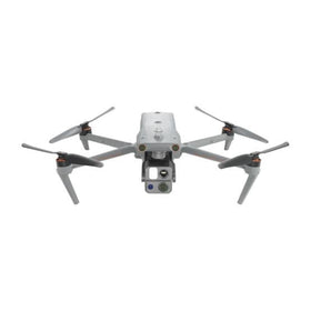
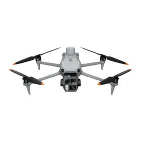
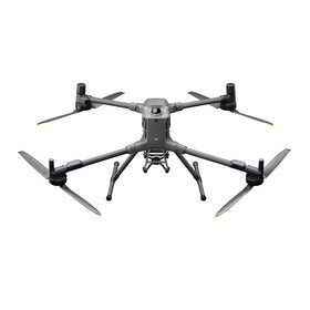
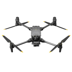
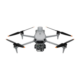
The SkyeBrowse update does not introduce new drone hardware, but it does affect how existing commercial drones are used. Operators who already fly mapping missions with DJI enterprise platforms or other survey-capable aircraft may find that their current hardware is sufficient to produce the datasets these new tools require. That is a meaningful point for fleet planners: the investment case shifts from buying a new aircraft to making better use of the software that processes the imagery.
For the pre-owned DJI market, this kind of software development can extend the useful life of older enterprise drones. A drone that produces clean, geotagged imagery remains valuable even if it lacks the latest obstacle avoidance or transmission features, because the analytical work happens in software after the flight. Reboot Hub has observed that mapping-focused operators often prioritize camera quality and flight stability over newer consumer features, which supports steady demand for inspected pre-owned DJI enterprise platforms and genuine OEM spare parts when repairs are needed. For readers evaluating drone ownership costs, the Drone Wiki offers a practical reference for understanding how platform and repair decisions affect long-term fleet value. For owners evaluating service and lifecycle risk, Drone Wiki explains the relevant repair, parts, resale, or operational path.
The practical takeaway for a drone buyer or fleet manager is to evaluate software capabilities alongside aircraft specifications. A newer drone with a better camera may not improve your deliverables if your mapping software cannot process the data efficiently. Conversely, a well-maintained older aircraft paired with capable software may deliver more billable value than a hardware upgrade alone. When repair decisions come up, the question should be whether the aircraft still produces imagery that your software stack can turn into client-ready reports.
Source-limited context and what remains unverified
This report is based on the DroneDJ coverage of the SkyeBrowse announcement. Reboot Hub has not independently verified the specific feature set, pricing, platform compatibility, or release timing. The source summary indicates that the tools are available directly in SkyeBrowse, but it does not specify which subscription tiers include them, whether the features apply to all supported drone models, or how the volume calculations are validated against traditional survey methods.
Operators should treat the reported capabilities as directionally accurate but unconfirmed at the detail level. Before changing a workflow or quoting a client, a mapping team should verify that their SkyeBrowse plan includes the new tools and that the output meets the accuracy standards their clients require. The ground control point check is a useful internal quality control step, but it does not replace a licensed surveyor's sign-off where one is legally required.
The absence of verified spec context for this article means Reboot Hub is not asserting any specific DJI compatibility, processing speed, or accuracy threshold. The commercial implication is straightforward, however: software that reduces export steps and adds analytical features makes drone mapping more accessible to smaller operators and more efficient for established teams.
FAQ
Frequently asked questions
What did SkyeBrowse announce?
According to DroneDJ, SkyeBrowse added tools for comparing up to 10 site surveys, calculating cut-and-fill volumes, checking accuracy against ground control points, and planning security camera placement directly in the platform.
Do I need a new drone to use these features?
The update is software-based, so operators may be able to use existing mapping drones that produce geotagged imagery. Reboot Hub has not verified which drone models or subscription tiers support the new tools.
How does this affect drone fleet planning?
Fleet managers should evaluate software capabilities alongside aircraft specifications. A well-maintained older drone paired with capable mapping software may deliver more billable value than a hardware upgrade alone, which supports continued demand for inspected pre-owned enterprise platforms and genuine OEM spare parts.
Which sources support this update?
The visible evidence links identify DroneDJ; each source is used only for the claim it directly supports.
What remains subject to change?
Retail pricing, availability, product bundles and regulatory timelines can change. Readers should verify the latest terms with the named retailer, manufacturer or regulator before acting.
How should buyers or operators use this analysis?
Use the verified facts as a starting point, then compare mission fit, lifecycle support, maintenance needs and current procurement terms before making a purchase or fleet decision.
Использованные источники
- DroneDJ - primary source
На момент публикации дополнительная официальная документация отсутствовала.
Редакция Reboot Hub предоставляет анализ по вопросам покупки, ремонта, перепродажи и эксплуатации БПЛА для их владельцев. Если вы заметили ошибку, свяжитесь с нами для ее исправления в соответствии с нашей редакционной политикой.