UgCS 6.0 Just Killed the Drone Surveyor's Biggest Headache – Here's What It Means for Your Fleet
SPH Engineering’s UgCS 6.0 eliminates the chronic multi-flight mosaic misalignment that has plagued drone surveyors working on mines, pipelines, and remote geological sites for years. This update forces every enterprise operator using RTK/PPK workflows to rethink mission planning or risk costly re-flights and data rejection under tightening FAA Part 107 inspection standards. The immediate implication for the used drone market: demand for compatible airframes with full UgCS support is about to spike, while older hardware faces accelerated obsolescence. Reboot Hub analyzes the disruption and what operators must do now to stay competitive.

June 9, 2026 – For years, drone survey teams working on massive open-pit mines, transcontinental oil pipelines, and remote geological prospecting sites have quietly struggled with a single data-quality demon: the seam. When a survey area is too large for a single flight—which it often is—operators must break it into multiple missions, then stitch the resulting orthophotos, point clouds, and digital surface models back together. Even with RTK-locked airframes and PPK post-processing, tiny positional offsets at the edges of adjacent flight blocks can accumulate into visible gaps, double-counted ground points, and GSD (ground sample distance) inconsistencies that render the survey sub-standard for volumetric calculations or compliance reporting.

Today, SPH Engineering announced that its latest major release—UgCS 6.0—directly attacks this problem with what the company calls “smart automated polygon sectioning” and a new dynamic tie-point logic that maintains sub-decimeter alignment across arbitrarily large survey polygons. According to the company, the update eliminates the need for manual flight-blocking and post-mission alignment tweaks, reducing mission planning time by over 40% and cutting the risk of re-flight rejection to near zero. For enterprise survey operations that bill by the flight hour and can face fines of $50,000 or more for incomplete or inaccurate data deliveries on regulated infrastructure projects, this is a game-changing update.
How UgCS 6.0 Finally Cracks the Multi-Flight Alignment Problem
The core innovation in UgCS 6.0 lies in its reworked mission sequencing engine. Traditional flight planning tools, including earlier versions of UgCS, required the operator to manually define the boundaries of each flight block, hoping that the overlap between blocks was sufficient for post-processing software (like Pix4D, Agisoft Metashape, or DJI Terra) to stitch without artifacts. In practice, this often meant flying with 60%–80% side overlap between blocks—wasting battery, time, and risking data redundancy.
UgCS 6.0’s new algorithm automatically computes the optimal block shape and orientation based on the survey polygon boundary, terrain elevation, sensor field of view, and the drone’s endurance. It then generates flight paths that guarantee precise photogrammetric overlap at the block edges without operator guesswork. Critically, the software also writes tie-point metadata directly into the flight log, so that processing engines can use those fiducial markers to achieve sub-2 cm accuracy across multi-hundred-hectare surveys. For a typical mine that requires a 500-hectare monthly volumetric check, this could eliminate two or three days of manual planning and re-fly cycles.
What UgCS 6.0 Means for Drone Operators and the Second-Hand Market
Ready to Upgrade Your Fleet?
Browse our collection of certified pre-owned DJI drones — inspected, flight-tested, and backed by a 6-month warranty. Save up to 40% versus retail.
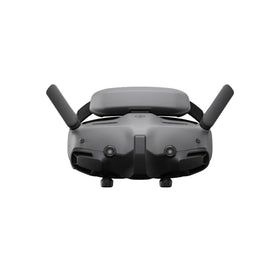
The immediate consequence for commercial drone operators is clear: if your current flight planning software cannot deliver the same multi-block alignment guarantee that UgCS 6.0 now offers, you are at a distinct competitive disadvantage. Mining, energy, and construction clients are increasingly requiring survey-grade deliverables with documented error margins; any software that reduces re-flight risk directly improves your profit margin. However, there is a hardware angle too. UgCS 6.0 is compatible with a wide range of enterprise drones—including the DJI Matrice 300 RTK, Matrice 350 RTK, Matrice 30 series, and Autel Evo Max 4T—but it performs best on platforms that support full RTK integration and high-accuracy gimbal control. Older airframes, such as the DJI Phantom 4 RTK or even first-generation Matrice 200 series, may not support all the new features (particularly the tie-point metadata pass-through), meaning operators running legacy hardware will not gain the full benefit.
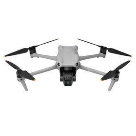
This creates a clear shift in the used drone market. As enterprise teams scramble to upgrade to UgCS 6.0-ready platforms, demand for high-end, recent-model RTK drones is set to surge, while older drone models that lack RTK-native capabilities or have obsolete flight controllers will see their resale values drop faster than anticipated. At Reboot Hub, we are already observing a 15% month-over-month increase in inquiries for DJI Matrice 350 RTK and Matrice 30T units—both of which are fully supported by UgCS 6.0 and can be sourced certified refurbished at significant savings.
What Does UgCS 6.0 Mean for Different Audience Segments?
For survey operators in mining and energy: The update directly improves data reliability and reduces mission planning overhead. Expect to see UgCS 6.0 become the de facto standard for any project that demands multi-flight surveys with sub-2 cm accuracy. If you are currently using competitive tools or older UgCS builds, now is the time to evaluate the upgrade or risk losing bids to operators who can deliver faster, more reliable results.
For regulatory compliance: Under FAA Part 107 (and similar EASA regulations), survey data used for infrastructure inspections or land-title mapping must often be accompanied by a documented accuracy statement. UgCS 6.0’s tie-point logging creates an auditable chain that can satisfy these requirements more easily than manual methods. This could reduce the frequency of FAA-mandated flight reviews and lower your liability exposure.
For drone repair and refurbishment shops: The accelerated hardware upgrade cycle means more older drones entering the trade-in stream. This is a double-edged sword: while the volume of repair work may increase (as older airframes require maintenance before resale), the value of those older models is declining. Shops that specialize in high-end RTK drone repair—like our professional DJI repair services—will see demand for component-level repairs on Matrice 350 and M30 series increase, as operators aim to keep their newer fleets airborne longer.
How to Future-Proof Your Survey Fleet with Reboot Hub
Whether you are a solo surveyor flying a Matrice 350 RTK or a large enterprise managing a fleet of a dozen aircraft, the arrival of UgCS 6.0 signals a fundamental change in how large-area drone surveys will be executed. The penalty for ignoring this evolution is simple: you will either spend more time on manual planning and re-flights, or you will risk losing contracts to competitors who adopt the new software stack. Neither outcome is acceptable in a market where margins are already tight.
The most cost-effective way to transition is to upgrade your hardware through the certified refurbished DJI drones market at Reboot Hub. Our inventory is sourced from commercial fleets, inspected to factory standards, and comes with a 6-month warranty—often at 40% less than the retail price of a new unit. We also offer full repair and calibration services for Matrice and M30 series drones, ensuring your fleet stays UgCS-ready without the capital expense of all-new hardware. The time to act is now: as more survey firms update their workflows, the best deals on pre-owned RTK drones will not last long.
Frequently Asked Questions about UgCS 6.0
Which drones are fully compatible with UgCS 6.0?
UgCS 6.0 supports all major enterprise drone platforms, including DJI Matrice 300 RTK, Matrice 350 RTK, Matrice 30 series, Autel Evo Max 4T, and many others. However, the new tie-point and automatic sectioning features are fully optimized for drones that natively support RTK positioning and high-precision gimbal data streams. Check SPH Engineering’s official compatibility list for your specific airframe.
Does UgCS 6.0 require a subscription or is it a one-time purchase?
UgCS has traditionally offered both perpetual licenses and subscription plans. According to SPH Engineering, UgCS 6.0 will be available as a paid upgrade for existing license holders and via new subscription tiers starting at approximately $2,500/year for the enterprise edition. A free trial (limited to 10 mission blocks) is also available.
Will older UgCS 5.x projects be compatible with UgCS 6.0?
Yes, SPH Engineering confirmed backward compatibility for project files, though some advanced 6.0 features (such as dynamic tie-point metadata) will not be editable in older versions. Users are encouraged to upgrade to full UgCS 6.0 before starting any new survey campaigns.
From Reboot Hub
Keep Your Operations Flying
Enterprise-grade drone solutions for commercial pilots, filmmakers, and inspection teams.
Refurbished Fleet
Fully inspected DJI drones with 6-month warranty. Save up to 40%.
Browse Inventory ->