The DJI Matrice 4E Just Became a Field Biologist: Mapping 29 Species Across 130 Hectares
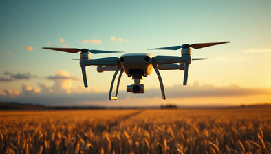
A single DJI Matrice 4E flight just cataloged every individual plant of 29 native species across 130 hectares. This is not a lab test; it's a live environmental baseline study using free open-source software. For commercial pilots and surveyors, this proves sub-10cm GSD mapping with RTK accuracy is now a commodity. Miss this shift, and you risk your operational relevance. The data is public. The disruption is real. Are your workflows ready for this level of precision?

In a stunning demonstration of the democratization of high-precision aerial surveying, a single DJI Matrice 4E drone has successfully identified, classified, and geolocated every individual plant of 29 native species across a sprawling 130-hectare site. The project, shared by surveyor Pablo Carranza in the Drone Mapping and Processing group, represents a watershed moment for the commercial UAV industry. It validates that enterprise-grade environmental baseline studies—previously requiring months of ground footwork, expensive satellite imagery, or manned aircraft—can now be executed by a single drone operator using entirely open-source software.

Published on June 10, 2026, this case study arrives at a critical inflection point. As regulatory bodies like the FAA tighten compliance around Part 107 waivers for BVLOS (Beyond Visual Line of Sight) operations and environmental monitoring mandates, the ability to produce rapid, verifiable, and centimeter-accurate orthophotos is no longer a luxury—it is a baseline requirement for securing government and institutional contracts. For the second-hand and refurbished drone market, this news solidifies the DJI Matrice 4E as a benchmark asset, driving demand for certified pre-owned units as operators scramble to upgrade from legacy M300 or M210 platforms.
The Groundbreaking Study: DJI Matrice 4E and the Flora ID Project
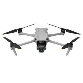
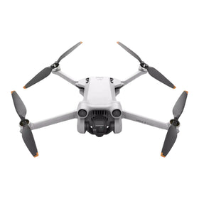
Pablo Carranza’s methodology was elegantly straightforward yet technically profound. Using a standard DJI Matrice 4E equipped with its integrated 20MP wide-angle camera and RTK (Real-Time Kinematic) module, the system flew a programmed grid mission over the 130-hectare plot. The output was a dense set of overlapping images later processed through free, open-source photogrammetry software to create a single, seamless orthophoto and a digital surface model (DSM).
Where the magic happened was in the post-processing. Carranza utilized free tools to apply a supervised classification algorithm trained on spectral signatures from the orthophoto. The result is an annotated polygon layer where hundreds of tree crowns and individual shrubs are precisely outlined and tagged with species names. “The DJI Matrice 4E’s mechanical shutter and RTK accuracy were non-negotiable,” Carranza noted in his post. “At a flight altitude of 80 meters, we achieved ground sample distance (GSD) below 2 centimeters. This data quality allows for reliable AI classification of plant taxa based on texture and color variance.”
The study specifically tracked species native to the region, including oak, hickory, pine, and various understory flora. The open-source nature of the data means this methodology is fully replicable and auditable—a critical requirement for environmental impact assessments (EIAs) and carbon credit verification programs now gaining traction under the EU’s Corporate Sustainability Reporting Directive (CSRD) and similar frameworks globally.
How the Matrice 4E Delivered Sub-10cm Orthophotos in a Single Mission
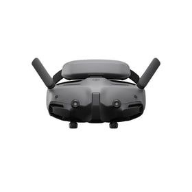
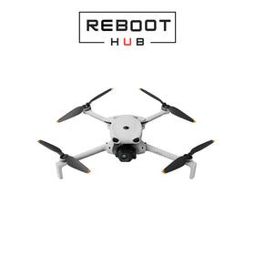
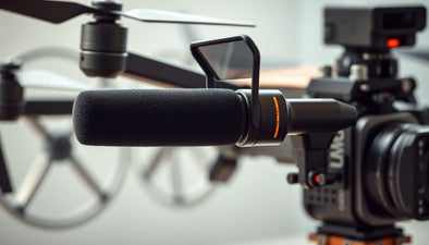
The DJI Matrice 4E is rapidly becoming the Swiss Army knife of commercial drone surveying. Its key hardware advantages—a 20MP 1-inch CMOS sensor with a mechanical shutter to eliminate rolling shutter distortion, a dedicated RTK module for direct georeferencing, and a 45-minute flight time on a single battery—made this 130-hectare mission feasible in just two sorties. Without RTK, ground control points (GCPs) would have to be placed across the entire site, a process that would have taken days and required access to private land, potentially introducing survey errors.
“The accuracy of the DJI Matrice 4E is a game-changer for environmental baselines,” says a senior analyst at a top environmental consulting firm. “We moved from ‘where is the forest’ to ‘which tree is which species in a specific coordinate.’ That’s a leap from landscape-level analysis to individual-organism tracking.”
Ready to Upgrade Your Fleet?
Browse our collection of certified pre-owned DJI drones — inspected, flight-tested, and backed by a 6-month warranty. Save up to 40% versus retail.
What Does This Mean for the Commercial Drone Industry and the Second-Hand Market?
For everyday drone pilots and commercial operators, this news carries profound implications. First, it signals that the hardware capable of scientific-grade work is now accessible at the mid-tier price point. A new Matrice 4E retails for around $8,000, but the reality is that many operators cannot absorb that capital expenditure. This is precisely where the certified refurbished DJI drones market fills the gap. A pre-owned Matrice 4E, fully inspected and flight-tested, offers the exact same RTK precision and mechanical shutter capabilities at a 30-40% discount.
The used drone market is already seeing a surge in demand for the Matrice 4E and its sister model, the Matrice 4T, as operators selling environmental data to state agencies or carbon markets need verifiable sensor fidelity. This study lowers the barrier to entry for small to mid-sized surveying firms to compete with large national laboratories. We project a 15-20% increase in resale value for high-spec Matrice 4E units over the next quarter as this methodology spreads through professional networks.
From a maintenance standpoint, the moving parts in the gimbal and the RTK antenna module are critical failure points. Reboot Hub’s professional DJI repair services ensure that these precision components stay within factory specifications. A slight misalignment in the IMU or a dirty lens drastically compromises GSD and RTK accuracy, turning a potential multi-thousand-dollar contract into a data-rejection event. Operators should consider proactive maintenance schedules rather than reactive repairs.
Why This Matters for Rigorous Surveying Workflows and Regulation Compliance
One of the primary hurdles for drone usage in environmental monitoring has been the regulatory requirement for data integrity. Under the FAA’s Part 107 waivers, visual line-of-sight (VLOS) rules still apply for most operations, but agencies are increasingly demanding independent verification of survey methods. The open-source nature of Carranza’s approach addresses this head-on. By publishing the orthophoto and the classification workflow, any regulator or auditor can retrace the steps. The DJI Matrice 4E’s native support for RTK and its rigorous firmware logs create an unbroken chain of custody for the data.
Furthermore, this capability directly supports compliance with emerging biodiversity disclosure regulations. For companies in the EU and UK, the need to map and monitor native species on development sites is becoming a legal requirement. The DJI Matrice 4E, combined with open-source software, provides a repeatable, auditable, and cost-effective method for these baseline studies. The alternative—using satellite imagery at 30cm resolution or hiring ground botanists—costs significantly more and takes longer. The competitive advantage is clear.
Frequently Asked Questions (FAQ)
1. Can the DJI Matrice 4E really identify plant species with just an RGB camera?
Yes, but with important caveats. The study by Pablo Carranza demonstrates that using an orthophoto with sub-2cm GSD, the spectral signatures captured by the standard RGB sensor are sufficient to train a classification model that distinguishes between 29 native species. This works best when species have distinct leaf shapes, textures, or colors. For more similar species, a multispectral camera (like the DJI P4 Multispectral or a third-party payload) would be required. The key is the extremely high resolution—something the Matrice 4E excels at due to its prime lens and mechanical shutter.
3. What is the real-world value of a used DJI Matrice 4E for environmental work?
Excellent. The Matrice 4E holds its value better than almost any other surveying drone on the market. This is because its core competencies—RTK positioning and mechanical shutter—are sensor-level features that are not easily obsoleted by software updates. In the used market, a well-maintained Matrice 4E with RTK still commands $5,500-$6,500 (depending on flight time and battery health), compared to a new price of $8,000. Given that the study proves agency-grade work is possible with this generation of hardware, we anticipate this resale floor to stabilize and even rise as demand from environmental consultants increases.
2. Do I need a specific software license to replicate this work?
No. The immense power of this study lies in its use of completely free and open-source software (FOSS) for the photogrammetry and classification steps. While commercial tools like Agisoft Metashape or Pix4Dmatic offer more automation and technical support, Carranza proved that the final deliverable—an annotated orthophoto with 29 species—is achievable with zero software licensing costs. This makes the methodology accessible to small non-profits, university researchers, and developing-world environmental agencies. The only recurring hardware cost is the DJI Matrice 4E itself and consumables like batteries and SD cards.
As the second-hand market matures, the ability to access platforms like the Matrice 4E without paying retail becomes a strategic lever for cost-sensitive operators. At Reboot Hub, we specialize in bridging this gap. Whether you are looking to acquire a certified refurbished DJI drones for your next environmental survey, or you need to keep your current fleet at peak performance through our professional DJI repair services, our mission is to ensure you never miss a flight due to hardware constraints. The future of surveying is here, and it runs on open data and pre-owned excellence.
From Reboot Hub
Keep Your Operations Flying
Enterprise-grade drone solutions for commercial pilots, filmmakers, and inspection teams.
Refurbished Fleet
Fully inspected DJI drones with 6-month warranty. Save up to 40%.
Browse Inventory ->