DJI Opens 2026 World Heritage 3D Conservation Mapping Initiative
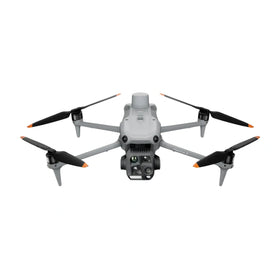
DJI has launched a 2026 World Heritage 3D Conservation Initiative focused on drone mapping and digital preservation. The program signals expanded commercial demand for survey-capable platforms, mapping workflows, and long-term fleet support across heritage and infrastructure documentation projects.

Quick answer
DJI has launched a 2026 World Heritage 3D Conservation Initiative for drone mapping and digital preservation, as reported by uasweekly.com.
- The initiative focuses on drone mapping and digital preservation of heritage sites.
- It signals expanded commercial use cases for survey and mapping drone platforms.
- Operators and fleet buyers should watch for related workflow and platform demand signals.
- The report does not yet specify participating sites, hardware models, or program terms.
Evidence: DJI ROMO official robot vacuum page · DJI Support ROMO beginner guide
DJI buying context
Match product news to hardware you can actually deploy.
Check inspected DJI aircraft, repair support, and trade-in timing before deciding whether to upgrade, repair, or wait.

DJI has launched a 2026 World Heritage 3D Conservation Initiative centered on drone mapping and digital preservation, according to a report published by uasweekly.com and surfaced through Google News DJI. The announcement frames heritage documentation as a growing operational category for commercial drone platforms, with the program positioned around 3D mapping workflows rather than consumer imaging or recreational flight.
For commercial operators, fleet managers, and buyers evaluating pre-owned DJI equipment, the initiative matters less as a single product launch and more as a demand signal. Heritage conservation, infrastructure documentation, and digital twin work have been expanding steadily as repeatable commercial drone applications. A DJI-branded initiative in this space suggests the manufacturer sees enough long-term volume to organize a formal program around it.
What the source actually reports
The central development is narrow and clearly attributed. UAS Weekly reports that DJI has launched a 2026 World Heritage 3D Conservation Initiative for drone mapping and digital preservation. The report does not provide a detailed list of participating heritage sites, specific drone models, sensor packages, software partners, or program funding figures. Reboot Hub analysis should treat those operational details as unconfirmed until DJI or a named partner publishes them directly.
What the source does establish is the program's thematic focus: using drone-based 3D mapping to document and digitally preserve heritage locations. That framing aligns with established commercial workflows in which survey-grade or mapping-capable drones capture overlapping imagery, which is then processed into textured 3D models, orthomosaics, and measurable digital records. The initiative name itself points toward conservation outcomes rather than promotional content creation.
Why heritage mapping is becoming a commercial category
Heritage and cultural-site documentation has moved from an academic niche into a repeatable commercial service category. Conservation authorities, architecture firms, engineering consultancies, and specialist surveying companies increasingly require current, measurable digital records of structures that may be fragile, difficult to access, or at risk from environmental exposure. Drone-based capture offers a practical route to that data without scaffolding, cranes, or direct physical contact with sensitive surfaces.
For operators, this category rewards platforms with reliable flight stability, consistent camera geometry, and compatibility with photogrammetry processing pipelines. It also rewards disciplined mission planning, because heritage documentation often involves irregular structures, variable lighting, and tight operating windows. The DJI initiative does not confirm which platforms will be used, but the commercial logic points toward mapping-capable airframes rather than ultra-light consumer models or purely cinematic tools.
What this means for drone owners and the market
The most immediate effect is likely demand-side. When a major manufacturer formalizes a conservation mapping initiative, it tends to raise visibility for that application among adjacent buyers: local governments, preservation trusts, university research groups, and private consultancies that may not yet run drone programs. Some of those buyers will purchase new equipment. Others will look for inspected pre-owned platforms that can handle mapping workloads at a lower entry cost. For owners of mapping-capable DJI airframes, that can support steadier resale interest and clearer positioning when listing equipment. Reboot Hub tracks these shifting use cases in its Drone Wiki for operators evaluating platform choices and long-term ownership costs.
There is also a fleet-planning angle. Programs like this tend to normalize multi-airframe operations, because documentation projects often run across multiple sites, seasons, or teams. A fleet manager watching this announcement should consider whether current airframes, batteries, and spare parts inventories can support sustained mapping work rather than occasional one-off flights. Genuine OEM spare parts and professional DJI repair support become more relevant when aircraft are expected to fly frequently and predictably.
For repair and maintenance providers, the signal is indirect but real. Mapping missions accumulate flight hours faster than casual photography work. That means more frequent wear on gimbals, landing gear, propellers, and battery cycles. Operators who treat heritage documentation as a recurring service line will need maintenance planning, not just purchase planning. Pre-owned DJI drones that have been inspected and supported with OEM-pulled parts can fit that model when buyers want additional airframes without full retail cost. For owners evaluating service and lifecycle risk, Drone Wiki explains the relevant repair, parts, resale, or operational path.
What operators should watch next
The source report leaves several practical questions open. It does not name the heritage sites included in the 2026 program, the hardware or software stack involved, the geographic scope, or whether participation is open to external operators. Those details will determine how directly the initiative affects commercial workflows outside DJI's own ecosystem.
Until those specifics appear, the sensible response for a buyer or fleet manager is to treat the announcement as a category signal rather than a procurement trigger. Operators already doing mapping or photogrammetry work should continue refining capture discipline, processing consistency, and equipment maintenance. Those considering entry into heritage or infrastructure documentation should evaluate whether their current platform, battery inventory, and repair support can handle sustained survey-style missions. The initiative reinforces that drone mapping is becoming a durable commercial line, not a short-term trend.
FAQ
Frequently asked questions
What is the DJI 2026 World Heritage 3D Conservation Initiative?
It is a DJI program reported by uasweekly.com that focuses on drone mapping and digital preservation of heritage sites. The source report does not yet list specific sites, platforms, or participation terms.
Does this announcement confirm which DJI drones will be used?
No. The source does not specify drone models, sensors, software, or program hardware. Operators should wait for direct DJI documentation before making platform assumptions.
How should commercial drone buyers respond to this news?
Treat it as a demand signal for mapping and documentation services. Buyers and fleet managers should assess whether their current aircraft, battery stock, and repair support can handle sustained survey-style operations before expanding into heritage or infrastructure work.
Which sources support this update?
The visible evidence links identify DJI ROMO official robot vacuum page and DJI Support ROMO beginner guide; each source is used only for the claim it directly supports.
What remains subject to change?
Retail pricing, availability, product bundles and regulatory timelines can change. Readers should verify the latest terms with the named retailer, manufacturer or regulator before acting.
How should buyers or operators use this analysis?
Use the verified facts as a starting point, then compare mission fit, lifecycle support, maintenance needs and current procurement terms before making a purchase or fleet decision.
Sources consulted
- uasweekly.com via Google News - primary source
- DJI ROMO official robot vacuum page - official product page
- DJI Support ROMO beginner guide - official support guide
Reboot Hub Editorial adds buyer, repair, resale, and operational analysis for drone owners. If you spot an error, contact us for correction review through our editorial policy.