SkyeBrowse Update Turns Every Drone Photo into a Clickable 3D Asset
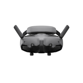
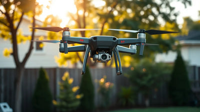
SkyeBrowse's latest platform update shatters a critical bottleneck in commercial drone operations: post-processing data utility. By making every image within a 3D model "clickable" and offering the Image Walkthroughs feature free to all users, the company is directly challenging the ROI calculus for Part 107 mapping missions. For surveyors and construction firms using RTK drones like the DJI Mavic 3 Enterprise, this eliminates the tedious back-and-forth between raw imagery and processed models. Miss this upgrade, and your competitors will be delivering actionable intelligence in minutes instead of hours.

Redakční poznámky
- Tento článek kombinuje konkrétní externí zprávy s vlastní analýzou Reboot Hub pro kupce dronů, provozovatele flotil, zákazníky servisů a sledovatele trhu s repasovanými zařízeními DJI.
- Fakta ze zdrojů jsou oddělena od interpretace. Pokud zpráva poskytuje omezená data, článek tuto omezenost uvádí a prezentuje pohled Reboot Hub jako analýzu.
- Reboot Hub má komerční vazby na produkty a servisní služby pro drony; tyto odkazy jsou zdroji pro čtenáře a neurčují závěr článku.
The commercial drone mapping sector has long faced a paradox: the software gets exponentially better at building dense, accurate 3D point clouds and orthomosaics, but the end-user experience often remains stuck in a data swamp. Surveyors, construction managers, and infrastructure inspectors can generate a stunning digital twin of a site, but extracting specific, actionable information from that model-like the condition of a single bolt on a bridge or the exact elevation of a foundation corner-often requires a tedious process of cross-referencing the model with the original raw photographs. This disconnect has been a silent killer of workflow efficiency, costing operators valuable time and frustrating clients who expect instant answers.
Today, on June 1, 2026, SkyeBrowse is announcing a major platform update that directly attacks this problem. The core of the update is a feature that makes every individual photograph used to construct a 3D model "clickable" from within the model itself. This seemingly simple innovation has profound implications for the speed and utility of drone-based data collection, effectively transforming a static 3D asset into a dynamic, interactive database. By coupling this with improved model quality, enhanced AI-generated floor plans, and the decision to make its Image Walkthroughs feature free for all users, SkyeBrowse is setting a new baseline for what professional drone operators should expect from their mapping software.
The "Clickable Photo" Revolution: From Model to Metadata
The headline feature is deceptively straightforward. In the past, a user viewing a 3D model in SkyeBrowse would see a textured mesh or point cloud. To inspect a specific element, they would have to mentally note a location, exit the model, and manually search through a folder of potentially thousands of images. The new update eliminates this friction entirely. Now, a user can simply click on any point within the 3D model, and the software instantly retrieves and displays the original, high-resolution photograph that best covers that area. This is not a thumbnail; it is the full, uncompressed image, complete with its original EXIF data including GPS coordinates, altitude, and camera settings.
Reader resources
Turn this drone news into a practical next step.
Compare inspected pre-owned DJI drones, repair options, and trade-in timing before the market moves again.
This functionality is a game-changer for forensic analysis and quality assurance. For a Part 107 operator inspecting a cell tower, being able to click on a suspicious antenna mount in the model and immediately see the raw, unprocessed photo allows for a level of detail and verification that was previously only possible with painstaking manual effort. For a construction firm monitoring progress, it means a project manager can instantly verify that a specific weld was completed to spec without leaving the digital twin environment. This convergence of the abstract model and the concrete photograph creates a single source of truth that dramatically reduces the risk of misinterpretation.
How This Update Reshapes the Commercial Drone Workflow
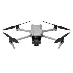
To understand the impact, it's important to break down the typical workflow for a high-stakes mapping mission. An operator using an RTK-equipped drone like the DJI Phantom 4 RTK or the DJI Mavic 3 Enterprise flies a pre-programmed grid, capturing hundreds or thousands of overlapping images. These images are then processed in photogrammetry software like SkyeBrowse, Pix4D, or DroneDeploy to create a 3D model. The model is the deliverable. But the value of that deliverable is only as good as the operator's ability to answer specific questions from it.
Before this update, answering a question like "Is there corrosion on the third pipe support from the north end?" required a multi-step process: locate the pipe support in the model, guess which images might show it, open the image viewer, and scroll through files. Now, the answer is one click away. This represents a massive efficiency gain. For a large industrial site with a complex 3D model, this can cut post-processing analysis time by 50% or more. It also empowers less technical stakeholders-a client's project manager, for instance-to navigate the data independently without needing a drone pilot or GIS specialist to interpret the model for them.
Ready to Upgrade Your Fleet?
Browse our collection of inspected pre-owned DJI drones - inspected, flight-tested, and backed by a 6-month warranty. Save up to 40% versus retail.
What Does This Mean for the Drone Pilot and the Second-Hand Market?
For the everyday commercial drone operator, this update lowers the barrier to entry for delivering high-value mapping services. You no longer need to be a photogrammetry expert to create a useful, interactive deliverable. This means a pilot with a solid understanding of flight planning and a capable drone can now compete for more sophisticated contracts. The software is doing the heavy lifting of data interpretation.
This has a direct and positive effect on the second-hand drone market. As software becomes more powerful and user-friendly, the hardware requirements become more defined. A well-maintained, used DJI Mavic 3 Enterprise or a pre-owned DJI drones like the Phantom 4 RTK becomes an even more attractive proposition. Why spend $10,000 on the latest model when software like SkyeBrowse can extract maximum value from a slightly older but perfectly capable airframe? This dynamic is driving growth in the used drone market, as operators realize that the bottleneck to profitability is often software and workflow, not the raw sensor resolution of the latest hardware. A drone with a 20MP camera and RTK capability, purchased from a reputable source and paired with cutting-edge software, can deliver results that rival pre-owned systems.
Furthermore, the decision to make Image Walkthroughs free is a strategic masterstroke. It effectively democratizes a premium feature. For a small surveying firm that might have been priced out of advanced analysis tools, this removes a significant financial hurdle. This could lead to a surge in demand for drones capable of high-accuracy mapping, further fueling the market for reliable, pre-owned equipment. For pilots, this means the most important investment might not be a pre-owned drone, but a subscription to the right software and a commitment to mastering its features.
Improved AI Floor Plans and Model Quality: The Foundation of Trust
Beyond the clickable photo feature, SkyeBrowse's update includes significant improvements to its AI-generated floor plans and overall model quality. The AI floor plans, which are critical for real estate, facility management, and insurance applications, have been refined to produce more accurate wall detection and room segmentation. This reduces the manual cleanup time that often plagues automated floor plan generation. The improvements to model quality, likely driven by better mesh algorithms and texture optimization, mean that the 3D models are not only more useful but also more visually compelling for client presentations.
These enhancements are built on a foundation of trust. For a B2B client, a floor plan that is 95% accurate is a liability. The new update pushes that accuracy closer to 99%, making it a reliable document that can be used for space planning, valuation, and compliance. This is especially critical in regulated industries like insurance and government, where data integrity is paramount. By improving the core product's reliability, SkyeBrowse is making a strong case for enterprise adoption, directly competing with established players like Autodesk and Bentley Systems in the digital twin space.
The Competitive Landscape and Future Implications
The drone mapping software market is fiercely competitive, with major players like Pix4D, DroneDeploy, and DJI's own Terra platform all vying for market share. SkyeBrowse's move to make Image Walkthroughs free is a direct challenge to competitors who often charge premium prices for similar interactive features. It signals a shift in strategy: instead of competing solely on processing speed or model accuracy, SkyeBrowse is competing on data utility and user experience. The company is betting that the ability to instantly access raw data from within a model is a killer feature that will drive platform switching.
For the future, this update points toward a world where the distinction between "drone data" and "actionable intelligence" continues to blur. We can expect to see further integration with AI for automated defect detection, where clicking on a photo doesn't just show you the image but also runs a pre-trained model to highlight potential cracks or corrosion. The data pipeline is becoming more intelligent and more accessible. For the commercial UAV analyst, the message is clear: the value of your drone is increasingly defined by the software that processes its data, not just the hardware itself. Investing in a high-quality, reliable drone-whether new or professional DJI repair services to keep your fleet in top condition-is a critical step, but mastering the software ecosystem is what will truly differentiate a successful operator from the competition.
FAQ: SkyeBrowse Update and the Commercial Drone Market
What is the most important new feature in the SkyeBrowse update?
The most impactful feature is the ability to click on any point within a 3D model to instantly view the original, high-resolution photograph that captured that area. This eliminates the need to manually search through image folders, dramatically speeding up post-processing analysis and verification for tasks like infrastructure inspection and construction monitoring.
How does this update affect the value of older or used drones?
This update significantly enhances the value of older, high-quality drones like the DJI Phantom 4 RTK or Mavic 2 Enterprise. Because the software is doing more of the heavy lifting in terms of data usability, the hardware requirements are more focused on reliable flight and sensor accuracy rather than the absolute latest processing power. This makes the used drone market a more attractive option for operators looking to maximize ROI.
Is the Image Walkthroughs feature really free for all users?
Yes, SkyeBrowse has announced that the Image Walkthroughs feature is now available to all users at no additional cost. This is a major shift in pricing strategy that makes advanced interactive data analysis accessible to smaller firms and independent pilots who may have been priced out of such tools previously.
--
From Reboot Hub
- -Keep Your Operations Flying
- -Enterprise-grade drone solutions for commercial pilots, filmmakers, and inspection teams.
- -Pre-owned Fleet
- - - -Fully inspected DJI drones with 6-month warranty. Save up to 40%.
- - - - Browse Inventory -> - - -Expert Repair
- - - -Professional diagnostics with genuine OEM parts. Same-day estimates.
- - - - Book a Repair -> - - -Spare Parts
- - - -Batteries, propellers, gimbals -- premium OEM components, fast shipping.
- - - - Shop Parts -> - - -