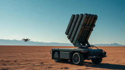
AI Drones Cut Search Times by 90%: Inside the Skydio & LOC8 Revolution
The Coconino County Sheriff's Office is deploying Skydio drones integrated with the LOC8 G2 AI platform to compress thousands of aerial images into just twenty actionable leads per search mission. This breakthrough in real-time AI-powered photogrammetry is not just a public safety milestone; it is a direct signal for commercial operators and defense contractors about the future of automated aerial intelligence. For Part 107 pilots and fleet managers, the implications are stark: the era of manual image review is ending, and the demand for AI-capable, second-hand drone platforms is about to spike. Failure to adapt to this new standard of autonomous data processing could render existing workflows obsolete.

Redakční poznámky
- Tento článek kombinuje konkrétní externí zprávy s vlastní analýzou Reboot Hub pro kupce dronů, provozovatele flotil, zákazníky servisů a sledovatele trhu s repasovanými zařízeními DJI.
- Fakta ze zdrojů jsou oddělena od interpretace. Pokud zpráva poskytuje omezená data, článek tuto omezenost uvádí a prezentuje pohled Reboot Hub jako analýzu.
- Reboot Hub má komerční vazby na produkty a servisní služby pro drony; tyto odkazy jsou zdroji pro čtenáře a neurčují závěr článku.
The Coconino County Sheriff's Office in Flagstaff, Arizona, has announced a paradigm shift in aerial search and rescue (SAR) operations, leveraging a cutting-edge integration of Skydio drones and the LOC8 G2 AI image-analysis platform. As of today, May 25, 2026, the agency reports that this new AI pipeline compresses the post-mission review of thousands of drone-captured images down to a mere twenty high-probability targets per operation, effectively slashing data processing time by over 90%. This is not a minor efficiency gain; it is a fundamental re-engineering of the search loop, transforming hours of human-intensive labor into a matter of minutes of automated analysis.
This deployment in Northern Arizona represents a critical case study for the commercial and defense drone sectors. By fusing Skydio's autonomous flight capabilities with the LOC8 G2's AI-driven object detection, the Sheriff's Office is demonstrating a blueprint for next-generation aerial intelligence. The implications extend far beyond locating lost hikers in the San Francisco Peaks. This technology directly addresses the single greatest bottleneck in modern drone operations: the sheer volume of data generated by high-resolution sensors and the time required to extract actionable intelligence from it.

The AI-Driven Search Loop: From Thousands of Images to Twenty Leads
The core of this breakthrough lies in the LOC8 G2 platform, developed by a company called LOC8 (based in the United Kingdom but working closely with Coconino County to build environment-specific AI models). The system is designed to ingest the full image set from a Skydio drone-often thousands of individual frames from a single search grid-and run them through a neural network trained to identify human subjects, vehicles, and other objects of interest against the complex background of a high-altitude forest ecosystem. The output is a curated set of images, typically around twenty, that have the highest probability of containing the missing person.
Fleet readiness
Keep DJI hardware available without overbuying new units.
Use this news as a planning signal for inspected DJI aircraft, repair support, and trade-in timing.
The operational impact is staggering. Previously, a search coordinator might have to manually scroll through 3,000 images looking for a single pixelated figure. Now, the AI does the heavy lifting, flagging potential finds with a confidence score. This allows ground teams to move directly to the most promising grid squares, saving critical hours when a subject might be suffering from hypothermia or injury. The Coconino County Sheriff's Office has been a proving ground for this technology, and the results are now being shared as a benchmark for public safety drone programs across the United States.

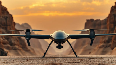
This integration is also a significant win for Skydio, which has positioned its drones as the premier platform for autonomous, AI-enabled operations. The Skydio X10 and other enterprise models offer the onboard computing power and open API necessary to run third-party AI payloads like the LOC8 G2. This is a stark contrast to many consumer-grade drones, where the processing must happen in the cloud post-flight, introducing latency. The ability to run AI inference on the edge-directly on the drone or on a connected ground station-is a key differentiator for high-stakes missions.

Ready to Upgrade Your Fleet?
Browse our collection of inspected pre-owned DJI drones - inspected, flight-tested, and backed by a 6-month warranty. Save up to 40% versus retail.
What Does This Mean for Commercial Operators and Part 107 Pilots?
Ready to Upgrade Your Fleet?
Browse our collection of inspected pre-owned DJI drones - inspected, flight-tested, and backed by a 6-month warranty. Save up to 40% versus retail.
The LOC8 G2 and Skydio integration is a direct signal to the broader drone industry. For commercial operators conducting infrastructure inspection, precision agriculture, or construction site monitoring, the core problem is identical to the Sheriff's Office: too much data, not enough time to analyze it. A single 20-minute flight over a power line corridor or a solar farm can generate thousands of high-resolution images. Manually reviewing these for defects, thermal anomalies, or structural cracks is a labor-intensive process that often leads to pilot fatigue and missed detections.
This announcement validates that AI-driven image analysis is no longer a futuristic concept but a deployable, operational necessity. For the average Part 107 pilot, the takeaway is clear: the value of a drone is no longer just about the quality of the camera or the stability of the flight. The true value is shifting to the data processing pipeline. Pilots and firms that can offer a complete solution-autonomous flight plus AI-powered analysis-will command a significant premium over those who simply deliver raw footage. This is forcing a rapid evolution in the skill set required to be a successful commercial operator.
Furthermore, this news has immediate implications for the used drone market. As agencies and companies rush to upgrade their fleets to AI-capable platforms like the Skydio X10 or the latest DJI Mavic 3 Enterprise with third-party payload integration, a wave of older, non-autonomous drones will enter the secondary market. This presents a unique opportunity for budget-conscious operators. A high-quality, pre-owned DJI drones from a previous generation can still be an incredibly powerful tool for many inspection and mapping tasks, especially when paired with a cloud-based AI service. The key is to understand the total cost of ownership, including the data processing software.
The Technical Architecture: Edge AI and Custom Models
The success of the Coconino County deployment hinges on two technical pillars: edge AI processing and custom model training. The LOC8 G2 platform is designed to run its inference engine directly on the drone's onboard computer or a connected ground station, minimizing latency. This is critical for SAR, where a delay of even a few seconds can mean the difference between life and death. The system can flag a potential find in real-time, allowing the pilot to immediately adjust the flight path for a closer look, rather than discovering the lead hours later during post-flight review.
The second pillar is the use of environment-specific AI models. The Coconino County Sheriff's Office is working with LOC8 to train custom neural networks on the specific visual characteristics of Northern Arizona-the Ponderosa pine forests, the volcanic geology of the San Francisco Peaks, and the high desert scrublands. A generic model trained on urban or coastal environments would perform poorly here. This bespoke approach is a powerful precedent. It suggests that the future of drone AI will not be a single, monolithic solution, but a marketplace of specialized models for different verticals: a model for power line inspection in the Pacific Northwest, another for construction site monitoring in Texas, and another for agricultural crop health in the Midwest.
For operators considering this technology, the path forward involves understanding the specific requirements of their use case. Can the drone's onboard computer handle the AI payload? Does the software integrate with existing flight planning tools like DJI Pilot or Skydio Cloud? What is the cost per flight hour for the AI analysis service? These are the questions that will define the next wave of drone procurement. The Coconino County case study proves that the technology works. The commercial challenge is now to make it accessible and cost-effective for the broader market.
Market Trends and the Second-Hand Drone Opportunity
The rapid push toward AI-capable drones is creating a bifurcation in the market. On one side, there is a premium tier of new drones like the Skydio X10 and the DJI Matrice 350 RTK, which are purpose-built for AI integration and come with a correspondingly high price tag. On the other side, there is a growing pool of highly capable, slightly older drones that are being traded in or sold off as organizations upgrade. This is where the savvy commercial operator can find exceptional value.
A DJI Mavic 3 Enterprise from 2023, for example, still has an excellent camera, a 45-minute flight time, and RTK capability for precision mapping. While it may not have the onboard AI processing power of a Skydio X10, it can still be used to capture the raw data that can then be uploaded to a cloud-based AI service. The key is to bridge the gap between hardware and software. For many small and medium-sized enterprises, investing in a professional DJI repair services to maintain a fleet of inspected pre-owned drones is a far more capital-efficient strategy than buying pre-owned top-tier equipment. The margin between a $2,000 refurbished drone and a $15,000 new drone can be reinvested directly into the AI software subscription that makes the data valuable.
This news from Coconino County should accelerate this trend. As more public safety agencies and large enterprises adopt AI-first workflows, the demand for used, non-AI drones will soften, creating a buyer's market. For the commercial operator, this is the moment to acquire high-quality hardware at a discount and pair it with the right software stack. The drone itself is becoming a commodity; the intelligence is the new differentiator.
Frequently Asked Questions
How does the LOC8 G2 platform work with the Skydio drone?
The LOC8 G2 is an AI image-analysis platform that integrates with Skydio's enterprise drones. It ingests the full set of images captured during a flight and uses a neural network trained to detect humans, vehicles, or other objects of interest. It then outputs a curated set of high-probability images, typically around twenty per mission, drastically reducing the time needed for manual review. The system can run on the edge, providing real-time alerts during the flight.
What does this mean for commercial drone operators using DJI drones?
This development signals that AI-powered data processing is becoming a standard requirement for competitive commercial operations. While the Skydio-LOC8 integration is a specific example, the principle applies broadly. Commercial operators using DJI drones can achieve similar efficiencies by using cloud-based AI services (like those from Pix4D, DroneDeploy, or specialized inspection platforms) to analyze their data. The news reinforces the need to invest in software as much as hardware.
Where can I find reliable, refurbishment-labeled drones to upgrade my fleet?
Reboot Hub specializes in the sale of inspected pre-owned drones, including high-demand models from DJI. Every drone undergoes a rigorous inspection, flight test, and comes with a 6-month warranty. This allows operators to access professional-grade hardware at a significant discount, freeing up budget for AI software and other operational needs. Visit reboot-hub.com/collections/refurbished-drones to browse the current inventory.
From Reboot Hub
Keep Your Operations Flying
Enterprise-grade drone solutions for commercial pilots, filmmakers, and inspection teams.
Pre-owned Fleet
Fully inspected DJI drones with 6-month warranty. Save up to 40%.
Browse Inventory ->