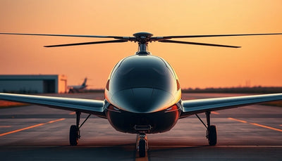
Ouster and Seneca pair lidar with wildfire response drones
Ouster and Seneca are collaborating to give autonomous wildfire-response drones sharper 3D vision in smoke and shifting terrain. The partnership signals growing demand for sensor redundancy on commercial aircraft operating in degraded visual conditions, with implications for fleet planning, maintenance, and resale value.

Quick answer
Ouster and Seneca are teaming up to give autonomous wildfire-response drones better 3D vision for navigating smoke, changing terrain, and heavy payload conditions.
- Ouster and Seneca are collaborating on lidar-equipped wildfire response drones
- The goal is sharper 3D vision in smoke, shifting terrain, and heavy-load flight
- The development points to rising demand for sensor redundancy on commercial drone fleets
- Operators should monitor how sensor upgrades affect maintenance, repair, and resale planning
Evidence: DroneDJ
Market context
Turn market news into a buy, repair, or trade-in decision.
Compare pre-owned availability, resale timing, and repair economics before the market moves again.

Verified facts
What the available evidence confirms
| Factor | Why it matters for wildfire drone operations |
|---|---|
| Smoke and obscured cameras | Lidar adds depth perception when visual cameras struggle |
| Changing terrain | Autonomous navigation needs reliable 3D mapping under dynamic conditions |
| Heavy payloads | Sensor confidence reduces risk when flight margins are tight |
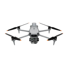
Wildfire response remains one of the hardest operational environments for autonomous drones. Smoke can blind visual cameras, terrain shifts as fire moves through a landscape, and an aircraft carrying water, retardant, or sensor payloads has very little room for navigation error. That operational reality is the backdrop for a new collaboration between Ouster and Seneca, reported by DroneDJ on October 2, 2026, aimed at giving autonomous wildfire-response drones a clearer three-dimensional picture of the world around them.
According to the DroneDJ report, the two companies are working together to integrate lidar sensing into wildfire drone platforms. The central idea is straightforward: when cameras are degraded by smoke or low light, lidar can still measure distance and shape, helping the aircraft understand its surroundings and maintain safe flight. For commercial operators who already fly in industrial, agricultural, or emergency-response roles, the announcement is a useful signal about where sensor technology is heading and what it may mean for fleet planning, maintenance, and the value of older airframes.
Why wildfire missions push drone sensors to their limits
The DroneDJ report highlights three specific pressures that make wildfire operations difficult for autonomous aircraft. First, smoke can obscure cameras, removing the visual reference points that many navigation systems rely on. Second, terrain can change quickly as fire alters vegetation, slopes, and obstacles. Third, a drone carrying a heavy load has less margin for error, meaning a navigation mistake that might be recoverable on a light inspection flight becomes far more serious during a payload mission.
Those pressures explain why lidar is attractive in this context. Lidar emits light pulses and measures their return time, building a three-dimensional map of nearby surfaces. Unlike a passive camera, it does not depend on ambient light or clear air to the same degree. For a fleet manager or procurement lead, the practical takeaway is that sensor redundancy is becoming a purchasing consideration, not just a research topic. An aircraft that can cross-check visual data against lidar returns is better positioned for degraded-visibility work than one that relies on cameras alone.
What the Ouster and Seneca collaboration signals
Ouster is known for digital lidar sensors used across industrial automation, robotics, and autonomous vehicle applications. Seneca, as described in the DroneDJ report, is working with Ouster to bring that sensing capability to autonomous wildfire-response drones. The collaboration is not framed as a single product launch with published specifications; rather, it is a technology partnership aimed at solving a specific operational problem.
Reboot Hub analysis: For commercial drone buyers, that distinction matters. A partnership announcement does not mean a finished, purchasable platform is available tomorrow. It means the sensor stack for high-risk autonomous missions is evolving, and operators should treat lidar integration as a near-term trend rather than a distant concept. Reboot Hub analysis suggests that the companies most likely to benefit first are enterprise fleets and specialist operators who already fly in smoke, dust, or low-visibility conditions, since those are the users who can justify the added sensor cost and integration effort.
What this means for drone owners and the market
The wildfire lidar development has implications that extend beyond emergency response. As sensor packages become more capable, the definition of a mission-ready commercial drone shifts. Buyers evaluating pre-owned DJI drones or other used enterprise airframes should pay closer attention to sensor compatibility and upgrade paths, because an aircraft that cannot host a modern sensor stack may lose operational relevance faster than its airframe hours alone would suggest. For operators who already own fleets, the question becomes whether existing platforms can accept lidar or other redundant sensing without a full replacement cycle.
Repair and maintenance planning also enters the picture. More sensors mean more components that can fail, need calibration, or require replacement after a hard landing or heat exposure. A drone that returns from a wildfire mission may need its lidar unit inspected alongside its gimbal, motors, and battery system. Fleet managers who understand the full sensor stack are better positioned to budget for maintenance and source genuine OEM spare parts before a failure grounds a high-value aircraft. For readers tracking the commercial drone ecosystem, the Drone Wiki offers a useful reference point for understanding how airframes, sensors, and repair considerations fit together as the market matures. For owners evaluating service and lifecycle risk, Drone Wiki explains the relevant repair, parts, resale, or operational path.
There is also a resale angle. In the pre-owned DJI market, aircraft that are compatible with modern sensing payloads tend to hold value better than closed platforms. If lidar-equipped wildfire drones become more common, the secondary market may start to differentiate between airframes based on sensor readiness, not just flight hours or cosmetic condition. Buyers who plan to resell in two or three years should consider whether the platform they purchase today can support the sensor upgrades that may be standard by then.
What operators should watch next
The most important near-term signal is whether Ouster and Seneca move from collaboration to a deployed, purchasable configuration. The DroneDJ report does not specify pricing, availability, or integration timelines, so operators should avoid treating the announcement as a procurement trigger. Instead, the practical response is to monitor how lidar integration affects real wildfire deployments and whether the technology migrates into adjacent use cases such as search and rescue, infrastructure inspection, or agricultural surveying.
For a buyer, pilot, or fleet manager, the immediate action is not to purchase anything new. It is to audit current platforms for sensor flexibility, review maintenance budgets for multi-sensor inspection costs, and watch whether lidar becomes a standard option on the next generation of enterprise airframes. The wildfire mission may be the proving ground, but the commercial ripple effects will likely reach far beyond the fire line.
FAQ
Frequently asked questions
What did Ouster and Seneca announce?
According to DroneDJ, Ouster and Seneca are teaming up to give autonomous wildfire-response drones better 3D vision, specifically to help them navigate smoke, changing terrain, and heavy payload conditions more safely.
Why is lidar useful for wildfire drones?
Lidar can measure distance and shape even when smoke or low light degrades visual cameras, giving the drone a more reliable understanding of its surroundings during high-risk autonomous flight.
Should commercial drone operators buy new equipment because of this news?
Not yet. The DroneDJ report describes a technology collaboration, not a finished product with pricing or availability. Operators should monitor the development and review whether their current fleets can support future sensor upgrades.
Which sources support this update?
The visible evidence links identify DroneDJ; each source is used only for the claim it directly supports.
What remains subject to change?
Retail pricing, availability, product bundles and regulatory timelines can change. Readers should verify the latest terms with the named retailer, manufacturer or regulator before acting.
How should buyers or operators use this analysis?
Use the verified facts as a starting point, then compare mission fit, lifecycle support, maintenance needs and current procurement terms before making a purchase or fleet decision.
تمت استشارة المصادر
- DroneDJ - primary source
ولم تكن الوثائق الرسمية الإضافية متاحة في وقت النشر.
تضيف افتتاحية Reboot Hub المشتري والإصلاح وإعادة البيع والتحليل التشغيلي لأصحاب الطائرات بدون طيار. إذا اكتشفت خطأ، فاتصل بنا لمراجعة التصحيح من خلال سياستنا التحريرية.