FAU AI Model Identifies Arctic Belugas From Just 34 DJI Drone Images
Florida Atlantic University researchers trained an AI model to spot Arctic beluga whales using only 34 labeled DJI drone images. The work points to faster, lower-cost wildlife monitoring for commercial drone operators and conservation fleets.

Quick answer
Florida Atlantic University researchers trained an AI model to detect Arctic beluga whales after labeling only 34 DJI drone images, according to a DroneXL report.
- The model identified belugas from a very small labeled dataset of 34 DJI drone images.
- The research suggests lower-cost AI training for wildlife and environmental monitoring.
- Commercial drone operators may need fewer labeled images to build useful detection models.
- The work highlights DJI platforms as practical tools for Arctic and marine survey missions.
Florida Atlantic University researchers have demonstrated that an AI model can identify Arctic beluga whales after being trained on just 34 labeled DJI drone images, according to a report published by DroneXL and surfaced through Google News DJI. The finding matters because wildlife and environmental monitoring has traditionally demanded large, expensive labeled datasets before machine learning systems become reliable enough for field use.
Market context
Turn market news into a buy, repair, or trade-in decision.
Compare pre-owned availability, resale timing, and repair economics before the market moves again.

The report describes a leaner path: a small set of drone-captured images, carefully labeled, was enough to teach the model to spot belugas in challenging Arctic water conditions. For commercial operators, conservation groups, and research fleets that already fly DJI platforms, the development suggests that practical AI-assisted survey work may be closer and cheaper than previously assumed.
What the FAU research actually shows
According to the DroneXL report, the FAU team worked with a strikingly small training set of 34 labeled DJI drone images. That is a fraction of the thousands or tens of thousands of labeled examples that many computer vision projects rely on. The model was still able to detect beluga whales in the imagery, a result that points to efficient transfer learning or a tightly scoped detection task rather than a broad, general-purpose recognition system.
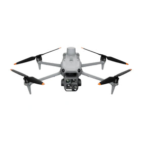
The source does not specify which DJI model captured the images, nor does it detail sensor resolution, flight altitude, or environmental conditions. Reboot Hub analysis should therefore treat the operational specifics as open questions. What is clear is that a DJI platform produced the source imagery, and that the academic team considered the output sufficient for a peer-visible detection result.
For drone operators, the practical takeaway is not that any 34 images will work. It is that well-chosen, consistently labeled aerial imagery can sometimes substitute for massive data collection efforts. That has real cost implications for small research teams and commercial survey providers who cannot afford to annotate tens of thousands of frames before deploying a detection tool.
Why small datasets change the economics of drone monitoring
Labeled data is one of the hidden costs in commercial drone analytics. A fleet operator who wants to count wildlife, inspect infrastructure, or monitor coastal conditions typically pays either for annotation labor or for third-party software trained on datasets they do not control. The FAU result, as reported by DroneXL, suggests that a focused detection problem can be bootstrapped with a modest image library when the target species or object is visually distinct.
Belugas are a useful test case because their white bodies contrast against dark Arctic water, though sea ice, glare, and surface chop can complicate detection. The fact that the model performed well enough to be reported after only 34 labeled images indicates that the visual signal was strong and the labeling was precise. Commercial teams working on similarly high-contrast targets may see faster model development cycles than they expected.
There is also a maintenance and repair angle. Operators who run repeated survey missions in remote Arctic or marine environments face higher wear on airframes, batteries, and gimbal systems. If fewer flights are needed to gather a usable training set, the cumulative stress on hardware drops. That can extend service intervals and reduce the volume of genuine OEM spare parts required over a season.
What this means for drone owners and the market
The FAU demonstration reinforces a broader market shift toward AI-assisted aerial survey work on commercially available platforms. DJI drones are already common in conservation, marine research, and environmental consulting because they offer predictable flight behavior and accessible camera systems. A published result showing useful AI detection from a small DJI image set strengthens the case for buying or retaining capable airframes rather than waiting for specialized, high-cost sensor packages.
For pre-owned DJI drone buyers, this kind of news has a subtle but real effect. Research teams and small survey firms often operate on tight budgets. When a study shows that a standard DJI camera platform can support meaningful AI training, demand for inspected pre-owned DJI drones may hold steady among cost-conscious operators who need reliable imaging without paying new-unit premiums. Readers evaluating the second-hand market can consult the Drone Wiki for guidance on platform selection and ownership considerations. For owners evaluating service and lifecycle risk, Drone Wiki explains the relevant repair, parts, resale, or operational path.
Fleet managers should also think about data governance. A model trained on 34 images is not a finished commercial product. Operators who adopt similar methods will still need to validate detection accuracy across seasons, lighting conditions, and locations. The FAU result is a proof point, not a procurement specification. Buyers should avoid assuming that any small dataset will produce field-ready performance without independent testing.
What operators should watch next
The most important follow-up questions are not answered by the source. Which DJI airframe was used? What altitude and camera settings produced the training images? How did the model perform on unseen data, and what was the false positive rate in cluttered ice conditions? Until those details are published, commercial operators should treat the FAU result as an encouraging signal rather than a replicable workflow.
Still, the direction is clear. Drone-based wildlife monitoring is becoming more data-efficient, and DJI hardware is frequently the platform underneath the research. Operators who already fly DJI aircraft for survey work may want to begin archiving well-labeled mission imagery now. A small, well-organized library of annotated frames could become the foundation for a custom detection model later, especially as AI tooling becomes more accessible to non-specialist teams.
For repair and maintenance planning, the implication is modest but worth noting. If fewer flights and smaller datasets can produce useful analytical models, some operators may shift from high-volume data collection to targeted, lower-frequency missions. That changes wear patterns and may influence when batteries, gimbal assemblies, and landing gear need inspection or replacement. Conservative fleet planning should still assume Arctic and marine environments accelerate corrosion and component fatigue regardless of mission count.
FAQ
Frequently asked questions
Did FAU use a specific DJI drone model for the beluga research?
The DroneXL report does not name a specific DJI model. It confirms that the labeled images came from DJI drone footage, but airframe, camera, and flight parameters were not disclosed in the source.
Can commercial operators train AI with only 34 labeled images?
Not universally. The FAU result shows that a focused detection task with a visually distinct target can work with a small labeled set. Operators should validate any model on their own mission conditions before relying on it for commercial decisions.
Does this research affect the pre-owned DJI drone market?
Indirectly, yes. Studies that show standard DJI platforms supporting useful AI work can reinforce demand among budget-conscious research and survey teams, which may support steady interest in inspected pre-owned DJI drones and genuine OEM spare parts.
Which sources support this update?
The article distinguishes reported information from analysis and does not present an unverified source as official confirmation.
What remains subject to change?
Retail pricing, availability, product bundles and regulatory timelines can change. Readers should verify the latest terms with the named retailer, manufacturer or regulator before acting.
How should buyers or operators use this analysis?
Use the verified facts as a starting point, then compare mission fit, lifecycle support, maintenance needs and current procurement terms before making a purchase or fleet decision.
تمت استشارة المصادر
- DroneXL via Google News - primary source
ولم تكن الوثائق الرسمية الإضافية متاحة في وقت النشر.
تضيف افتتاحية Reboot Hub المشتري والإصلاح وإعادة البيع والتحليل التشغيلي لأصحاب الطائرات بدون طيار. إذا اكتشفت خطأ، فاتصل بنا لمراجعة التصحيح من خلال سياستنا التحريرية.