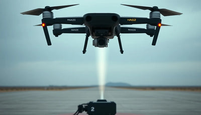
DJI drones map Segovia's Alcázar, the castle said to inspire Disney
Digital Camera World reports that DJI drones recreated the Alcázar of Segovia, the Spanish fortress often linked to Disney castle designs, as an explorable digital model. The project highlights how commercial UAV mapping is moving beyond inspection into heritage documentation and public-facing 3D experiences.

Quick answer
Digital Camera World reported that DJI drones were used to recreate the Alcázar of Segovia, the Spanish castle often associated with Disney castle designs, as a digital model for public exploration.
- The project focused on the Alcázar of Segovia in Spain, a fortress frequently linked to Disney castle inspiration.
- DJI drones were used to capture imagery for a digital reconstruction of the castle.
- The resulting model was made available for exploration, suggesting a public-facing heritage documentation use case.
- The report highlights growing commercial UAV applications in cultural heritage and 3D mapping beyond traditional inspection work.
Digital Camera World has reported that DJI drones were used to recreate the Alcázar of Segovia, the Spanish fortress widely associated with Disney castle designs, as a digital model that viewers can explore. The report, surfaced through Google News DJI coverage, frames the project as a demonstration of how consumer and commercial UAV platforms are being applied to heritage documentation and public engagement work.
DJI buying context
Match product news to hardware you can actually deploy.
Check inspected DJI aircraft, repair support, and trade-in timing before deciding whether to upgrade, repair, or wait.

The Alcázar of Segovia is one of Spain's most recognizable monuments, a medieval castle perched on a rocky crag that has long been cited as an inspiration for Disney's fairy-tale castle imagery. Using DJI drones to capture the structure from multiple angles, the project produced a navigable digital reconstruction of the site. For commercial operators and drone buyers, the report matters less for its tourism appeal than for what it signals about the expanding role of UAV mapping in cultural heritage, architecture, and visual documentation markets.
What the Segovia project actually shows
According to Digital Camera World, the DJI drone deployment at the Alcázar of Segovia was structured around capturing the castle's exterior in sufficient detail to build an explorable digital version. The report does not specify which DJI model or models were used, nor does it detail the software pipeline behind the reconstruction. What it does establish is that a recognizable heritage site was mapped using DJI hardware and that the output was presented as an interactive experience rather than a static inspection dataset.
That distinction is commercially significant. Traditional drone mapping for infrastructure or construction often produces orthomosaics, point clouds, or inspection reports consumed by engineers and project managers. A public-facing 3D model of a castle implies a different workflow: one oriented toward visual fidelity, texture quality, and user navigation. For operators who already fly DJI platforms for surveying or inspection, the Segovia report suggests that heritage and cultural tourism projects may represent an adjacent revenue stream with distinct deliverable expectations.
Reboot Hub analysis: the source is limited in technical detail, so operators should treat the Segovia project as an indicator of market direction rather than a replicable workflow. No flight parameters, sensor specifications, or post-processing methods were disclosed in the available reporting.
Why heritage mapping is becoming a commercial UAV niche
Cultural heritage documentation has quietly become one of the more stable niches for commercial drone work. Castles, cathedrals, archaeological sites, and historic districts often require periodic condition assessment, but they also demand visual documentation that can support tourism, education, and preservation funding applications. A drone can capture facade details, roof conditions, and site context far more efficiently than ground-based photography or scaffolding-based inspection.
The Segovia project, as reported by Digital Camera World, fits this pattern. The Alcázar's dramatic setting on a rocky outcrop makes it difficult to photograph comprehensively from the ground. Aerial capture solves that problem while also producing imagery suitable for 3D reconstruction. For fleet managers and independent operators, the takeaway is that heritage clients may value deliverables that look polished and navigable, not just technically accurate.
That said, operators should not assume that any DJI drone can produce this kind of result without planning. Heritage sites often sit in controlled airspace, near urban centers, or on land with specific access rules. The Segovia report does not address regulatory approvals, flight permissions, or coordination with local authorities. Those operational details remain unknown and should not be inferred.
What this means for drone owners and the market
For drone owners and buyers, the Segovia report reinforces a broader trend: DJI hardware continues to appear in creative and commercial mapping projects beyond the usual construction and agriculture use cases. A pilot who currently flies a DJI Mavic, Air, or Mini series for real estate or inspection work may find that heritage documentation, tourism promotion, and cultural site mapping are accessible entry points into more specialized work. The equipment barrier is often lower than the skill barrier; the differentiator is the ability to plan flights around complex structures and deliver clean, navigable 3D output.
The pre-owned DJI market also feels the ripple effect of these use cases. When operators see new applications like castle mapping gaining visibility, demand for capable used platforms tends to hold steady, particularly for models with strong camera performance and reliable obstacle sensing. Buyers evaluating inspected pre-owned DJI drones for mapping or heritage work should prioritize camera quality, gimbal stability, and flight time over accessory bundles. For repair customers, the implication is straightforward: drones used in heritage and cultural projects often fly close to stone, ironwork, and irregular surfaces, increasing the value of professional DJI repair and genuine OEM spare parts when collisions or wear occur. Operators planning this kind of work can use resources like the Drone Wiki to understand platform capabilities before committing to a purchase or repair decision. For owners evaluating service and lifecycle risk, Drone Wiki explains the relevant repair, parts, resale, or operational path.
What should a buyer or operator do differently after reading this? If heritage mapping or cultural site documentation is a potential service offering, start by assessing whether your current platform can capture the image quality and flight stability these projects require. Then research the regulatory environment for the specific site you want to map. The Segovia project is a useful proof point, but it does not replace local airspace knowledge or client-specific planning.
The limits of the source and what to watch next
The Digital Camera World report is a news brief rather than a technical case study. It names the location, the general tool category, and the outcome, but it does not provide model numbers, flight counts, processing software, accuracy figures, or project duration. For operators who want to replicate the approach, those missing details matter. Without them, the Segovia project is best understood as a signal that DJI drones are being used for visually rich heritage reconstruction, not as a blueprint for a specific workflow.
Looking ahead, the more interesting question is whether heritage institutions begin commissioning drone-based 3D documentation as a standard practice. If museums, tourism boards, and preservation agencies start budgeting for aerial capture on a recurring basis, that would create a more predictable demand stream than one-off projects. The Segovia example, as reported, is a single data point. But it aligns with a pattern of DJI platforms appearing in cultural documentation work across Europe and beyond.
For now, commercial operators should watch for follow-up reporting that includes technical specifications, software names, or regulatory context. Those details will determine whether the Segovia project is an outlier or a template for a growing service category.
FAQ
Frequently asked questions
What did Digital Camera World report about DJI and the Segovia castle?
Digital Camera World reported that DJI drones were used to recreate the Alcázar of Segovia, a Spanish castle often linked to Disney castle designs, as a digital model that people can explore.
Which DJI drone model was used for the Segovia castle project?
The available source does not specify which DJI model or models were used. The report identifies DJI drones generally but omits technical details such as model numbers, sensors, or flight parameters.
Does the Segovia project mean heritage mapping is a viable drone service?
The project suggests that heritage documentation and public-facing 3D reconstruction are emerging use cases for commercial UAV operators, but the source is limited. Operators should treat it as a market signal rather than a proven, replicable service template.
Which sources support this update?
The article distinguishes reported information from analysis and does not present an unverified source as official confirmation.
What remains subject to change?
Retail pricing, availability, product bundles and regulatory timelines can change. Readers should verify the latest terms with the named retailer, manufacturer or regulator before acting.
How should buyers or operators use this analysis?
Use the verified facts as a starting point, then compare mission fit, lifecycle support, maintenance needs and current procurement terms before making a purchase or fleet decision.
تمت استشارة المصادر
- Digital Camera World via Google News - primary source
ولم تكن الوثائق الرسمية الإضافية متاحة في وقت النشر.
تضيف افتتاحية Reboot Hub المشتري والإصلاح وإعادة البيع والتحليل التشغيلي لأصحاب الطائرات بدون طيار. إذا اكتشفت خطأ، فاتصل بنا لمراجعة التصحيح من خلال سياستنا التحريرية.