Blue Marble Pushes Drone Mapping Toward a Unified Geospatial Workflow
Blue Marble is moving its geospatial tools toward an end-to-end workflow that connects drone data, desktop analysis, and field operations. The subscription shift signals where commercial drone mapping software is heading, with practical implications for fleet operators and data service buyers.

Quick answer
Blue Marble is building deeper connections between drone data, desktop analysis, and field operations through a new Global Mapper subscription model.
- Blue Marble announced a new Global Mapper subscription that brings geospatial tools together.
- The company is positioning the move as part of an end-to-end geospatial workflow for drone mapping professionals.
- Drone imagery and lidar still need processing, positioning, analysis, and conversion into usable information.
- The development reflects broader commercial software consolidation around connected field-to-desktop workflows.
Evidence: DRONELIFE
Market context
Turn market news into a buy, repair, or trade-in decision.
Compare pre-owned availability, resale timing, and repair economics before the market moves again.

Blue Marble Geographics is moving its geospatial software portfolio toward a connected, end-to-end workflow that spans drone data collection, desktop processing, and field operations. The shift, reported by DRONELIFE on September 29, 2026, centers on a new Global Mapper subscription offering that bundles geospatial tools into a more unified package for mapping professionals.
For commercial drone operators, the announcement matters less as a single product update and more as a signal of where the drone mapping software market is heading. Drone imagery and lidar are only valuable after they are processed, positioned, analyzed, and converted into information that clients can actually use. Software vendors that reduce friction between those steps are competing for the same operational budgets that fleet managers and surveying teams already allocate across multiple disconnected tools.
The reported development and its source
According to DRONELIFE, Blue Marble is building deeper connections between drone data, desktop analysis, and field operations. The new Global Mapper subscription is presented as a way to bring geospatial tools together rather than leaving operators to stitch workflows across separate applications. The reporting frames this as part of a broader company direction rather than a narrow licensing change.
This is a source-limited report. Reboot Hub has not independently verified the subscription structure, feature set, or commercial terms described in the primary reporting. What is clear from the source is the strategic direction: Blue Marble is positioning itself around workflow continuity, not just desktop software capability. For operators evaluating mapping software, that distinction can shape procurement decisions even before full product details are public.
Why workflow consolidation is becoming a commercial pressure point
Drone mapping has matured beyond the early phase where raw photogrammetry outputs were enough to impress clients. Today, surveyors, infrastructure inspectors, and construction managers expect orthomosaics, point clouds, and elevation models to move cleanly into GIS environments, CAD platforms, and field review tools. Every manual export, format conversion, or software handoff adds labor cost and introduces error risk.
Blue Marble's reported move reflects a broader industry pattern: software providers are trying to own more of the pipeline from drone to deliverable. For fleet operators, this has a practical consequence. A subscription that consolidates processing, analysis, and field access can reduce the number of seats and licenses a team needs to manage. But it can also deepen dependence on a single vendor, which is why procurement teams should evaluate workflow fit before committing to bundled pricing.
What this means for drone owners and the market
For commercial drone owners, the Blue Marble development is a reminder that software costs and workflow efficiency now rival hardware selection as operational differentiators. A mapping drone is only as productive as the pipeline that turns its captures into client-ready outputs. Teams that still run fragmented, manually bridged workflows may find themselves at a cost disadvantage compared to competitors using consolidated platforms.
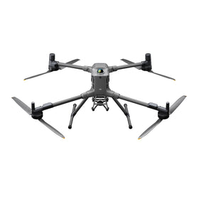
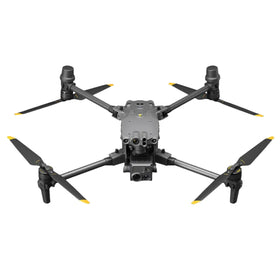
The pre-owned DJI market is indirectly relevant here. Many operators buy inspected pre-owned DJI drones to enter mapping work at a lower hardware cost, but they often underestimate the software and processing burden that follows. A subscription-based geospatial workflow can lower the initial barrier to professional-grade processing, which may make pre-owned mapping platforms more viable for smaller service providers. Buyers evaluating a used Matrice or Phantom for survey work should factor software subscription costs into their total ownership calculation, not just the airframe price. Reboot Hub's Drone Wiki provides background on DJI platforms and ownership considerations for operators building a mapping fleet. For owners evaluating service and lifecycle risk, Drone Wiki explains the relevant repair, parts, resale, or operational path.
For fleet managers, the practical takeaway is to audit how many separate software tools currently sit between drone capture and final deliverable. If the answer is more than two or three, a consolidated subscription may reduce both direct licensing costs and the hidden labor spent on file management and format conversion. That audit should happen before any renewal cycle, because bundled pricing often rewards early commitment.
The operator-facing decision after this announcement
The immediate action for a drone mapping operator is not to switch software overnight. It is to map the current workflow and identify where time and money leak between field capture, desktop processing, and client delivery. Once those friction points are documented, the Blue Marble subscription direction becomes easier to evaluate against existing tools.
Operators should also watch how competitors respond. When one established geospatial vendor moves toward subscription-based workflow consolidation, others typically follow with their own bundling or pricing adjustments. For buyers, that can create negotiation leverage or reveal which vendors are genuinely investing in integration versus simply repackaging existing licenses. The source report does not provide pricing or feature specifics, so Reboot Hub advises treating this as a directional signal rather than a final procurement trigger.
FAQ
Frequently asked questions
What did Blue Marble announce?
According to DRONELIFE, Blue Marble introduced a new Global Mapper subscription as part of a broader effort to connect drone data, desktop analysis, and field operations into an end-to-end geospatial workflow.
Why does this matter for commercial drone operators?
Drone mapping requires processing, positioning, analysis, and conversion before data becomes useful. A consolidated workflow can reduce software handoffs, licensing complexity, and the labor cost of moving files between disconnected tools.
Should drone owners change their software immediately?
No. Operators should first audit their current workflow to identify friction points and total software costs. The Blue Marble move is a market signal worth monitoring, but procurement decisions should wait for verified subscription details and competitive responses.
Which sources support this update?
The visible evidence links identify DRONELIFE; each source is used only for the claim it directly supports.
What remains subject to change?
Retail pricing, availability, product bundles and regulatory timelines can change. Readers should verify the latest terms with the named retailer, manufacturer or regulator before acting.
How should buyers or operators use this analysis?
Use the verified facts as a starting point, then compare mission fit, lifecycle support, maintenance needs and current procurement terms before making a purchase or fleet decision.
تمت استشارة المصادر
- DRONELIFE - primary source
ولم تكن الوثائق الرسمية الإضافية متاحة في وقت النشر.
تضيف افتتاحية Reboot Hub المشتري والإصلاح وإعادة البيع والتحليل التشغيلي لأصحاب الطائرات بدون طيار. إذا اكتشفت خطأ، فاتصل بنا لمراجعة التصحيح من خلال سياستنا التحريرية.