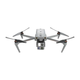
Antigravity A1 Flight Turns Bulgarian Fortress Into 3D Model
A single ten-minute Antigravity A1 flight over Bulgaria's Ovech Fortress produced an explorable 3D Gaussian Splatting model. The project shows how compact camera drones are entering heritage documentation and commercial mapping workflows.

Quick answer
DroneXL.co reported that Mikhail Svilanov used the Antigravity A1 360 drone to capture Ovech Fortress in Bulgaria and converted a single ten-minute flight into an explorable 3D Gaussian Splatting model with Splatica.
- The project, called Project Eternal, documented a 1,000-year-old Bulgarian fortress in 3D from one short flight.
- The workflow used Gaussian Splatting rather than traditional photogrammetry, producing an explorable model.
- The Antigravity A1 360 was the drone platform used for the capture.
- The report appeared on DroneXL.co on August 24, 2026.
Evidence: DroneXL.co
Market context
Turn market news into a buy, repair, or trade-in decision.
Compare pre-owned availability, resale timing, and repair economics before the market moves again.

A heritage documentation project in Bulgaria has given commercial drone operators a concrete look at how compact camera platforms are being pushed into 3D capture workflows that were once reserved for specialized mapping rigs. According to a report published by DroneXL.co, Mikhail Svilanov flew the Antigravity A1 360 drone over Ovech Fortress and converted a single ten-minute flight into an explorable 3D Gaussian Splatting model using Splatica.
The project, called Project Eternal, focused on preserving a 1,000-year-old fortress in digital form. Rather than relying on traditional photogrammetry pipelines that require extensive image overlap and heavy processing, the workflow used Gaussian Splatting to generate a navigable 3D scene from a short capture window. For commercial operators watching the mapping and inspection segments, the report offers an early signal of how newer capture-to-model approaches are lowering the barrier to entry for 3D documentation work.
What the Ovech Fortress project actually shows
DroneXL.co's reporting frames the Ovech Fortress flight as a demonstration of efficiency rather than a large-scale survey operation. The entire capture took roughly ten minutes, and the resulting model was described as explorable in 3D, meaning a viewer can move through the scene rather than simply inspecting a static orthomosaic or point cloud. That distinction matters commercially because explorable models are increasingly used in client presentations, heritage documentation, and preliminary site assessments.
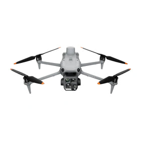
The Antigravity A1 360 platform is central to the story. While the source does not provide detailed technical specifications for the drone, the project name and the 360 designation suggest a capture approach oriented toward spherical or wide-field imagery. Operators who have worked with 360-degree camera payloads know that this type of capture can reduce the number of flight passes needed to cover a structure, which is a meaningful operational advantage when documenting complex vertical surfaces like fortress walls, towers, and cliffside fortifications.
Gaussian Splatting itself is the other half of the equation. Unlike conventional photogrammetry, which reconstructs geometry from matched image features, Gaussian Splatting renders scenes as collections of splats that can produce visually rich, fast-loading 3D environments. The source does not detail processing times or hardware requirements, but the fact that a single short flight produced a usable model suggests that the processing side of the workflow is becoming more accessible to independent operators and small studios.
Why heritage documentation is becoming a commercial signal
Heritage and cultural preservation projects rarely generate the same revenue volume as infrastructure inspection or construction monitoring, but they serve as useful proving grounds for new capture techniques. The Ovech Fortress project demonstrates that a single operator with a compact drone can produce a deliverable that would previously have required a larger team, specialized equipment, or significantly more flight time.
For commercial operators, this type of case study has practical value. It suggests that 3D documentation work is expanding beyond the traditional enterprise drone segments and into markets where budgets are tighter and turnaround expectations are shorter. Municipalities, tourism boards, archaeological teams, and cultural institutions often need visual documentation but cannot justify the cost of a full photogrammetry campaign. A workflow that produces an explorable model from one short flight changes that calculus.
Reboot Hub analysis: the broader implication is that compact camera drones with 360 capture capability may become more attractive to operators who want to offer 3D documentation as a secondary service without investing in dedicated mapping payloads. The source does not provide pricing, availability, or commercial terms for the Antigravity A1, so procurement decisions should be based on verified specifications from the manufacturer rather than this single project report.
What this means for drone owners and the market
The Ovech Fortress project points to a gradual shift in how 3D capture is positioned in the commercial drone market. For years, mapping and modeling have been associated with RTK-equipped platforms, high-overlap flight planning, and desktop processing workstations. The DroneXL.co report suggests that a lighter-touch approach, built around short flights and Gaussian Splatting, is now producing results that are visually compelling enough to share publicly.
For drone owners, the practical takeaway is that capture efficiency is becoming a differentiator. A platform that can gather enough visual data in ten minutes to support a 3D model reduces time on site, battery consumption, and post-flight sorting. Those factors directly affect operating costs, especially for small operators who handle multiple jobs per week. Buyers evaluating new hardware should pay attention to how a drone's camera configuration supports fast, wide-field capture rather than focusing only on raw resolution or flight time.
For fleet managers and repair-conscious operators, the case study also reinforces the value of keeping camera payloads in good condition. Gaussian Splatting and similar rendering techniques are sensitive to image quality, and a scratched lens, misaligned gimbal, or degraded sensor can undermine the entire capture. Operators who rely on 3D documentation workflows should treat camera inspection and calibration as part of routine maintenance rather than an afterthought. When hardware needs service, using genuine OEM spare parts and professional DJI repair channels helps preserve the image consistency that these workflows depend on. For guidance on maintaining camera drones and understanding repair options, Reboot Hub maintains a Drone Wiki covering practical ownership topics. For owners evaluating service and lifecycle risk, Drone Wiki explains the relevant repair, parts, resale, or operational path.
The pre-owned market may also feel a subtle effect. As compact 360-capable platforms prove themselves in documentation workflows, older camera drones that can capture spherical imagery may hold resale value better than models limited to standard gimbal perspectives. Pre-owned DJI drones with strong camera performance remain relevant for operators who want to experiment with Gaussian Splatting workflows before committing to newer hardware. The key is verifying camera condition and sensor health before purchase, since rendering pipelines amplify any optical flaws.
What operators should watch next
The Ovech Fortress project is one data point, not a market-defining event. DroneXL.co's report does not include processing benchmarks, model accuracy figures, or comparisons against photogrammetry outputs, so operators should treat the workflow as promising rather than proven across commercial use cases. The source also does not specify whether the Antigravity A1 is available for general purchase or what the platform costs.
What operators should watch is whether Gaussian Splatting workflows begin appearing in client requests. If architecture firms, property managers, or cultural institutions start asking for explorable 3D models instead of traditional orthomosaics, that shift will create demand for drones and operators who can deliver the right capture style. The Ovech Fortress example suggests that the capture side can be remarkably short, which means the competitive advantage will come from knowing how to plan the flight, process the data, and present the model effectively.
Reboot Hub analysis: For now, the most sensible response is to treat this as an early indicator of workflow evolution. Operators who already own capable camera drones can experiment with 3D capture on small projects without major new investment. Buyers evaluating their next platform should consider whether 360 capture capability aligns with the types of documentation jobs they want to pursue. And everyone should keep an eye on processing software developments, because the bottleneck in this emerging segment is likely to be on the software side rather than the drone itself.
FAQ
Frequently asked questions
What drone was used to capture Ovech Fortress in 3D?
According to DroneXL.co, Mikhail Svilanov used the Antigravity A1 360 drone to capture Ovech Fortress in Bulgaria. The entire flight took approximately ten minutes.
What is Gaussian Splatting in drone mapping?
Gaussian Splatting is a rendering technique that creates explorable 3D scenes from captured imagery. In the Ovech Fortress project, it was used with Splatica software to turn a single short drone flight into a navigable 3D model.
Why does this matter for commercial drone operators?
The project shows that compact camera drones can produce usable 3D documentation from very short flights, which may lower the cost and time required for heritage, tourism, and small-scale mapping work. Operators should watch whether client demand shifts toward explorable 3D models rather than traditional photogrammetry outputs.
Which sources support this update?
The visible evidence links identify DroneXL.co; each source is used only for the claim it directly supports.
What remains subject to change?
Retail pricing, availability, product bundles and regulatory timelines can change. Readers should verify the latest terms with the named retailer, manufacturer or regulator before acting.
How should buyers or operators use this analysis?
Use the verified facts as a starting point, then compare mission fit, lifecycle support, maintenance needs and current procurement terms before making a purchase or fleet decision.
تمت استشارة المصادر
- DroneXL.co - primary source
ولم تكن الوثائق الرسمية الإضافية متاحة في وقت النشر.
تضيف افتتاحية Reboot Hub المشتري والإصلاح وإعادة البيع والتحليل التشغيلي لأصحاب الطائرات بدون طيار. إذا اكتشفت خطأ، فاتصل بنا لمراجعة التصحيح من خلال سياستنا التحريرية.