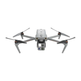
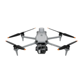
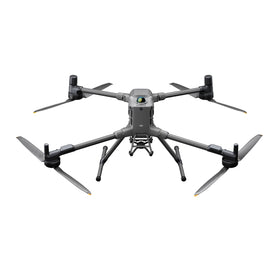
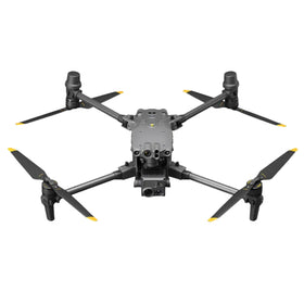
GeoComm and SkyfireAI Link 911 Data to DFR Drone Launch
GeoComm and SkyfireAI are connecting 911 location data directly to autonomous drone launch for Drone as First Responder programs. The integration gives public safety teams faster, more complete routing intelligence before takeoff.

GeoComm and SkyfireAI have announced a new integration designed to strengthen Drone as First Responder (DFR) programs by connecting 911 location intelligence directly to autonomous drone dispatch. The partnership combines GeoComm's DFR Routing technology with SkyfireAI's autonomous drone platform, giving public safety agencies a more complete picture of an emergency before an aircraft leaves the launch pad. The announcement, reported by DRONELIFE on July 31, 2026, signals a tightening link between traditional emergency call infrastructure and drone response operations.
For fleet operators and public safety buyers, the practical value is not in the hardware itself but in the data flow around it. DFR programs have matured to the point where the limiting factor is often response coordination, not aircraft capability. By routing 911 data into the launch decision process, this integration aims to reduce the gap between a call coming in and a drone being wheels-up with relevant location context already loaded.
What the GeoComm and SkyfireAI integration actually changes
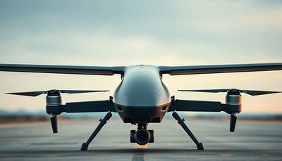
The core of the announcement is straightforward: GeoComm's DFR Routing technology is being integrated with SkyfireAI's autonomous drone platform. In operational terms, that means a public safety dispatch system can hand off location data and call intelligence directly to the drone platform that manages DFR aircraft. The intent is to give first responders more complete location intelligence before the drone launches.
Industrial drone procurement
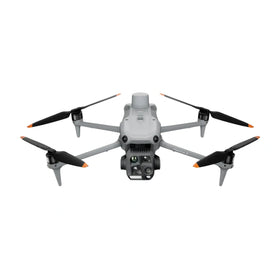
Source a brand-new industrial drone for this mission.
Discuss mission fit, aircraft model, quantities, configuration, pickup, and lifecycle support with Reboot Hub.

This is a meaningful shift from older DFR workflows where a human pilot or visual observer would manually receive a location, input coordinates into a flight app, and then initiate a response. Automating that handoff reduces cognitive load during high-stress incidents and shortens the time between a 911 call and an aerial view of the scene. For a DFR program operating across a city or county, that difference can matter in minutes, which are often decisive in emergency response.
The integration also points to a broader trend: drone response is becoming less about piloting skill in the moment and more about system design. The aircraft still needs to be maintained, configured, and launched correctly, but the competitive edge for agencies is increasingly in software that turns raw 911 data into actionable flight intelligence.
What this means for enterprise operators
For commercial and public safety operators evaluating new drone procurement, this announcement is a reminder that mission fit now includes the data ecosystem around the aircraft. The capability described here is not tied to a specific airframe in the source data, which means agencies and operators should be asking platform-agnostic questions: Does the DFR software we use accept data from our existing dispatch system? Can our current fleet be integrated, or is a new aircraft required to take advantage of these routing improvements?
That distinction matters for fleet planning. If your agency already fields a DFR aircraft that performs well, the integration described by GeoComm and SkyfireAI may be achievable through a software update rather than a hardware replacement. In that case, brand-new industrial drone procurement is a practical next step only when mission requirements have truly outgrown the current airframe, such as needing longer endurance, heavier sensor payloads, or more robust weather tolerance. When those conditions exist, the procurement decision should be driven by mission fit and lifecycle support, not by the availability of new dispatch integration features.
For operators who do decide to upgrade, the resale value of existing DFR aircraft becomes part of the economic equation. Public safety agencies often replace equipment on a scheduled cycle, and well-maintained drones with documented flight logs hold value on the secondary market. That creates a planning lever: trade in current platforms before major maintenance expenses arrive, or hold them longer if the software ecosystem continues to support their mission. The drone trade-in guide can help agencies model that timing against expected lifecycle costs.
Maintenance and downtime also deserve attention. An autonomous DFR platform still depends on airframes that are mechanically sound and sensors that are properly calibrated. Agencies adopting integrations like this should ensure their repair strategy can keep aircraft available during peak call volumes. Basing procurement on average fleet readiness rather than peak demand can leave DFR programs short during the exact incidents that justify the program. Understanding when an airframe needs professional servicing versus when it can be returned to service after minor inspection is a core part of that readiness calculation. For teams translating this development into public-safety mission and fleet requirements, Reboot Hub's B2B drone procurement service can help scope configuration, fleet quantity, maintenance planning, and lifecycle support before a quotation.
Market implications for the pre-owned DJI drone segment
Integrations between dispatch software and drone platforms do not directly involve DJI hardware in the source data, but the market effect is still relevant. Public safety agencies frequently operate DJI aircraft in DFR programs, and software compatibility often influences fleet refresh cycles. When an agency adopts a new routing integration, the question of which aircraft are officially supported can accelerate or delay hardware replacement decisions.
That dynamic affects the pre-owned market. Agencies that transition to new platforms may release well-documented, low-cycle aircraft onto the secondary market. Buyers evaluating pre-owned DJI drones should look for units with clear maintenance records and verified flight hours, particularly if the aircraft will be used for public safety or enterprise work where reliability is non-negotiable. The presence of fleet operators selling older DFR units can create procurement opportunities for organizations that need capable aircraft at lower capital cost, but due diligence on airframe condition becomes even more important when the aircraft has seen operational use.
For repair customers, the takeaway is that software upgrades do not eliminate hardware maintenance. A DFR drone launched autonomously still needs routine inspection, battery health management, and occasional component replacement. The growing sophistication of dispatch integration raises the cost of downtime, which means operators should prioritize access to genuine OEM spare parts and repair workflows that return aircraft to service quickly. A grounded DFR aircraft cannot respond to a single 911 call, no matter how elegant the routing software is.
What fleet managers and pilots should do differently now
The concrete action after this announcement is to review your agency's data flow, not just its hardware. Fleet managers should ask their current drone platform provider whether 911 or dispatch data integration is on the roadmap, and if so, what hardware and software versions will be required. If the integration requires a specific airframe or flight controller firmware, that may influence replacement timing. If it is software-only, the immediate priority is testing the handoff in a non-emergency drill before relying on it during a live incident.
Pilots and visual observers should also consider how their role changes in an autonomous DFR workflow. Even with automated routing, a human must still assess whether the launch location is safe, whether the airspace is clear, and whether the aircraft is ready for flight. The integration described here supports decision-making; it does not replace it. Training should be updated to include scenarios where dispatch data arrives in a new format or where the autonomous platform makes a routing suggestion that conflicts with the pilot's knowledge of local airspace.
For repair and maintenance teams, the operational implication is to tighten scheduled inspection intervals during the first months after adopting any new dispatch integration. New software workflows can change how the aircraft is flown autonomously, which may reveal previously unseen mechanical stress patterns. Catching those early through professional inspection is cheaper than recovering from an in-flight failure during an emergency response.
The broader strategic message is that DFR programs are now competing on integration quality. Agencies that connect their dispatch and drone systems effectively will respond faster with less pilot workload. Those that delay risk falling behind on response times, not because their aircraft are inferior, but because their information pipeline is slower. For commercial operators watching the public safety market, the same lesson applies: the value of a drone platform is increasingly defined by the systems it connects to.
Does this integration require new drone hardware?
The source announcement does not specify exact hardware requirements. The partnership combines GeoComm's routing technology with SkyfireAI's autonomous platform, so agencies should verify compatibility with their current airframes before assuming a hardware upgrade is mandatory.
Who benefits most from the GeoComm and SkyfireAI integration?
Public safety agencies operating Drone as First Responder programs stand to benefit most, since the integration is designed to route 911 location intelligence directly into the drone launch process, potentially reducing response times and pilot workload.
How should fleet operators prepare for DFR software upgrades?
Fleet managers should test data handoff workflows in drills, confirm which aircraft and firmware versions are supported, and schedule professional inspections during the adoption period to catch stress patterns introduced by new autonomous flight behavior.
Surse consultate
- GeoComm and SkyfireAI Connect 911 Data to Drone as First Responder Operations - DRONELIFE - primary source
- DIU Blue UAS - official government source
Redacția Reboot Hub oferă analize privind achiziția, reparația, revânzarea și operarea pentru proprietarii de drone. Dacă observați o eroare, contactați-ne pentru revizuirea corecției conform politicii noastre editoriale.